Our experts continue their successful endeavors with unmanned aerial systems abroad, and this time, we've conducted a geophysical survey in Laos. The client for this project was the local firm ATLANTIC, specializing in the exploration and extraction of valuable minerals. Armed with existing geological data indicating deposits of malachite, marble, titanium, gold, and iron ore within their territory, our specialists were tasked with verifying the accuracy of this information and precisely pinpointing the locations of these deposits.
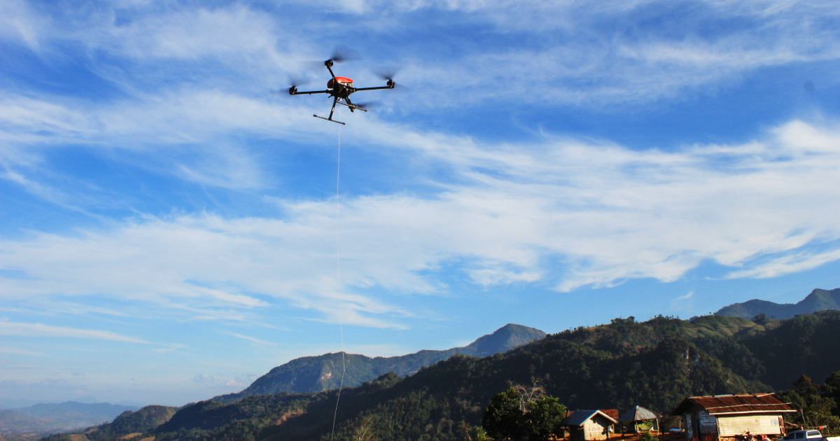
The scope of our operations included an aeromagnetic survey utilizing the Geoscan 401 Geophysics system, along with preliminary aerial photography employing the Geoscan 201 model to generate a digital terrain model (DTM), which helped identify terrain features and determine optimal altitude for magnetometer-equipped quadcopter flights. On average, magnetic reconnaissance was carried out at a distance of 50 meters from the ground, increased if necessary up to 70 (in areas with power lines), which was taken into account in the subsequent data processing. Over the course of seven working days, our survey covered 550 square kilometers of dense jungle and steep slopes where ground-based measurements were impossible to perform.
“In addition to the challenges posed by the rugged jungle terrain, our survey encountered substantial layers of sediment resulting from the weathering of various rock formations or the decomposition of foliage, devoid of any mineral content. Accessing the deeper bedrock layers potentially holding deposits would require excavations spanning tens of meters. Without precise guidance on the points of digging, the endeavor would inevitably consume extensive time and resources. The implementation of UAV aeromagnetic surveys makes it possible to pinpoint areas exhibiting magnetic anomalies, guiding subsequent exploration efforts swiftly and efficiently. Given the steep gradients of our survey areas, ground-based magnetic profiling was feasible at the maximum pace of only 200 meters per day; in contrast, we covered 70-80 linear kilometers daily,” remarked Dmitry Goglev, Head of the Geophysics Department at Geoscan.
All collected data underwent meticulous preliminary (office) processing, culminating in the creation of maps delineating anomalous magnetic fields and vertical gradients. An interpretation specialist analyzed this data, cross-referencing it with the information from local geologists to describe geological structures, potential formations, and promising exploration sites within the surveyed areas. Subsequently, we delivered a comprehensive report comprising over 20 geological maps to ATLANTIC, empowering them to identify prospective mining sites.
“This project constitutes a logical extension of our prior engagements in Laos dating back to 2019. Our earlier surveys, conducted two kilometers away from our current site of operations, successfully identified anomalies which turned out to be iron ore deposits. Our new client secured adjacent territory in anticipation of these mineral veins continuing there. The likelihood of this scenario is substantiated by our observations during preliminary analysis, where we identified a pronounced magnetic anomaly later confirmed to be magnetite. With ground-based operations now underway, we are confident in delivering the expected outcomes,” said Dmitry Goglev.


