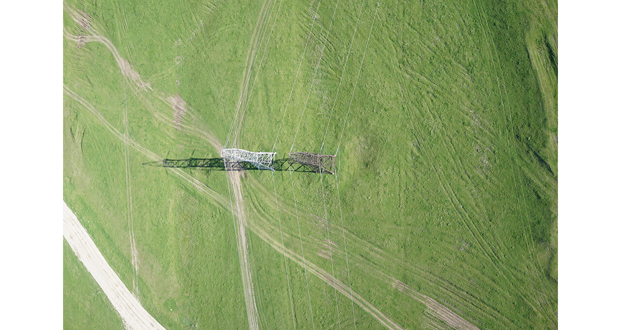
The Geoscan Group of Companies provides monitoring with an unmanned aerial vehicle (UAV).
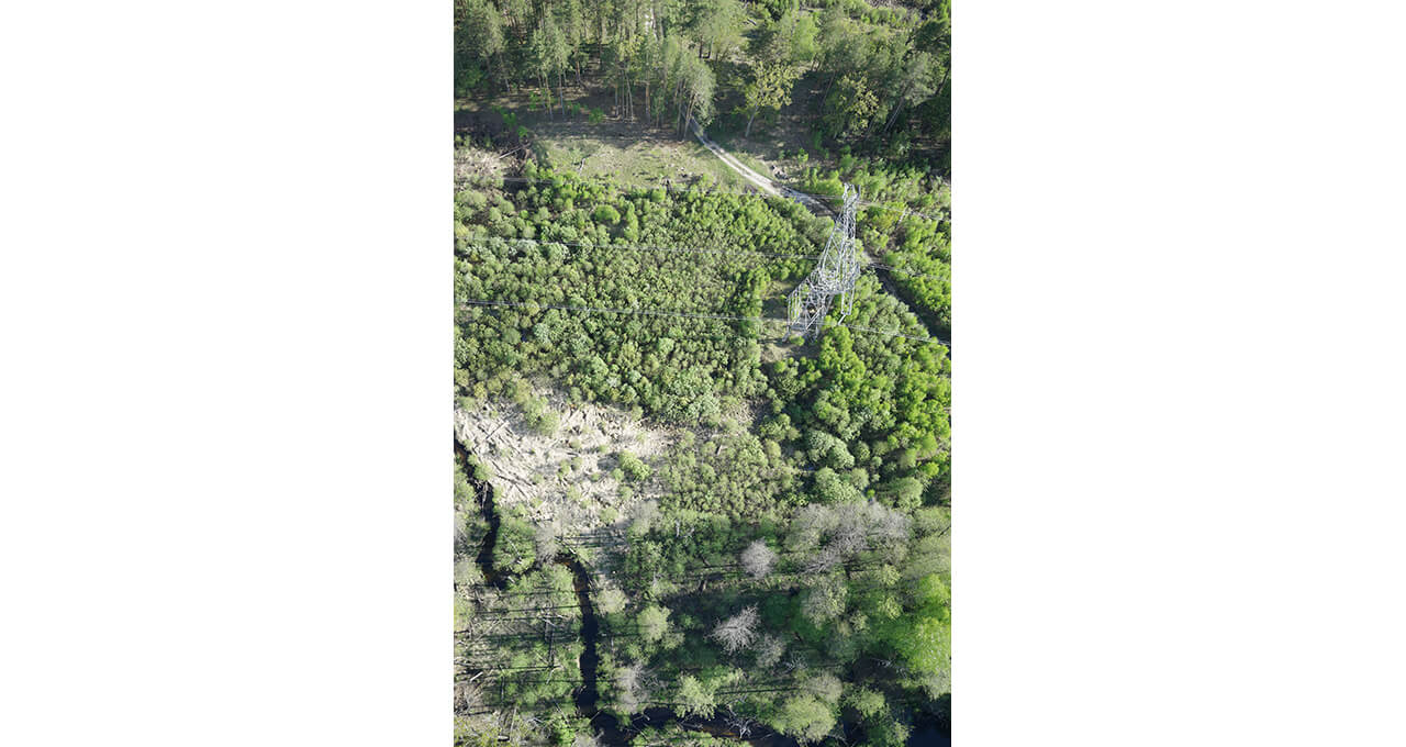
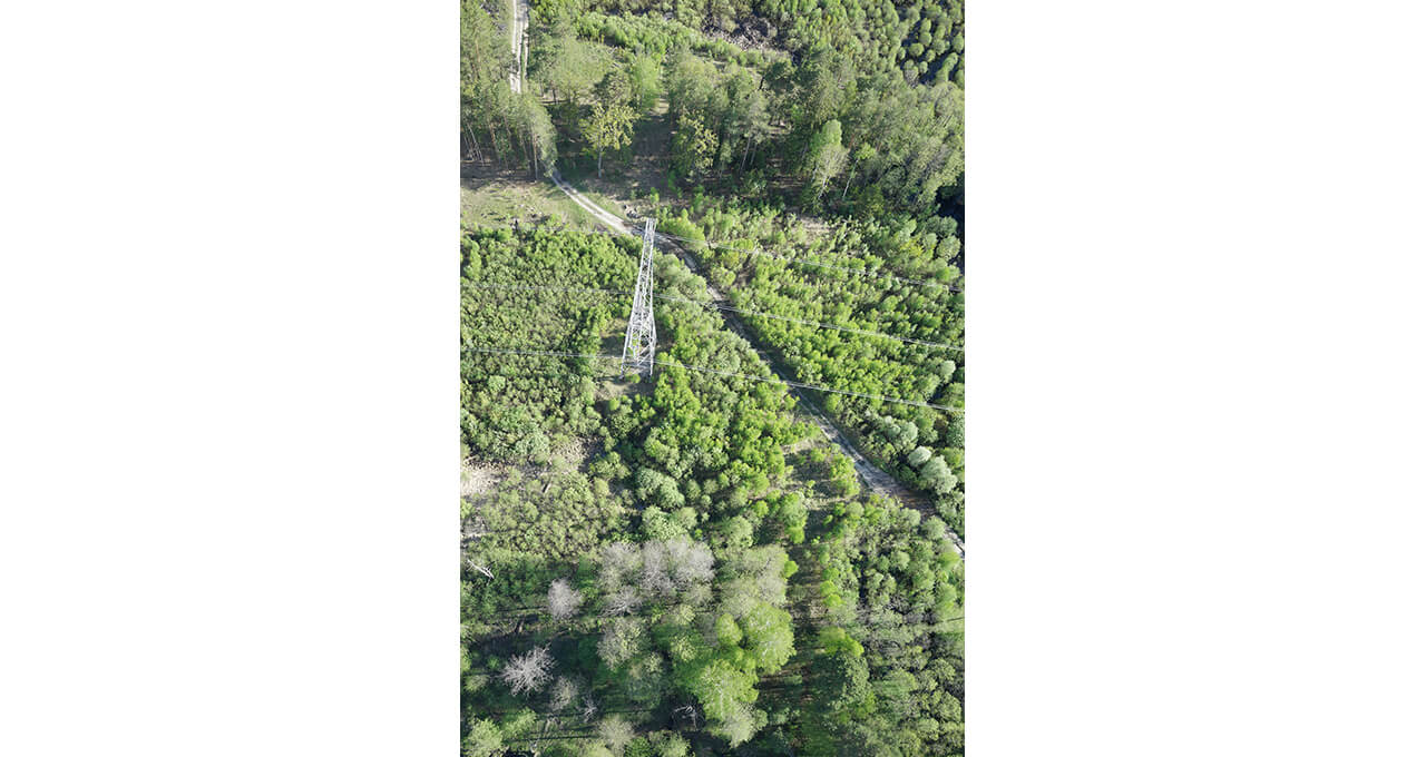
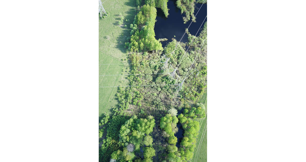
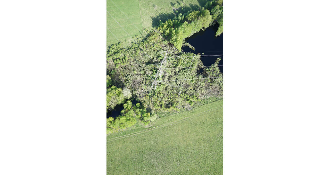
Monitoring with an UAV equals in-situ one and sometimes surpasses it. For instance, when determining the distance between overhead line towers, data inaccuracy with an UAV is less than 10 cm while manual GPS receivers may contain inaccuracy up to 5 m.
Since 2016 the Geoscan Group of Companies has carried out projects on aerial survey of PTL for Russian and foreign companies by using their own UAVs. The whole length of surveyed PTL is more than 20 000 km.
As a result, you receive:
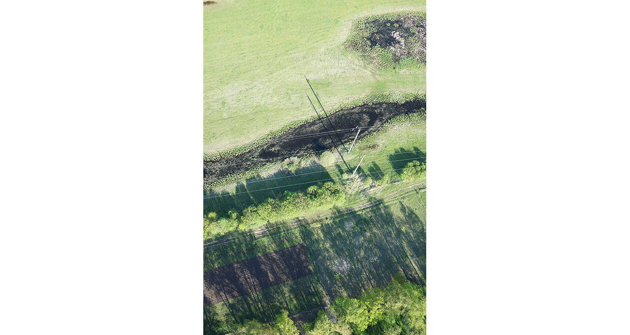
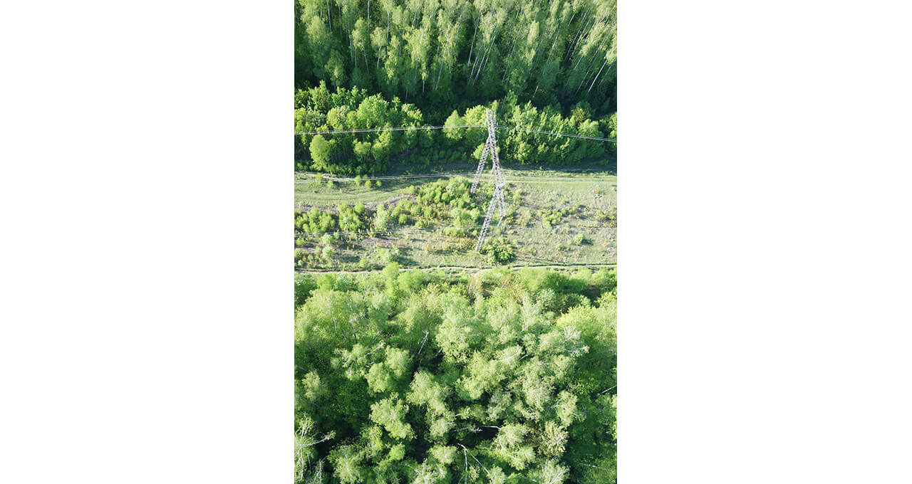
Photos
In jpeg format
(resolution is 5 cm/pix and higher)

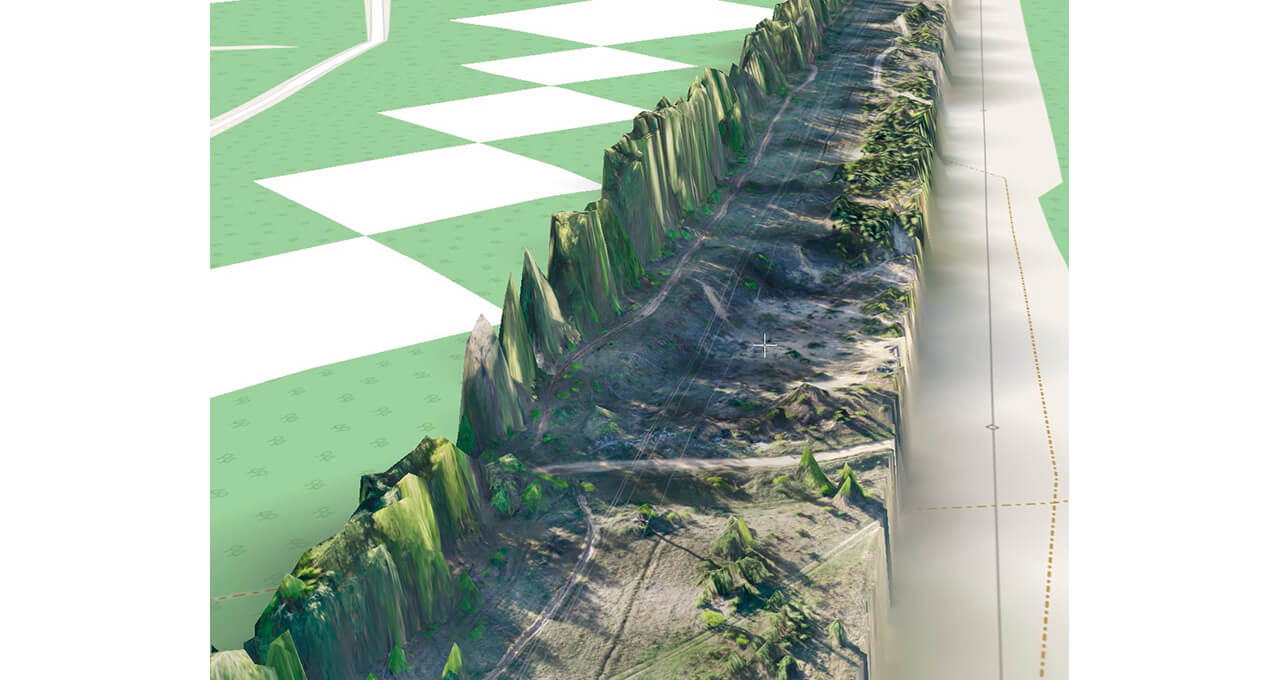
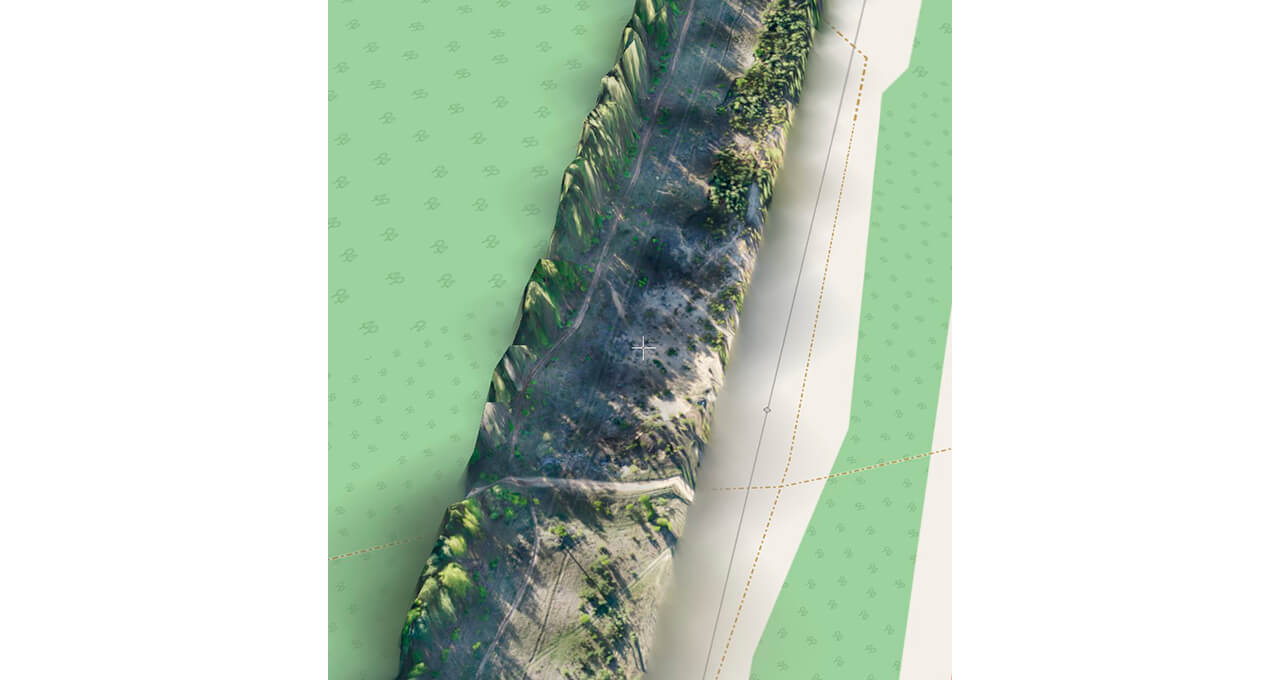
Digital terrain models
In tif, kmz formats
(height accuracy is not lower than 16 cm)
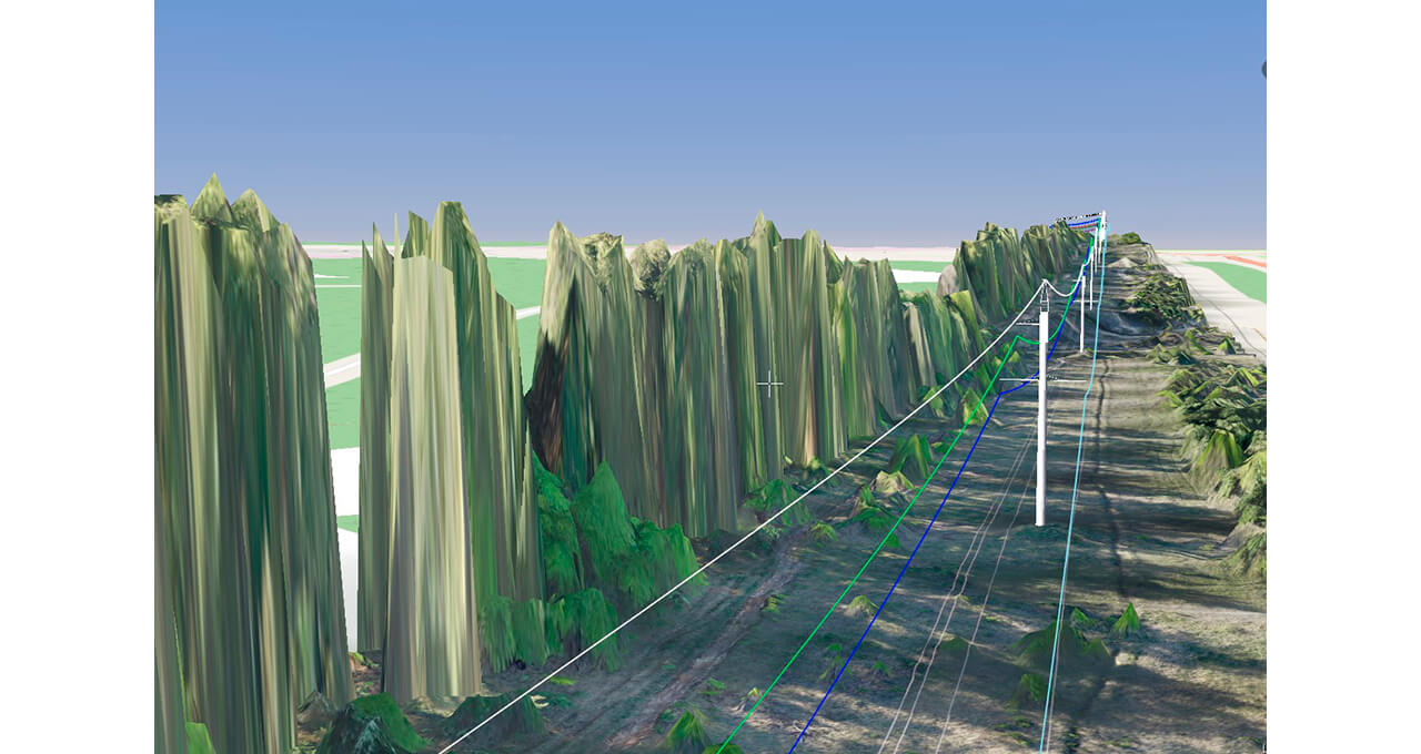
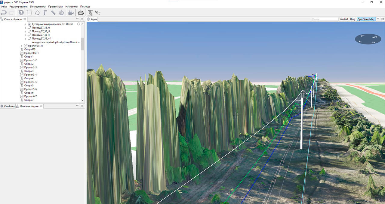
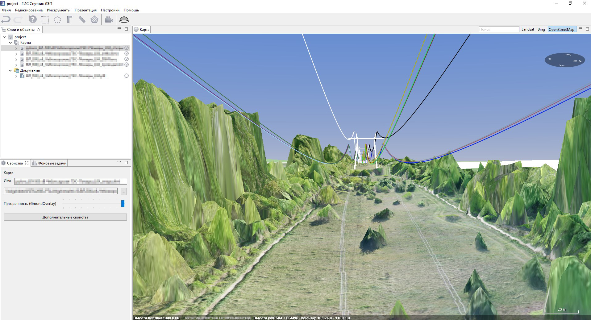
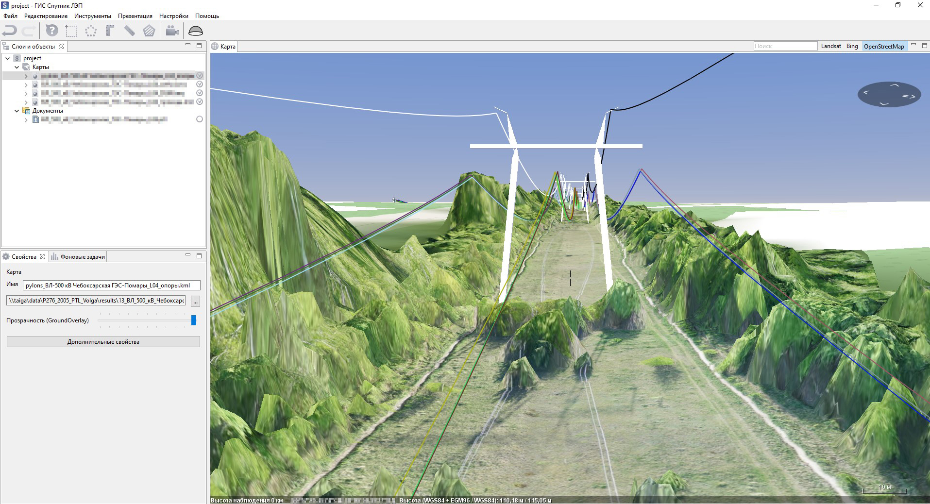
Three-dimensional
wireline models
In kml format
Reporting tables
with data
In xls format
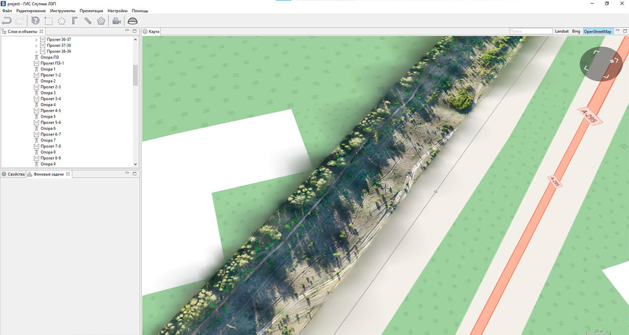
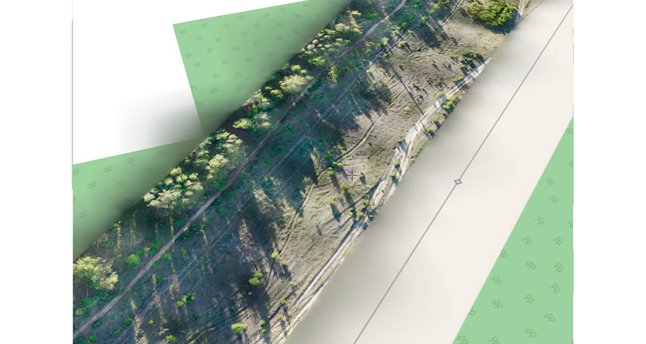
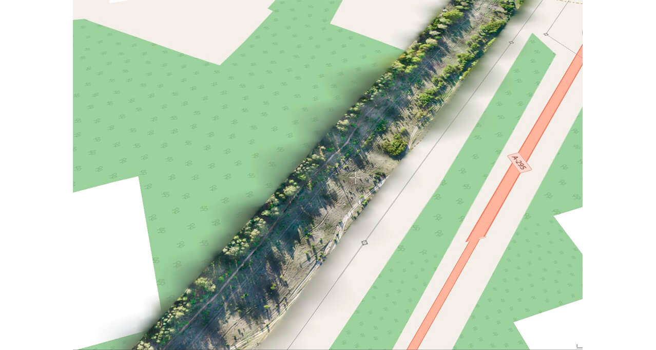
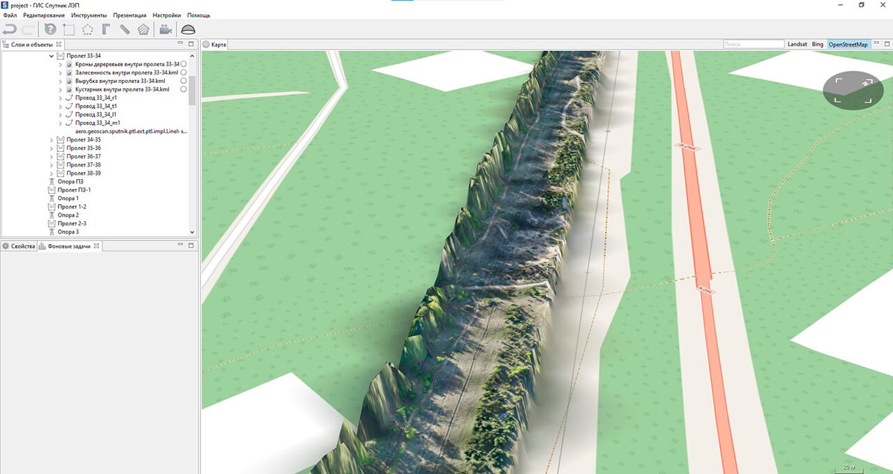
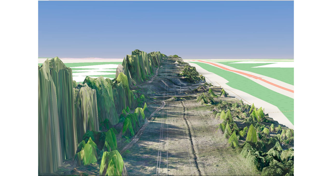
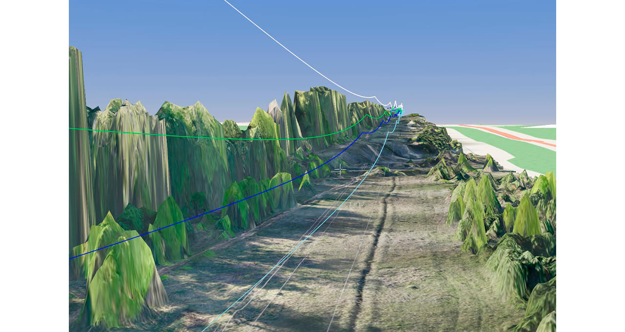
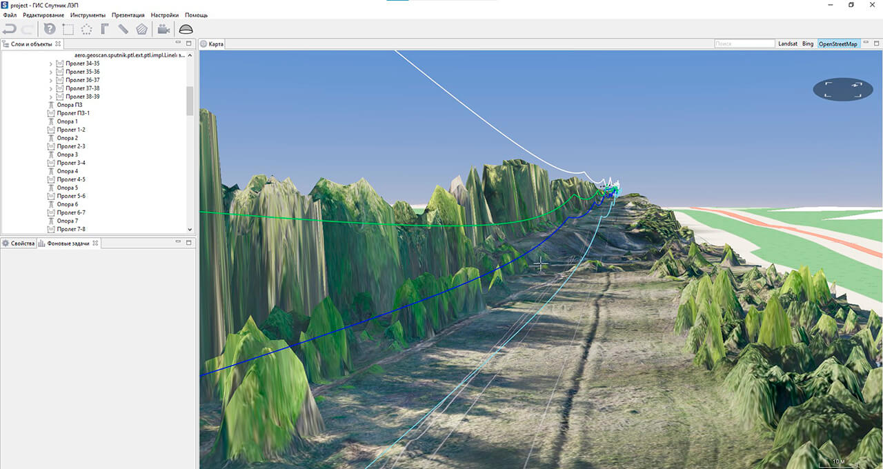
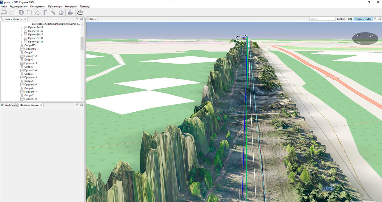
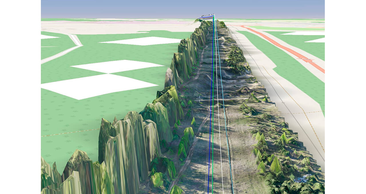
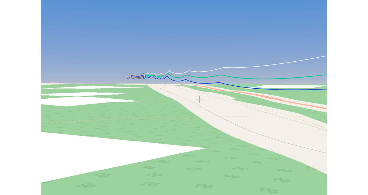
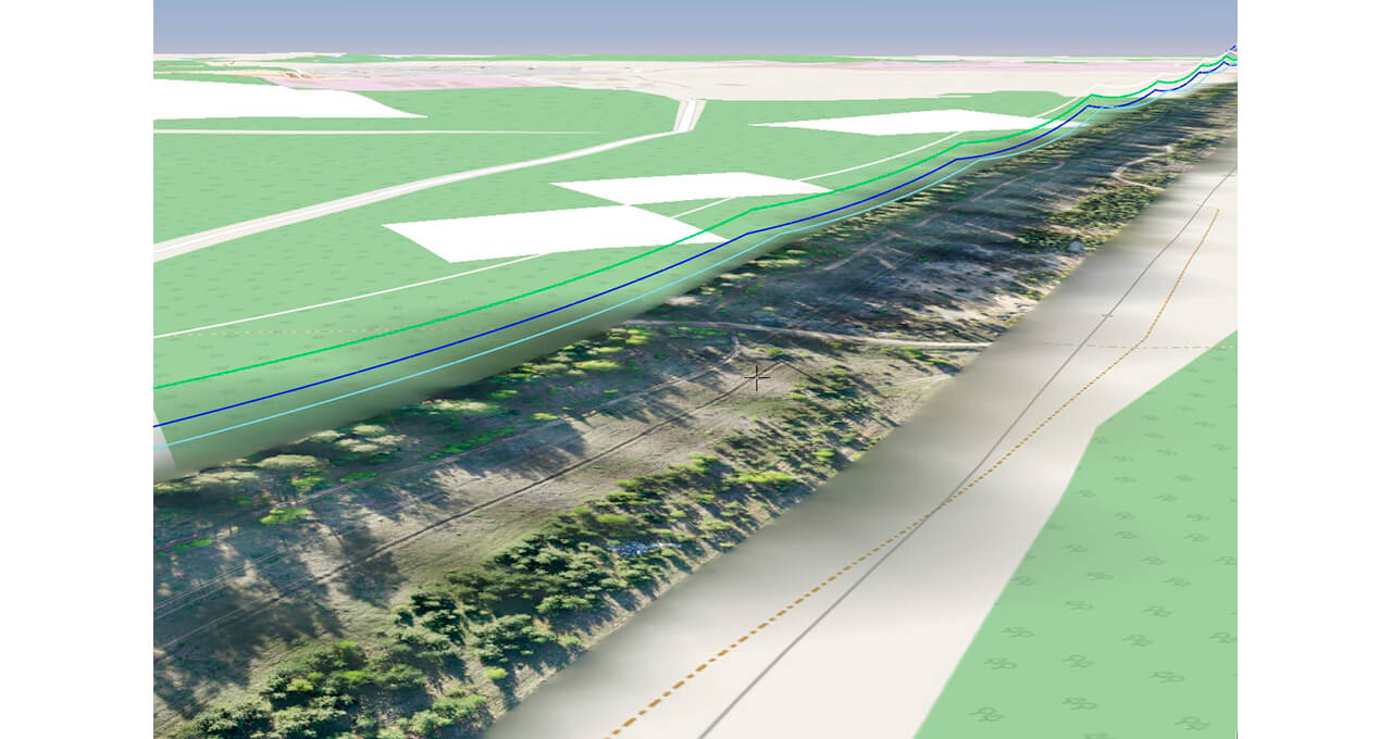
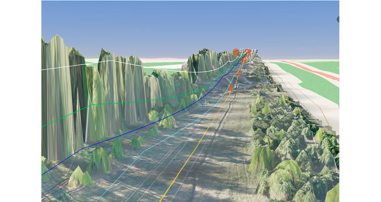
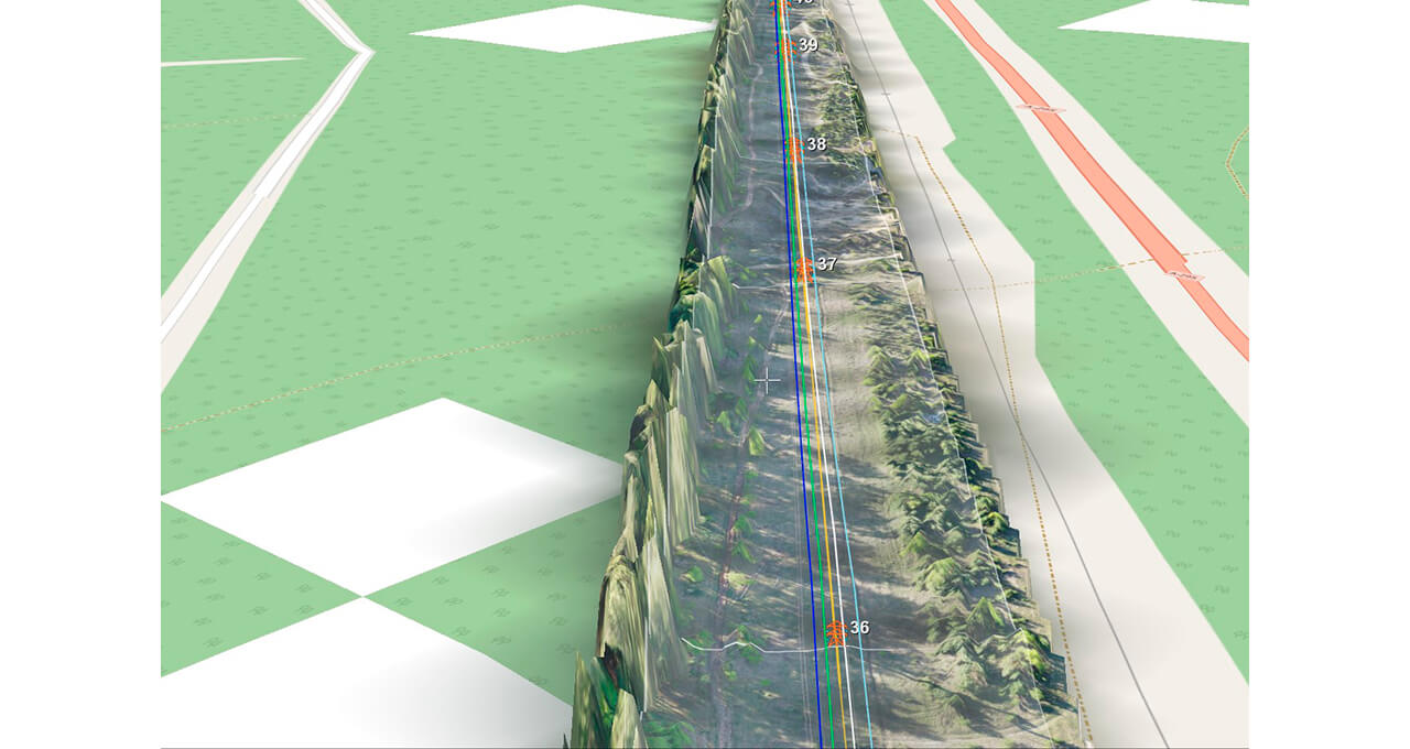
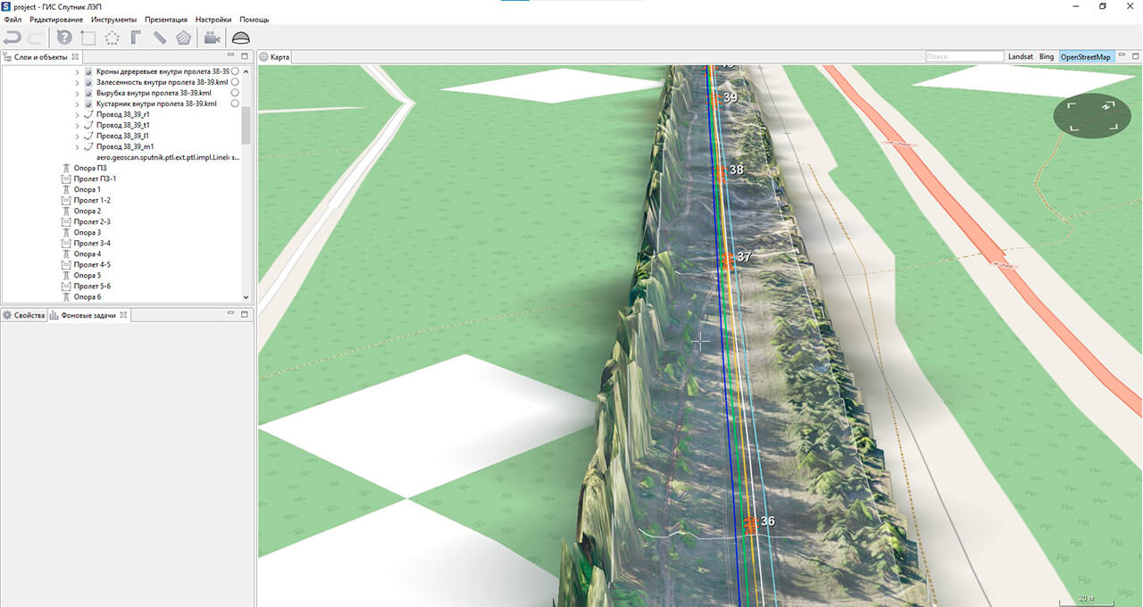
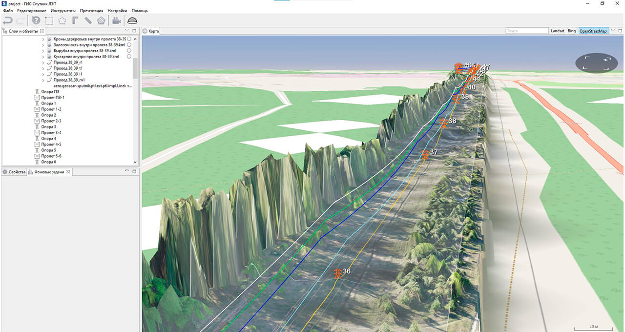
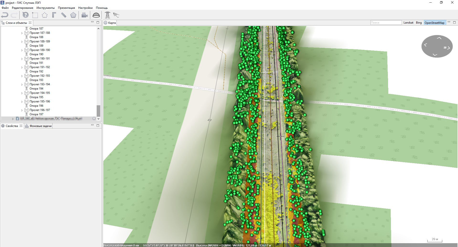
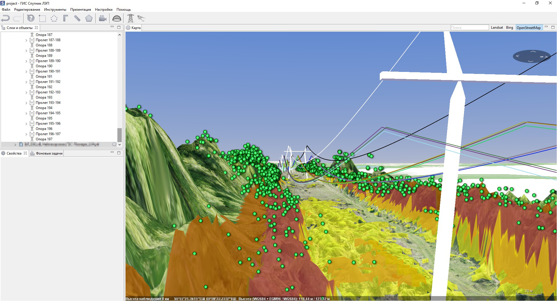
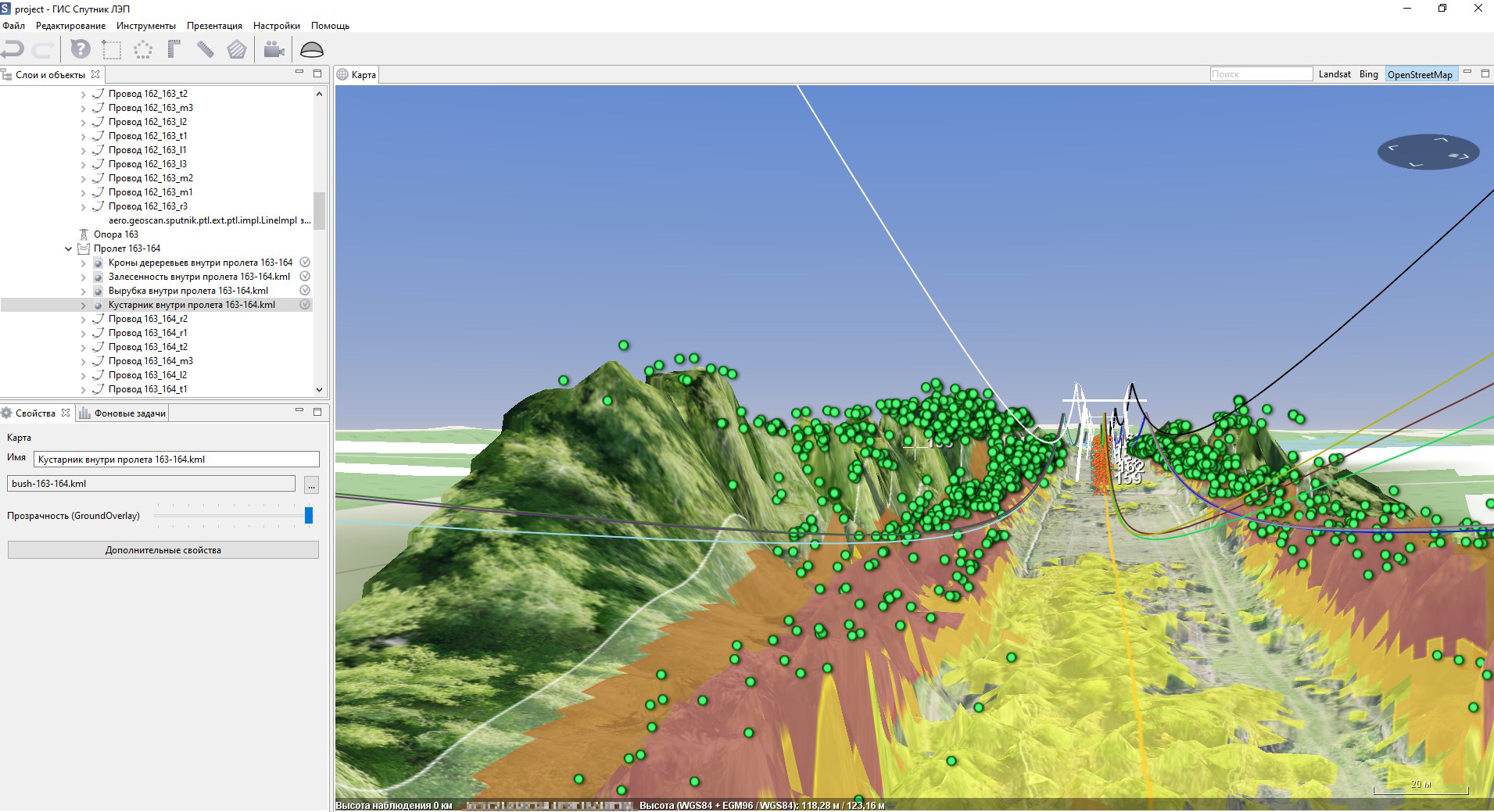
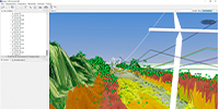
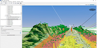
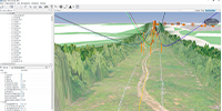
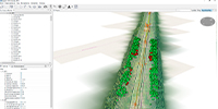
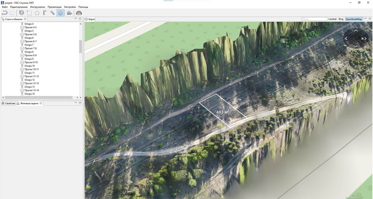
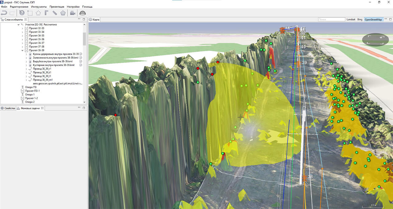
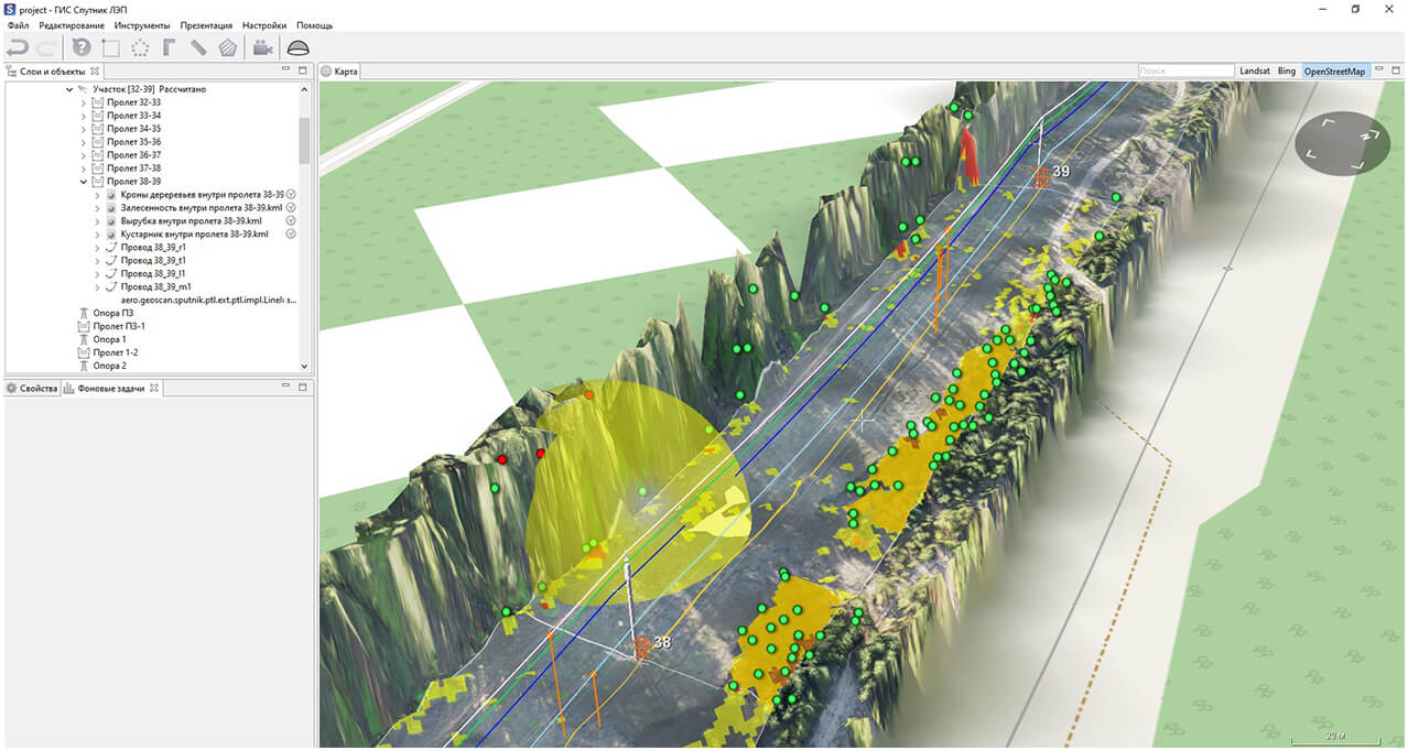
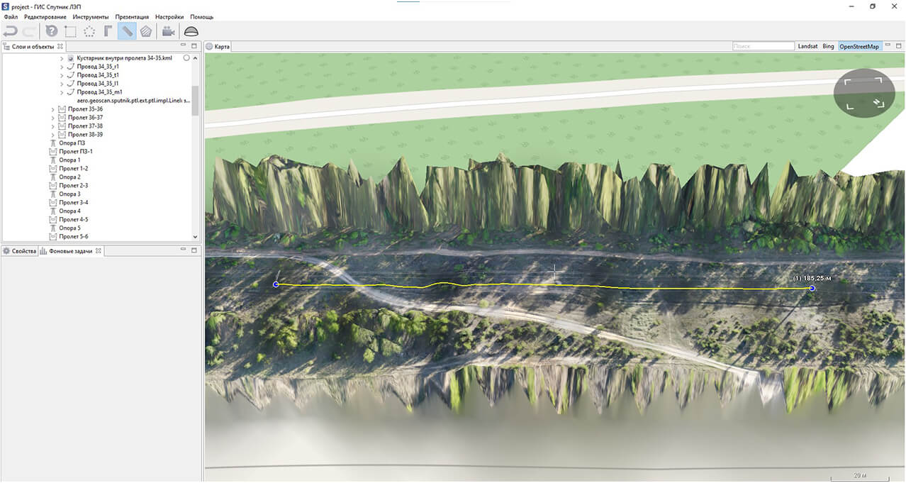
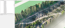
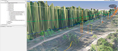
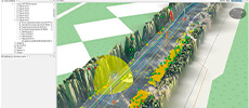
Besides the report and described data, specialized “Sputnik LEP” GIS with uploaded results of the survey is provided.
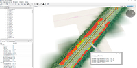
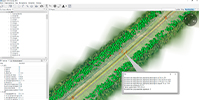
Sputnik LEP is a convenient instrument to analyse and inspect PTL.
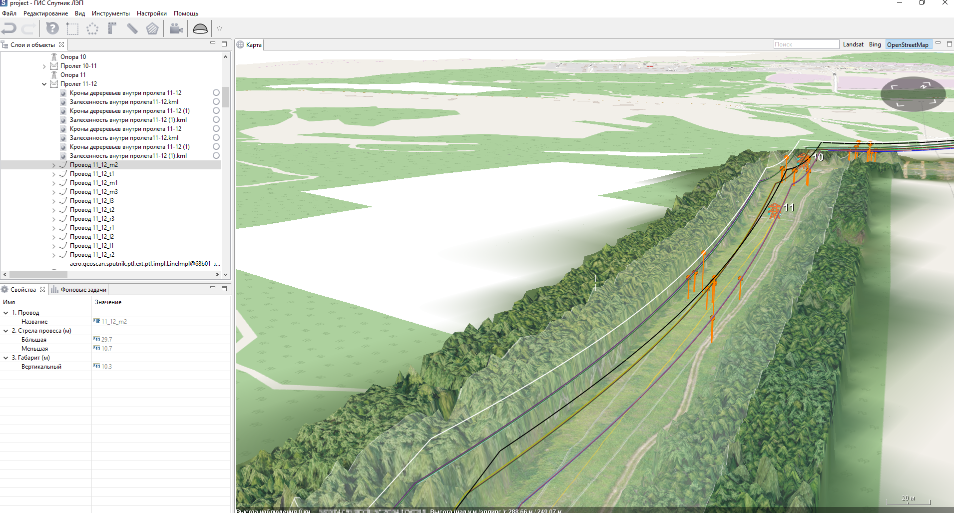
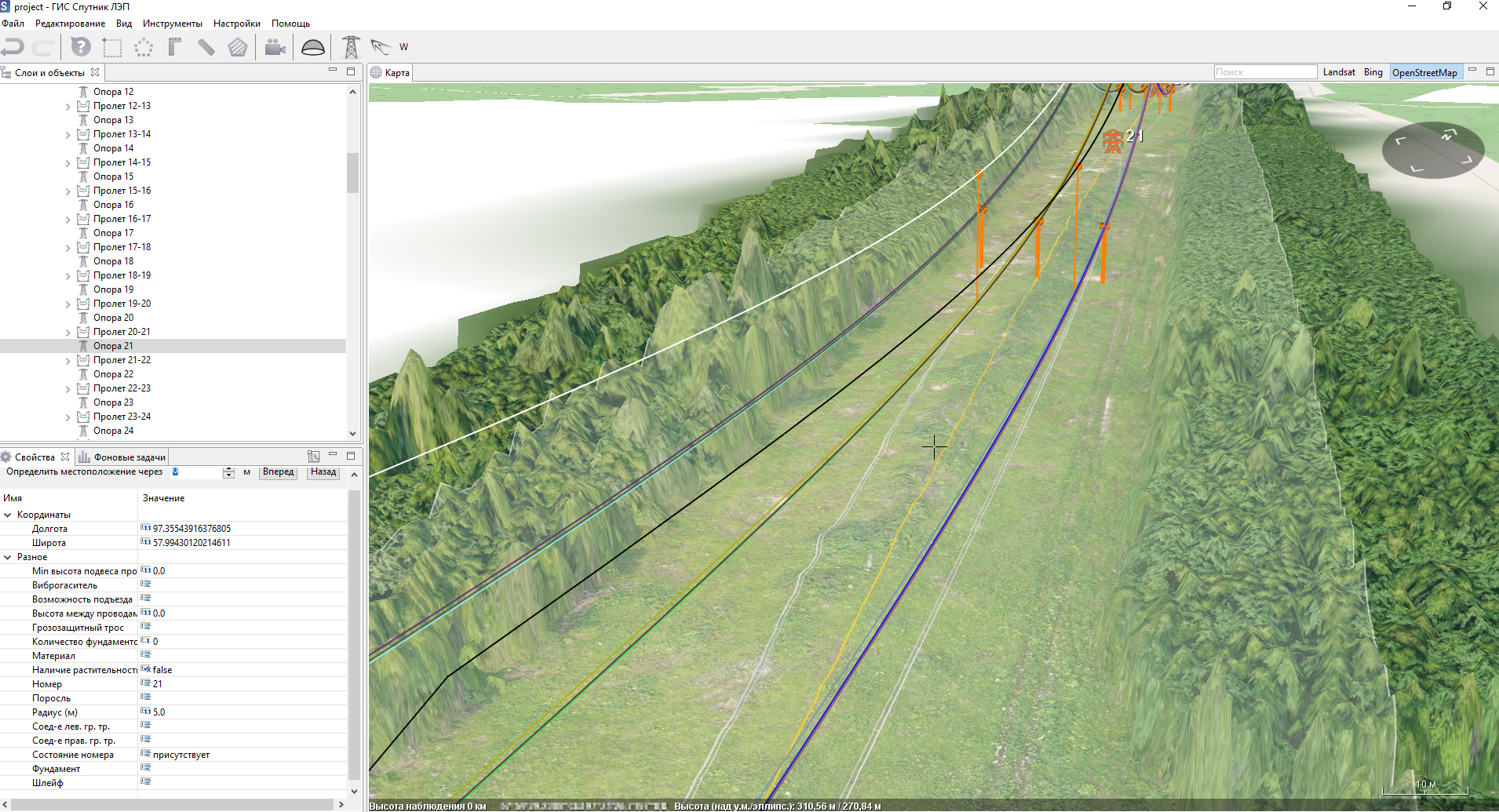
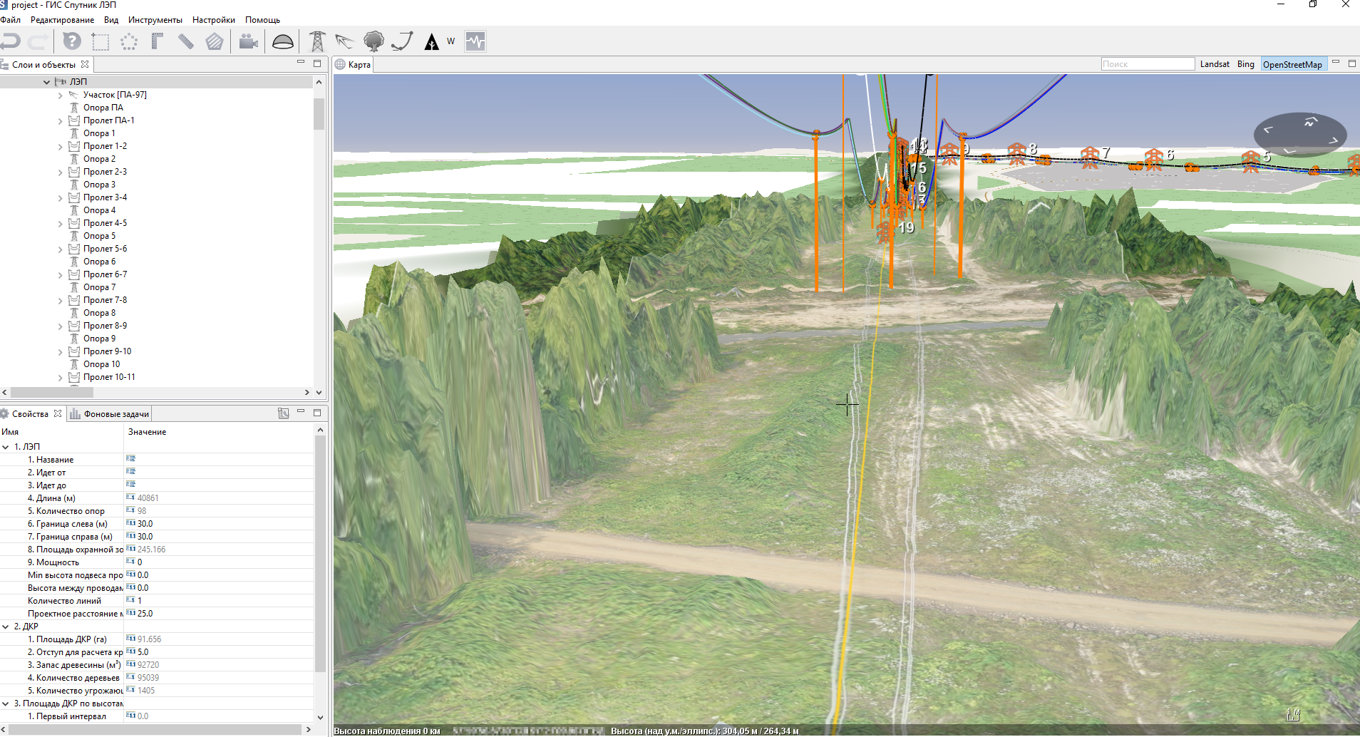
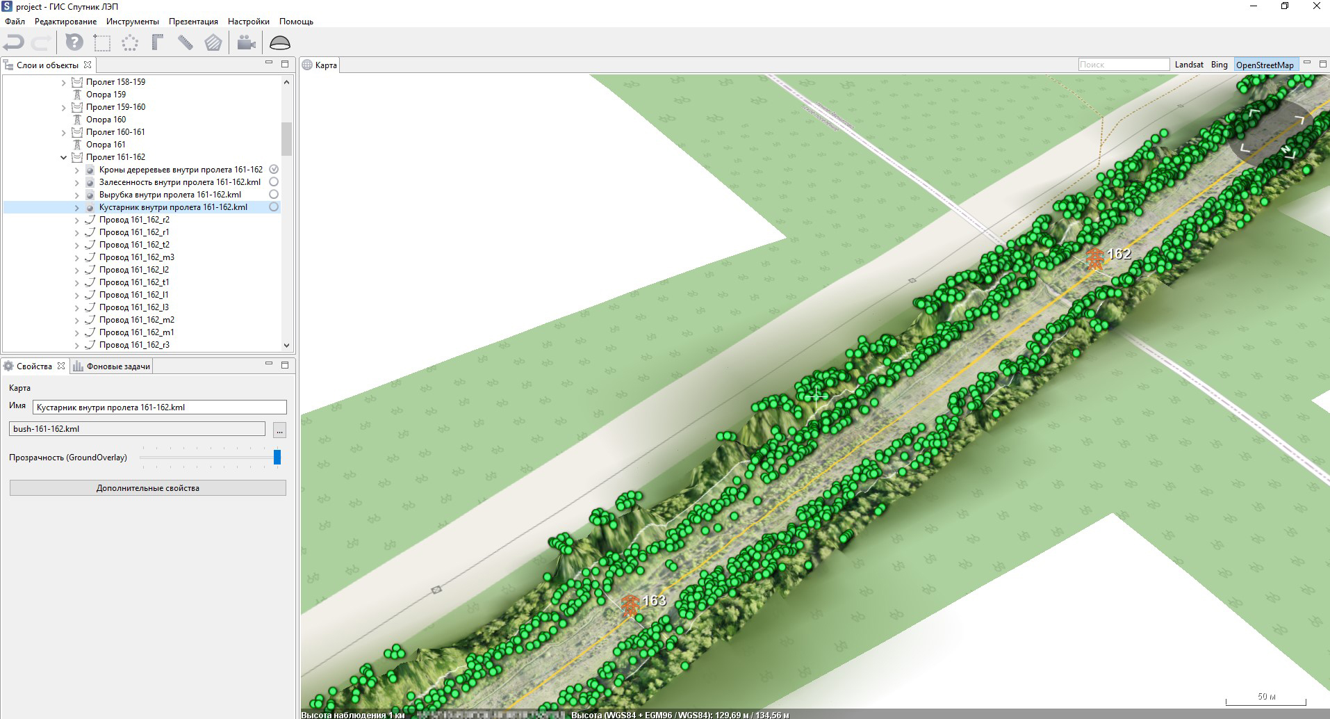
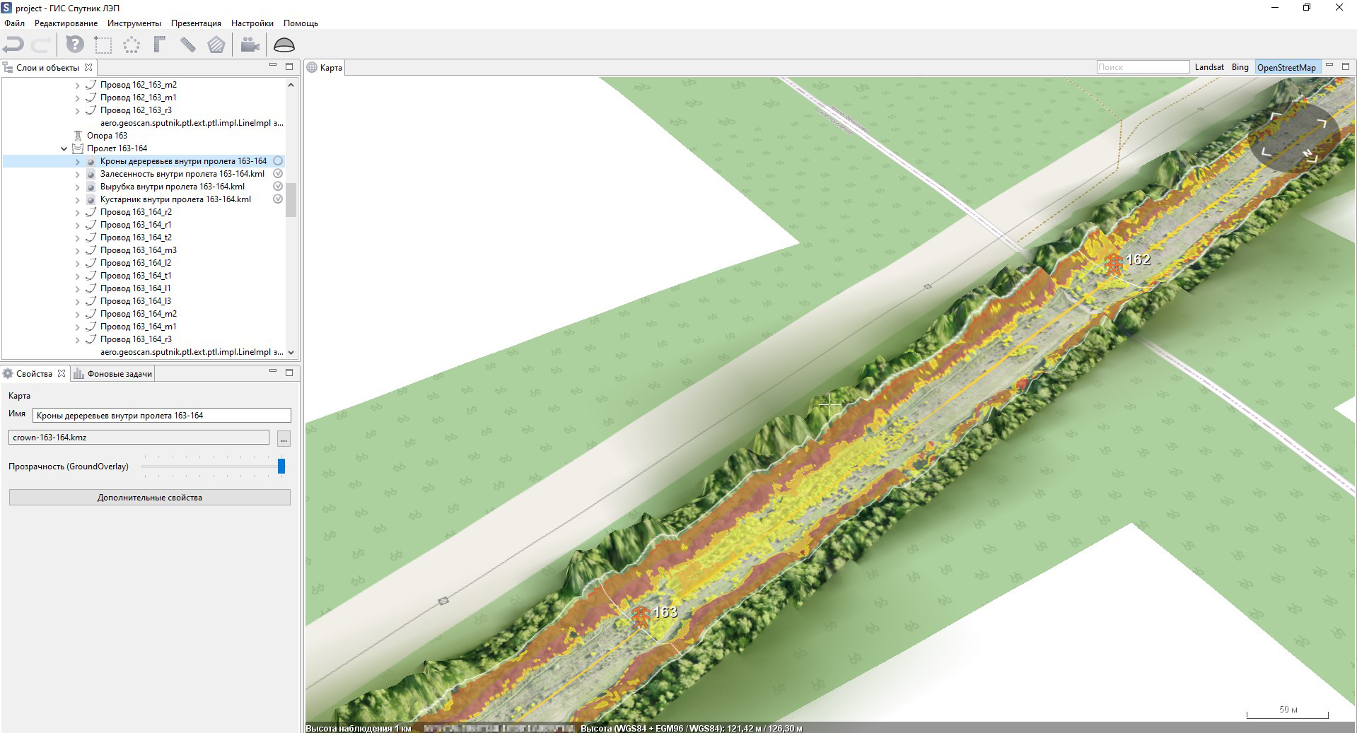
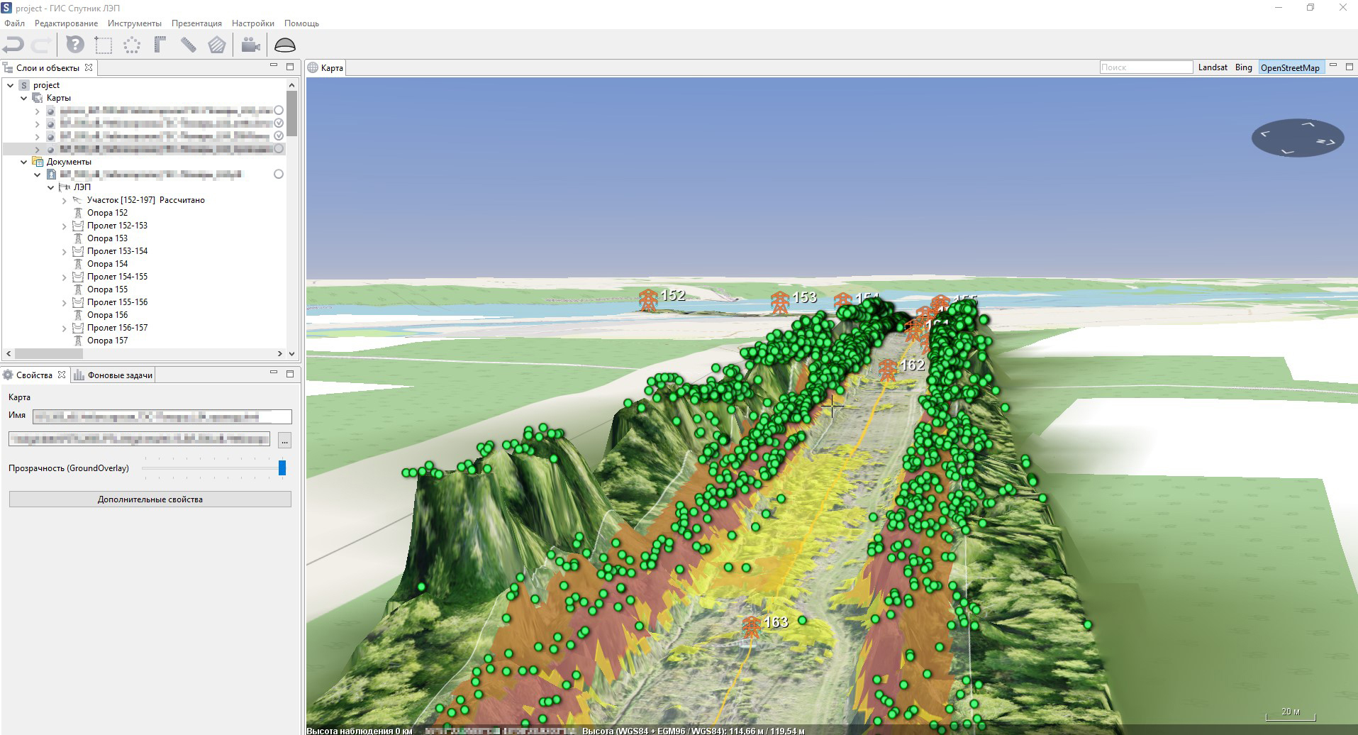
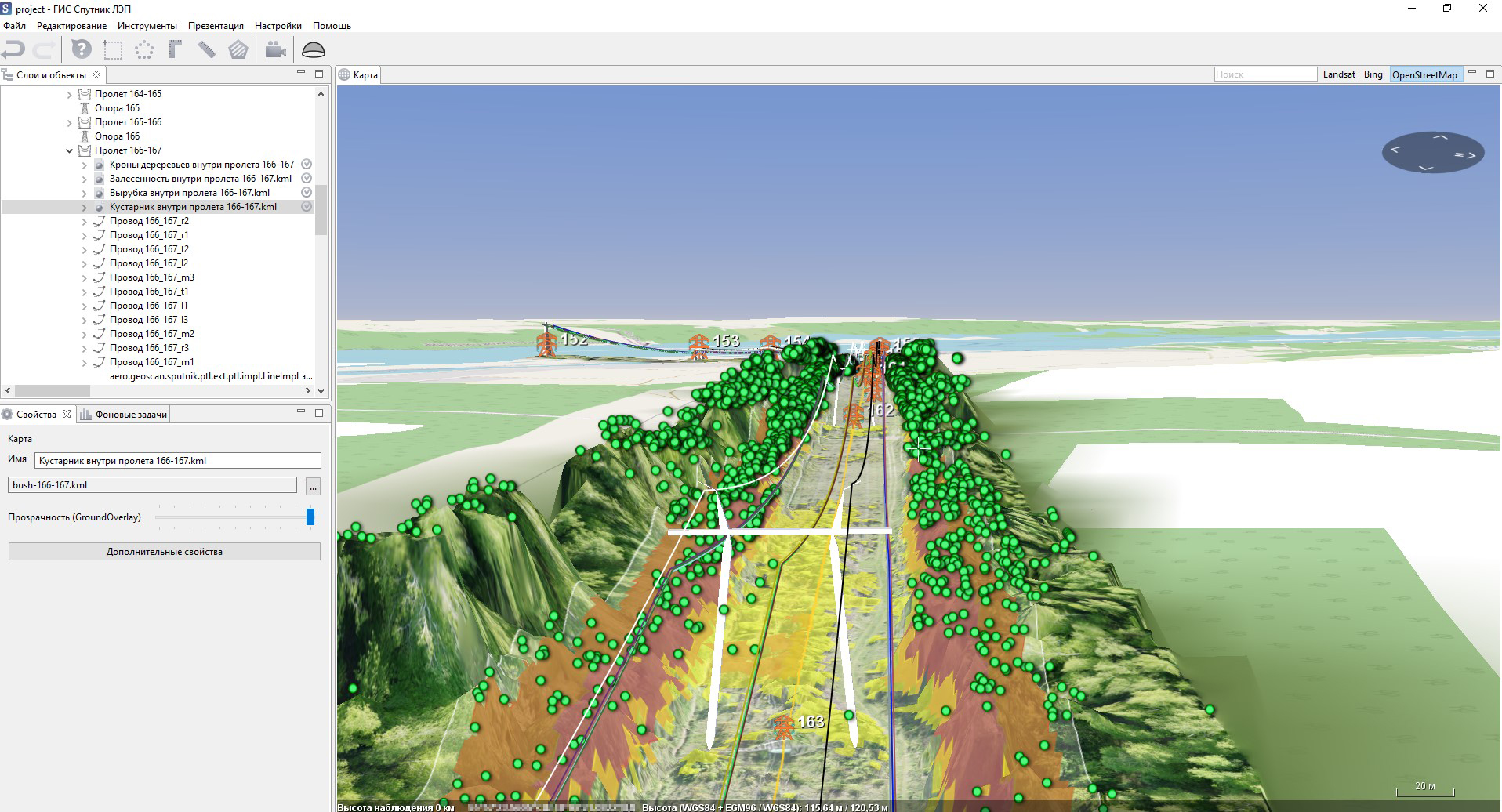
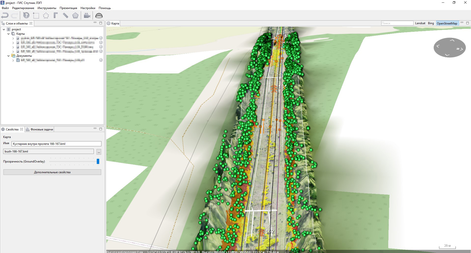
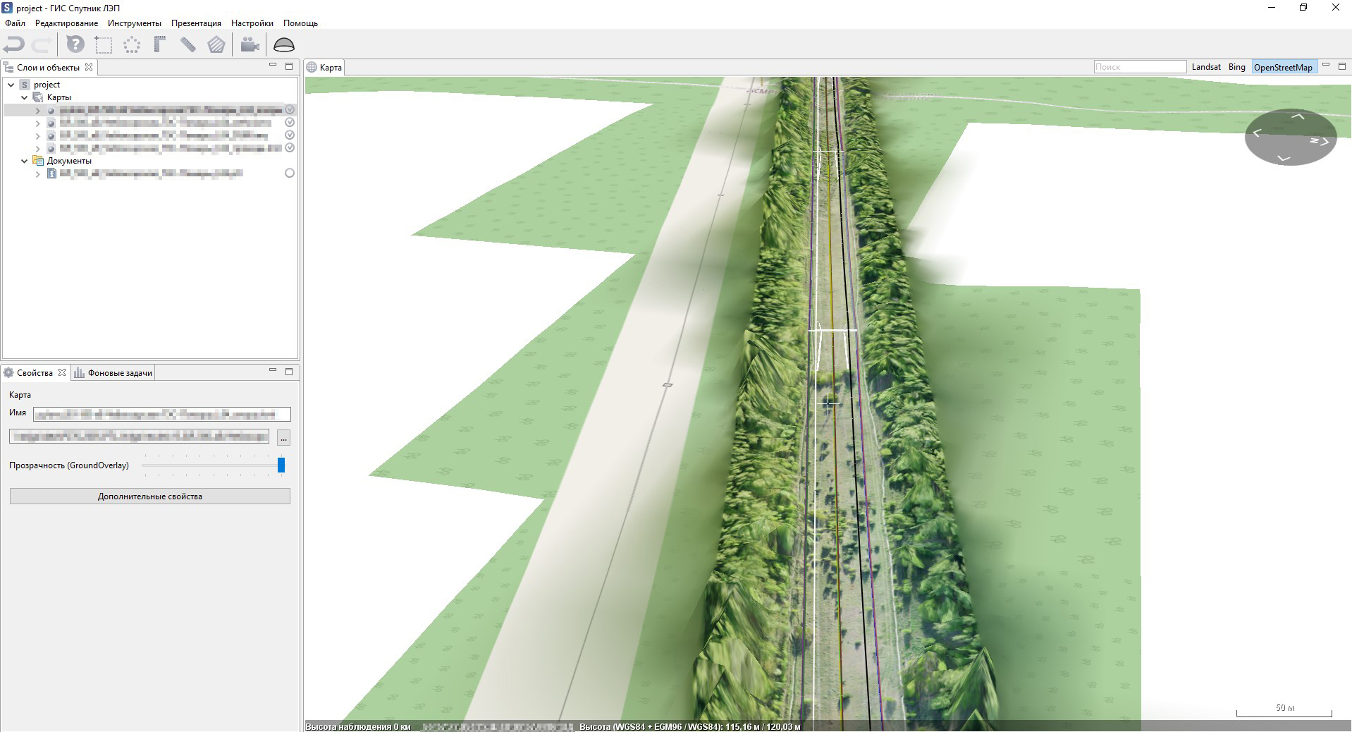
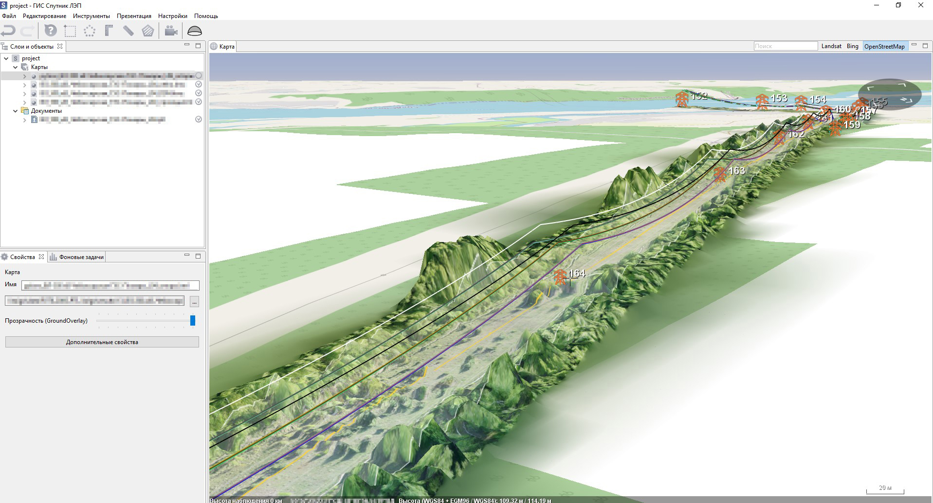
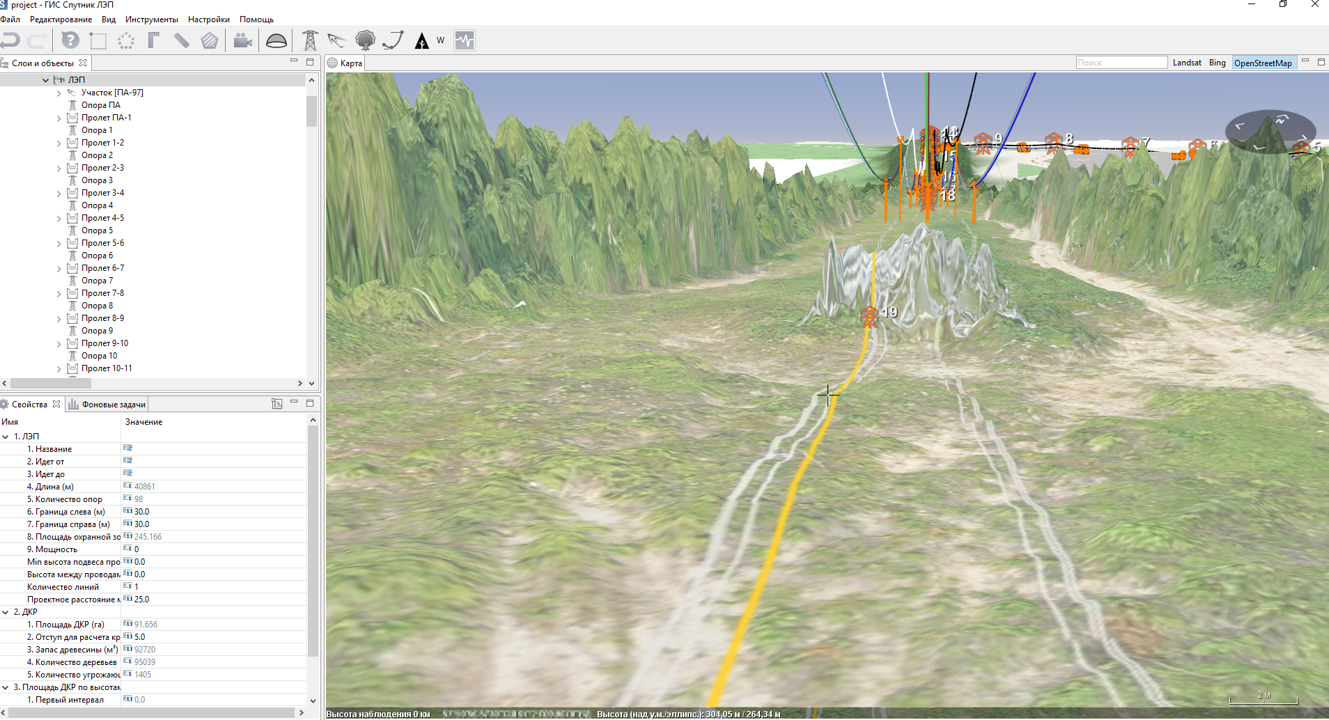
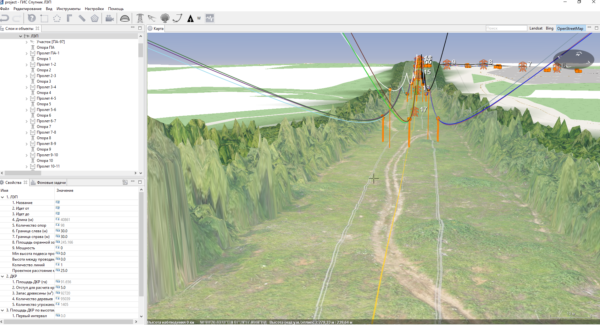
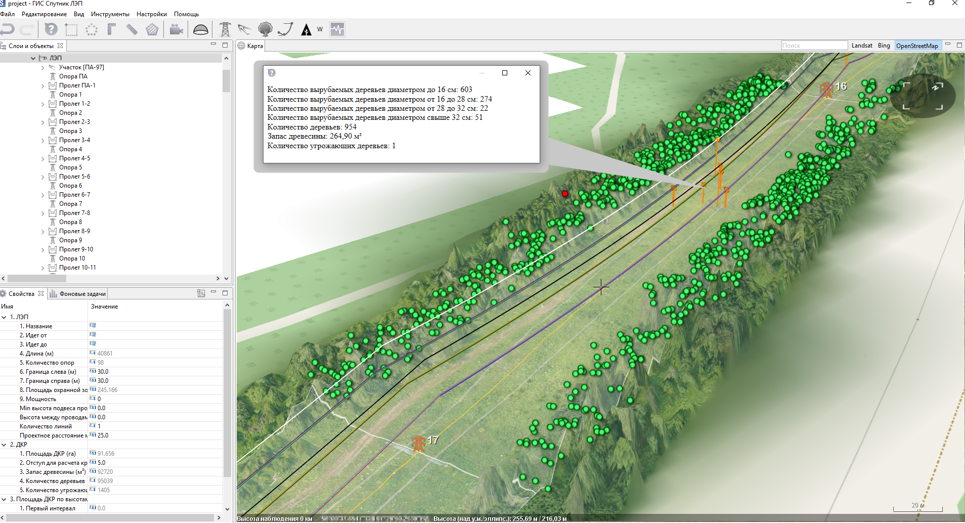
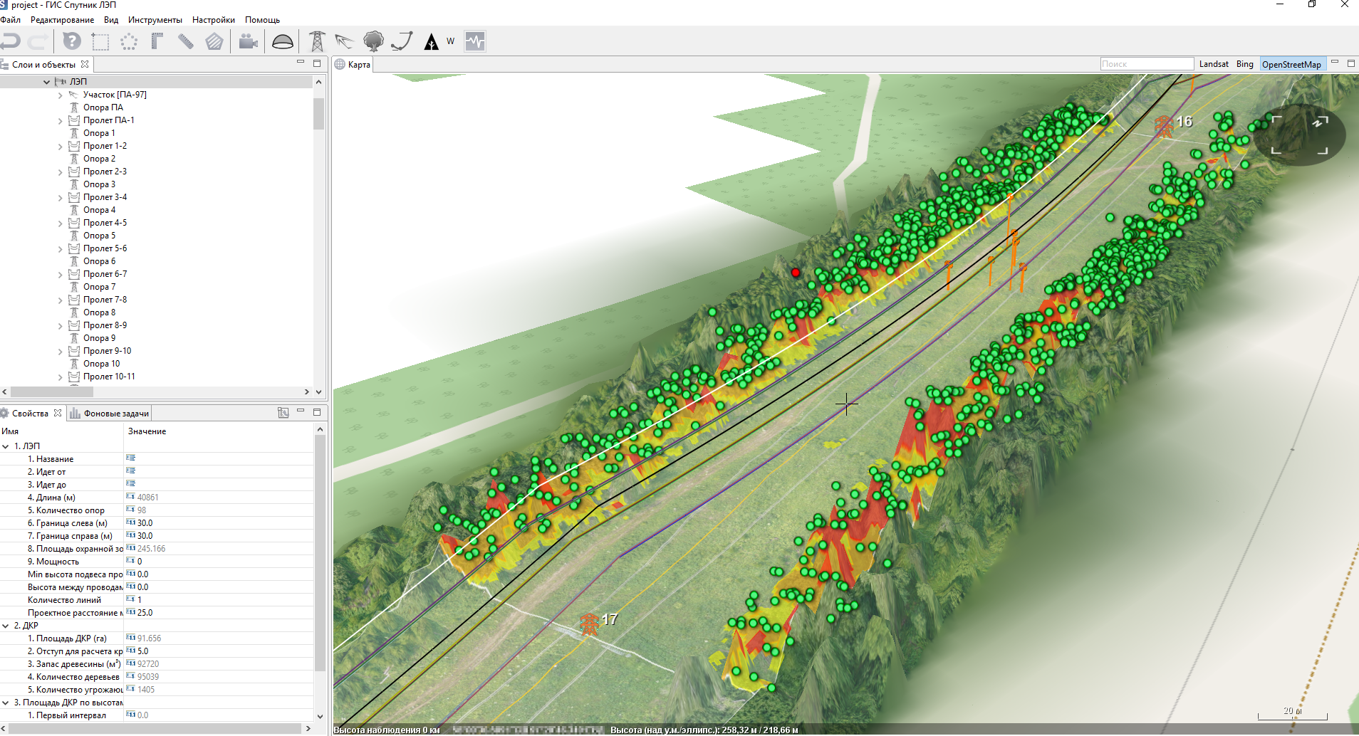
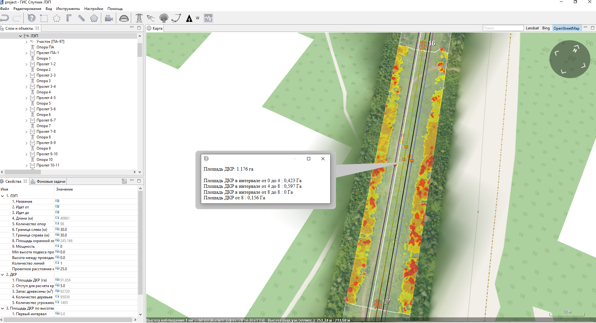
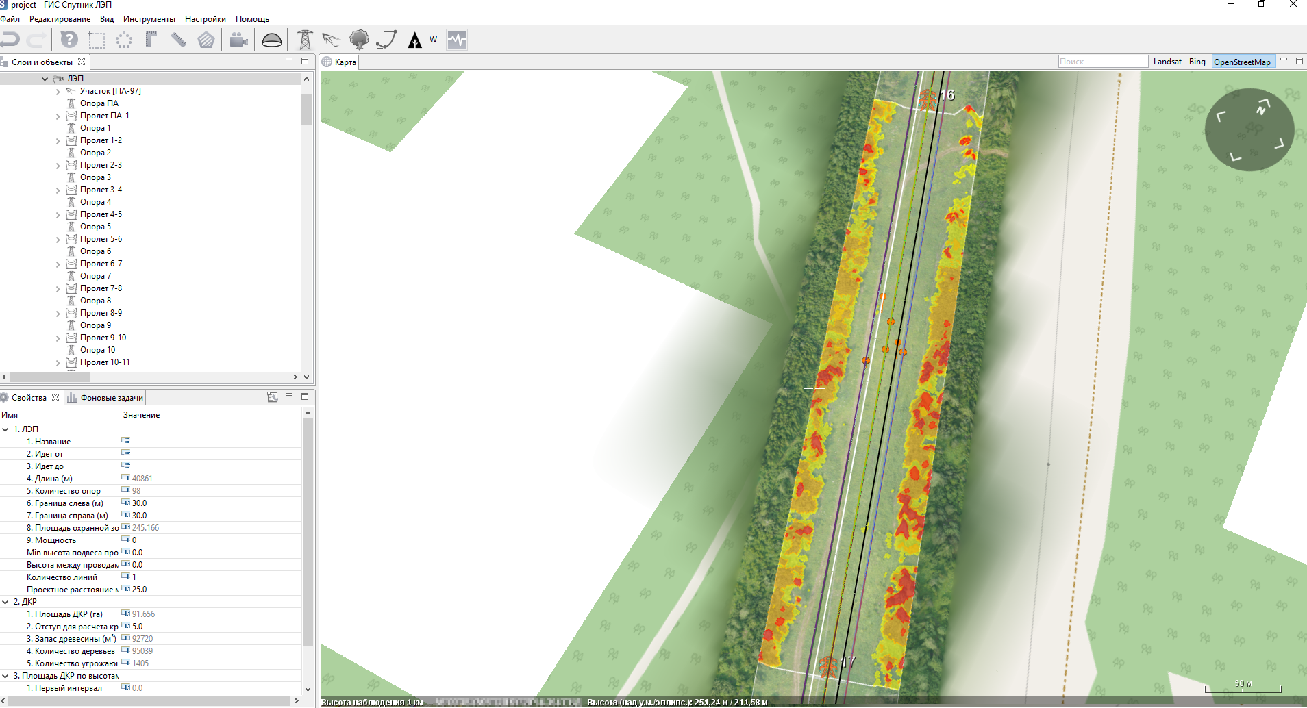
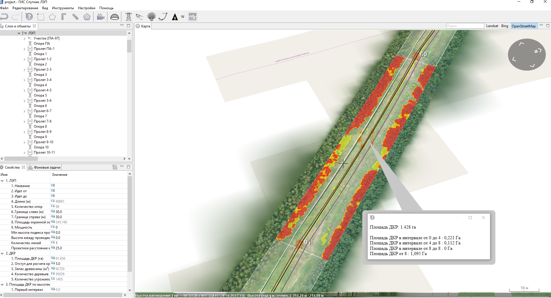
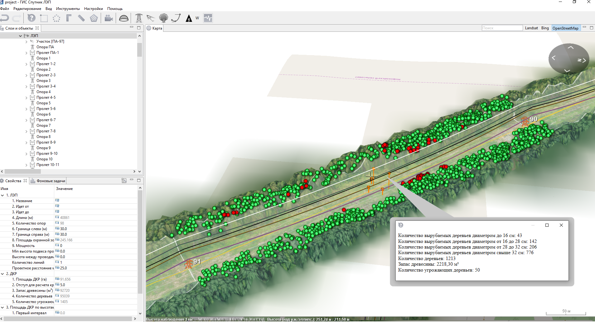
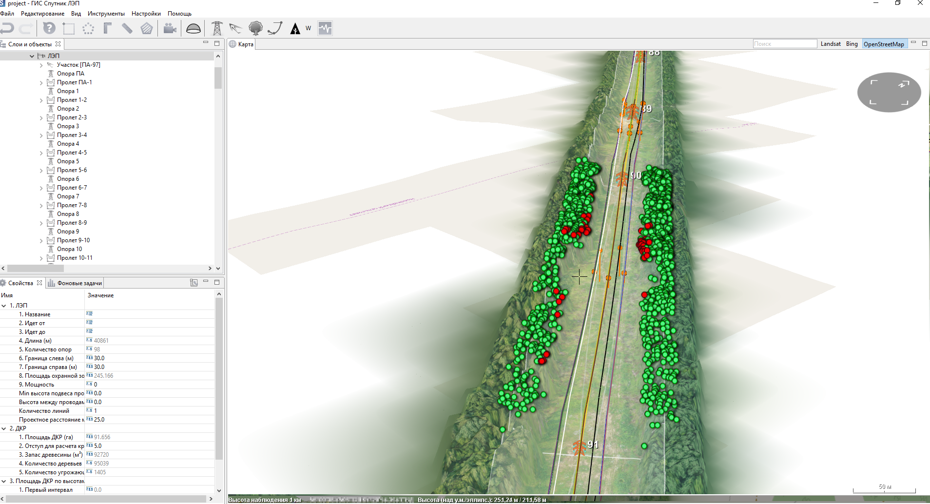
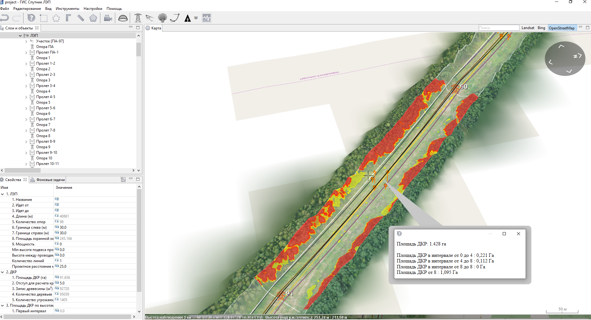
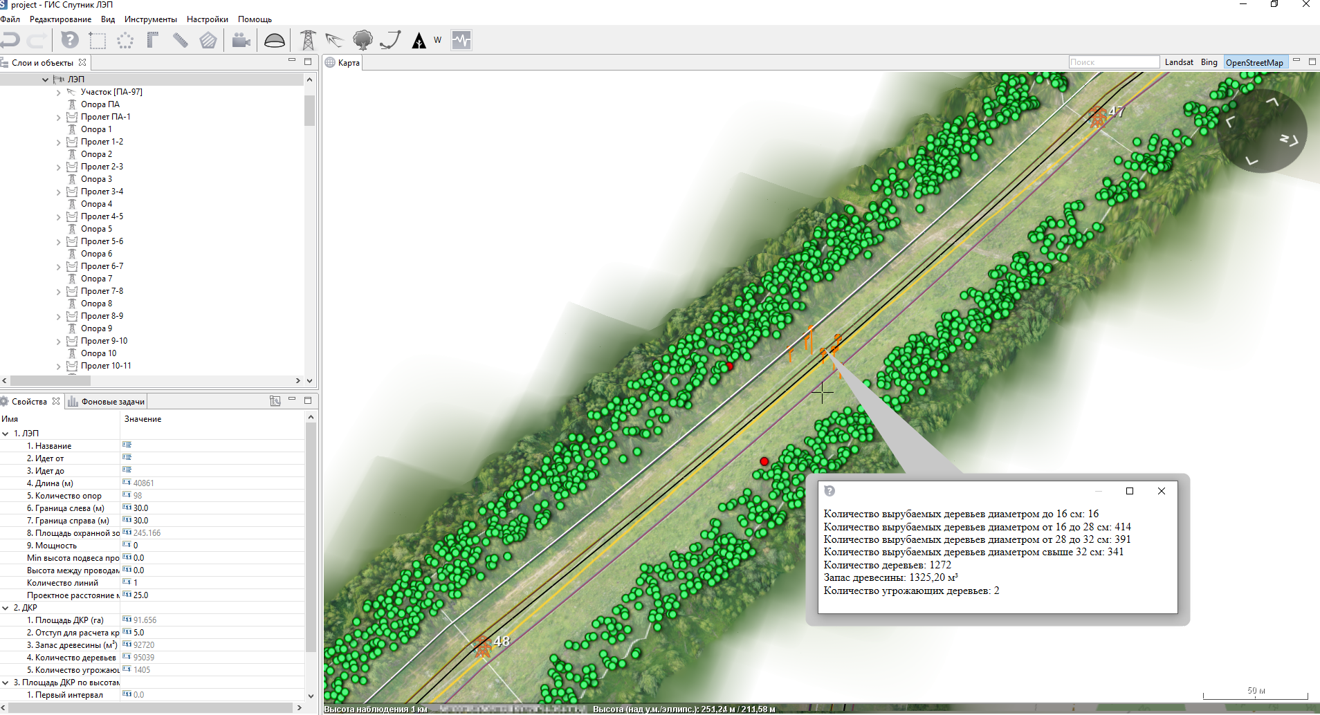
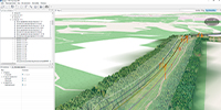
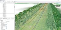
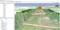
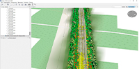
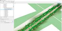
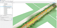
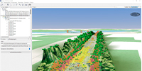
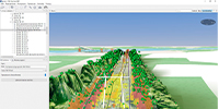
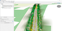
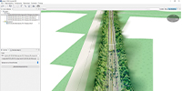
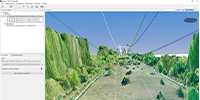
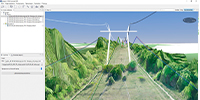
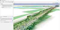
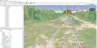
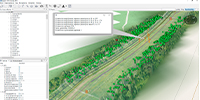
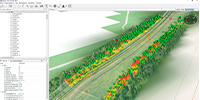
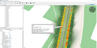
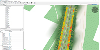
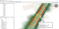
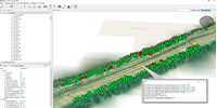
Functionality
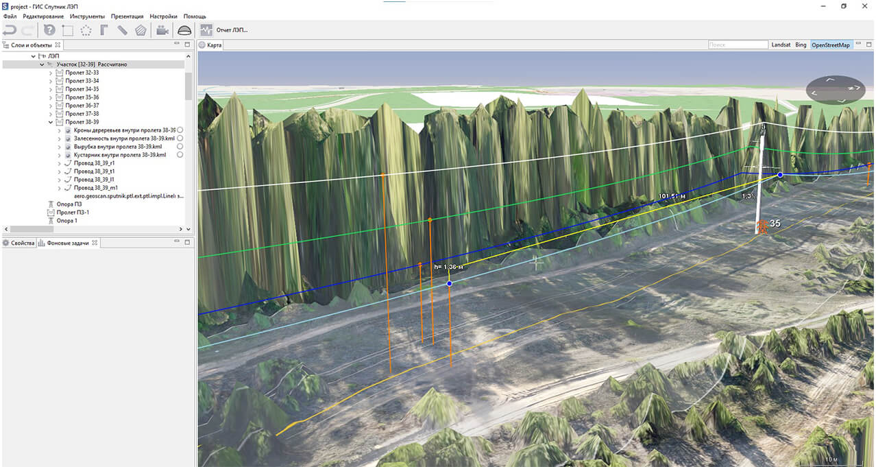
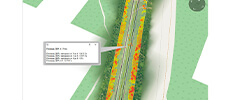
- Measure dimensions and slack of the wire;
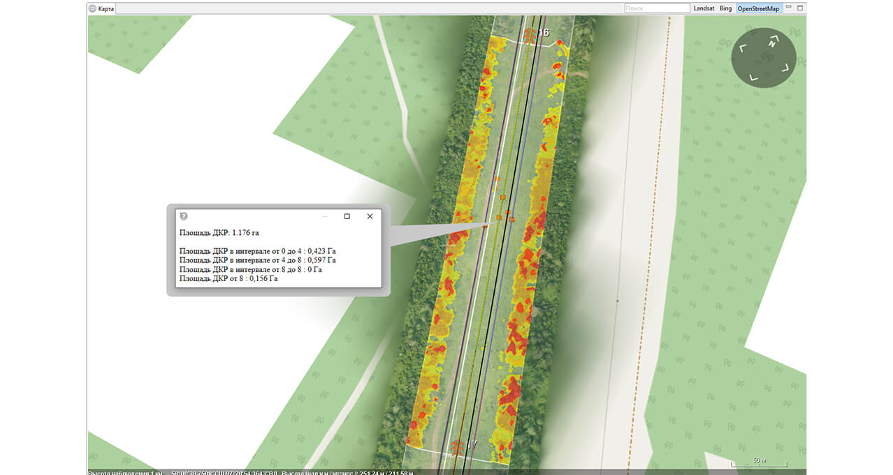
- Measure the forestry area;
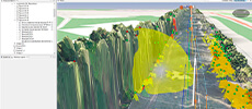
- Find out the vegetation dangerous to wires;
- Measure distances with respect to terrain;
- Measure slops, difference of height, ground distance;
- Measure the area on digital terrain model (DTM) and digital surface model (DSM);
- Export the reports as XML file;
- Render the trees impact zones.
.jpg)
.jpg)
Application fields:

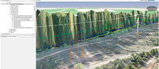
Prevention of emergency situations (dangerous vegetation, wire slack)
- Monitor trees and shrubs dangerous to wires
- Define the compliance of wire slack
- Model the trees impact zones

Scheduled monitoring
- Detect irregularities within exclusion zones of HVL
- Monitor trees and shrubs growth
- Measure wire clearance to earth

Power lines maintenance (maintenance, lines reengineering)
- Plan the forest corridors widening
- Plan ground maintenance
- Plan power lines reengineering

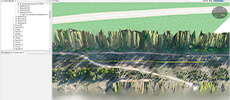
Mapping
- Count the number of trees growing in exclusion zone
- Measure the trees height and diameter of trunks
- Zone trees and shrubs by height
- Value the cut and slash