


Geoscan Planner
Easy-to-use software for mission planning and controlling (including manual) as well as for video-monitoring and georeferencing of the data collected.
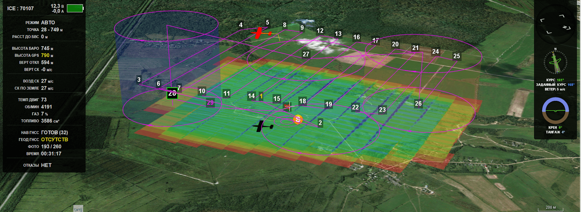
Geoscan Planner is the basis of ground control station for the Geoscan UAVs. Being an automated workplace for pilots, this software is bundled with Geoscan Lite, 201, 401, 701, and Gemini.
The programme is designed for corridor and large-area planning as well as for video-monitoring and dealing with various payloads. Connection to an UAV, preparation for a flight, various manipulations during the flight and raw data processing after landing are available for a pilot.
Map import
Use WMS and various data sources about terrain (Bing, OpenStreetMap and Landsat maps). Import KML/KMZ files if required.
Measures on the map
Find the distance between points on the terrain for safe and effective mapping.
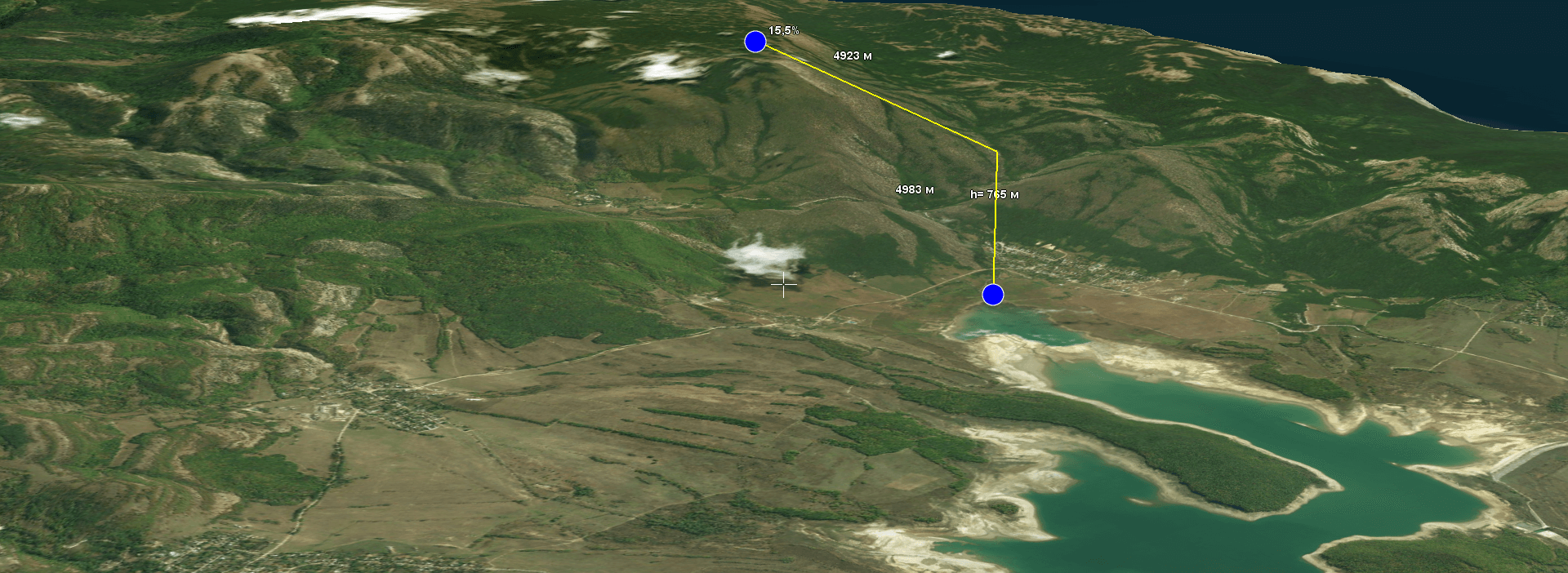
Measure instruments
With the Rectangular Ruler instrument, Geoscan Planner calculates differences and grades on the map.
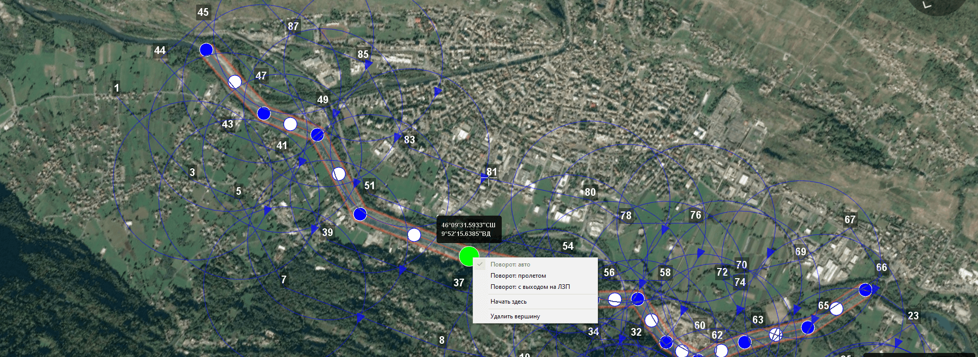
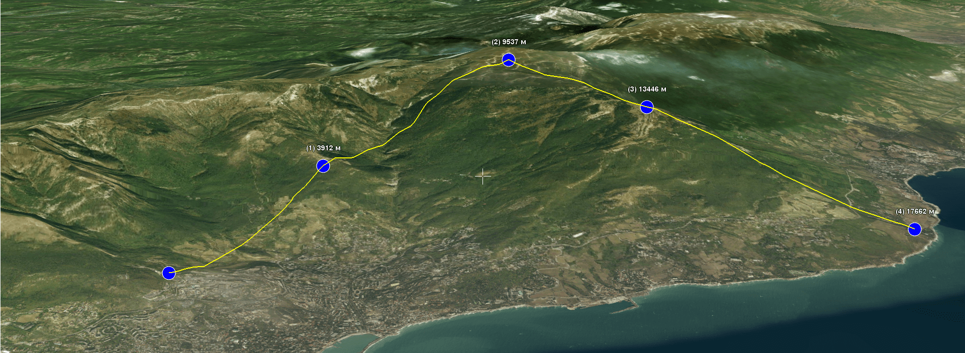
Corridor mapping
Use corridor mapping to cover long, narrow stretches such as rivers, roads, power transmission lines or pipelines. Edit a coverage width and control an UAV when it is turning.
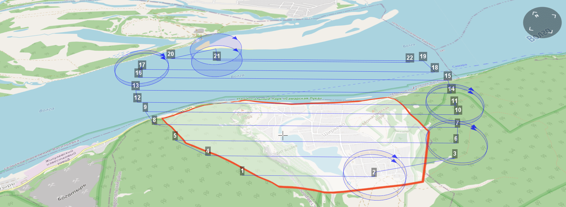
Large-area mapping
Place points at the borders of the area of interest, and Geoscan Planner will automatically construct the optimal flight path to cover it. Change a flight direction. Plan a mission with terrain following and with steady altitudes.
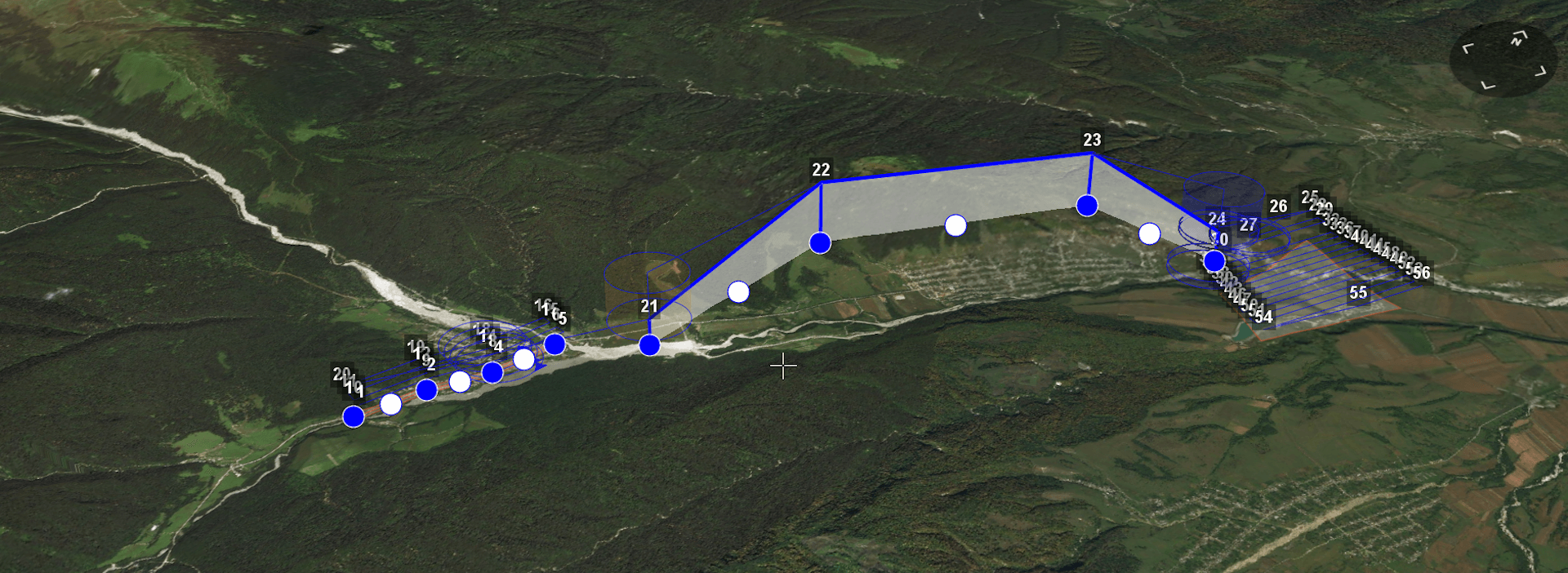
Passing obstacles
Add into the mission a flight between coverage zones to safely pass high objects such as towers, chimneys, etc. If you use a fixed-wing UAV, it will fly in a linear or spiral pattern.

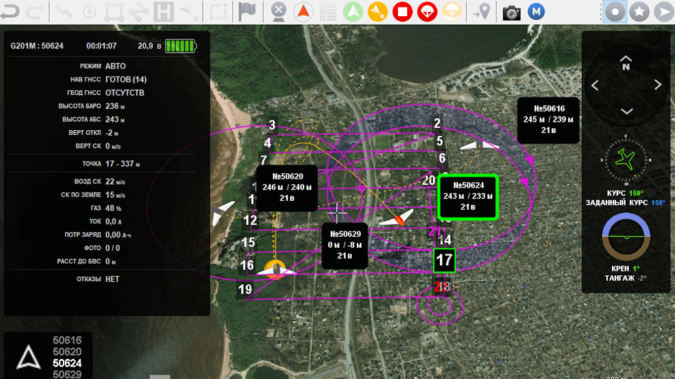
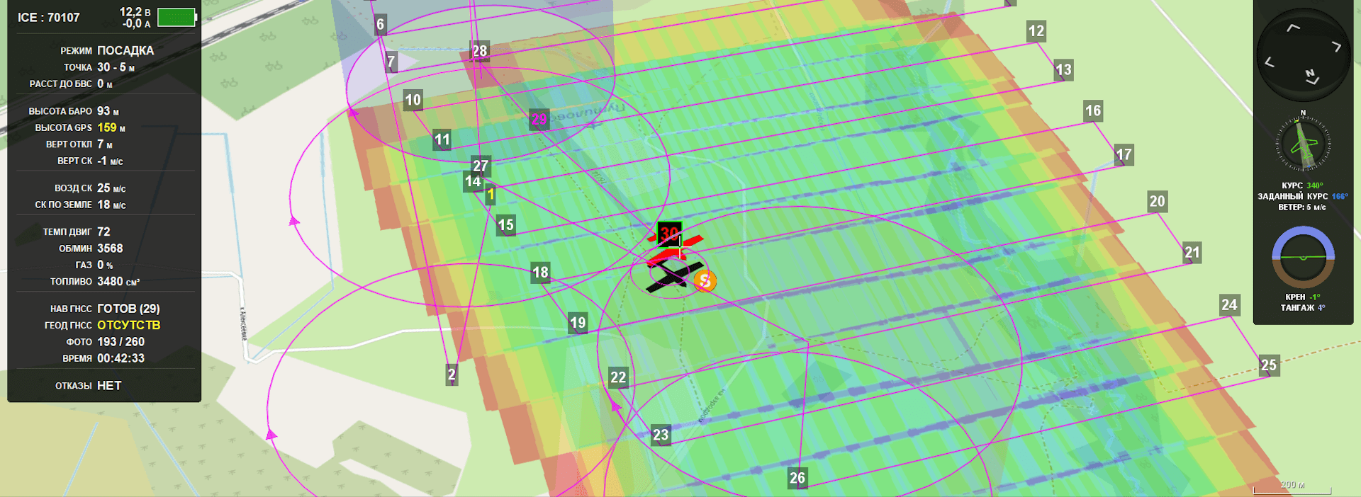
Telemetry
Check elevation, airspeed, and battery charge. Monitor several UAVs from one workplace. Two workplaces Geoscan Planner can be connected through one channel and control an UAV from different points.
Change mission on the spot
Send an UAV to the point at any time during the mission. Change the landing path during the flight if wind speed or its direction has suddenly changed.
Analysis
Look at the data of performed flights in the player regime in order to analyse pilot‘s and equipment‘s work.