Airborne laser scanning (ALS)
Geoscan provides airborne laser scanning followed by data analysis with receiving the following main results:

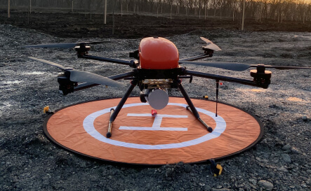
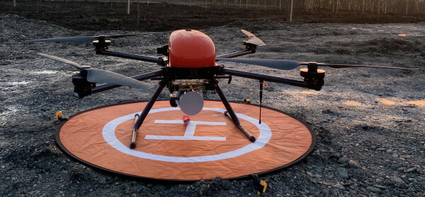
The survey is carried out with the Geoscan 401 Lidar UAV, supplied with the AGM laser scanner with a geodetic GNSS receiver. Aerial photography with the Geoscan UAV accompanies ALS. Data analysis is conducted by stages by using the AGM ScanWorks/PosWorks and Agisoft Metashape Professional software.
ALS advantages:

Efficiency
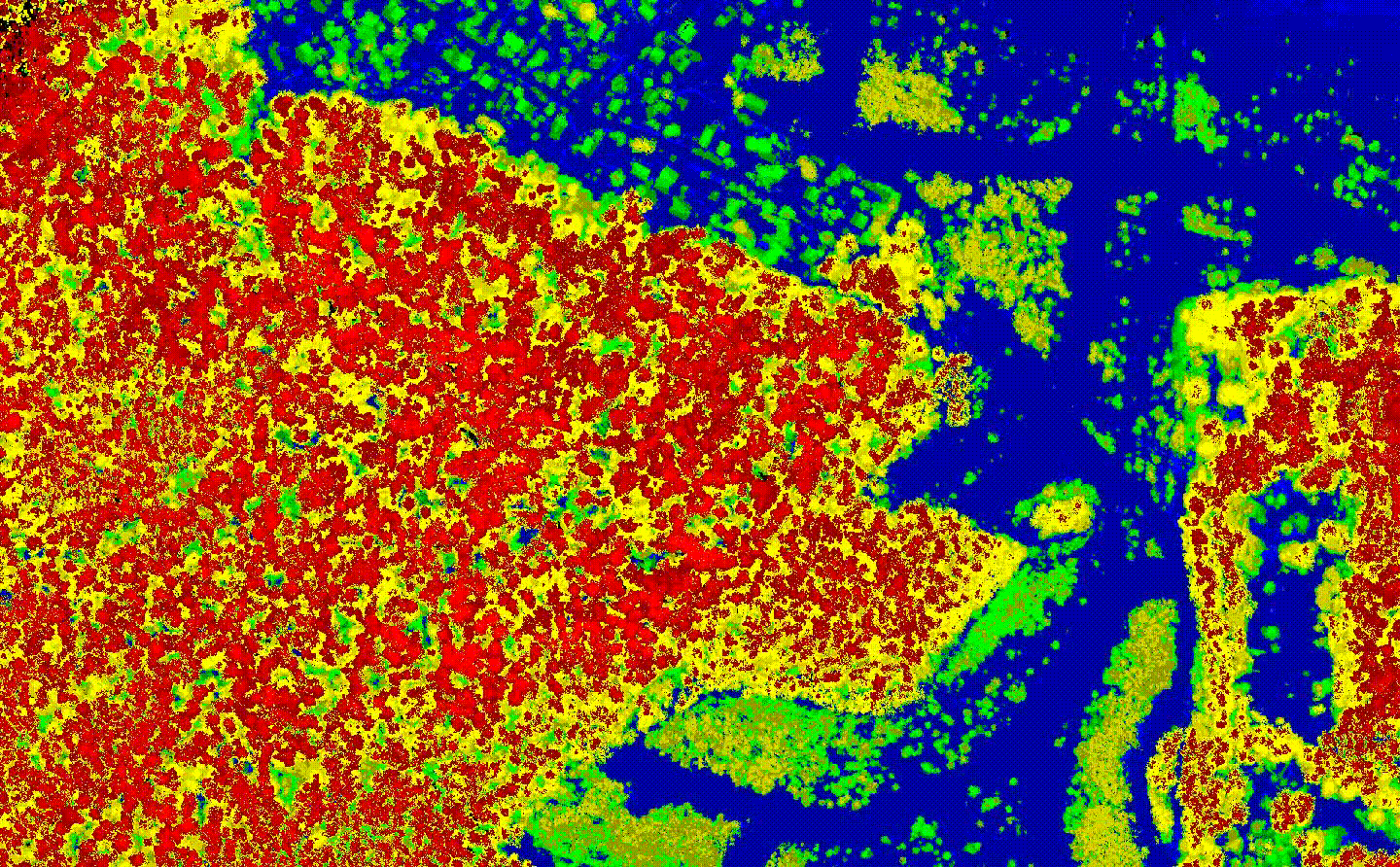
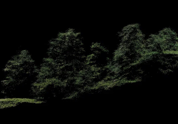
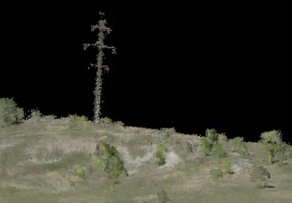
Lidar builds a dense point cloud even in the densely forested conditions, which allows depicting terrain precisely.

Precision
Standard deviation of digital elevation models is about 10cm.

High productivity
1800 ha can be surveyed per day.

Low price
ALS costs several times less than traditional surveying.

Work in necessary coordinate system
During office work, results can be received in any coordinate system.

Productivity
ALS can be performed at the objects even with difficult terrain at any season.
Acquired data


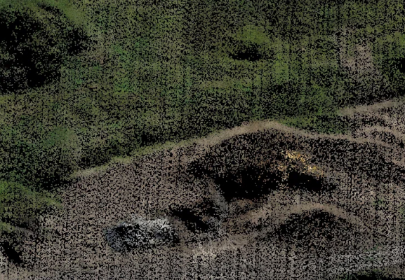
The Agisoft Metashape software allows building a three-dimensional polygonal model of an object after processing point clouds of laser reflections. Learn more about 3D models of territories on the website.
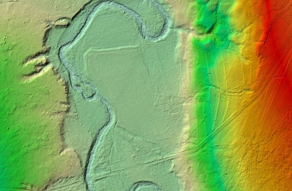
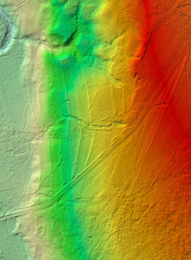
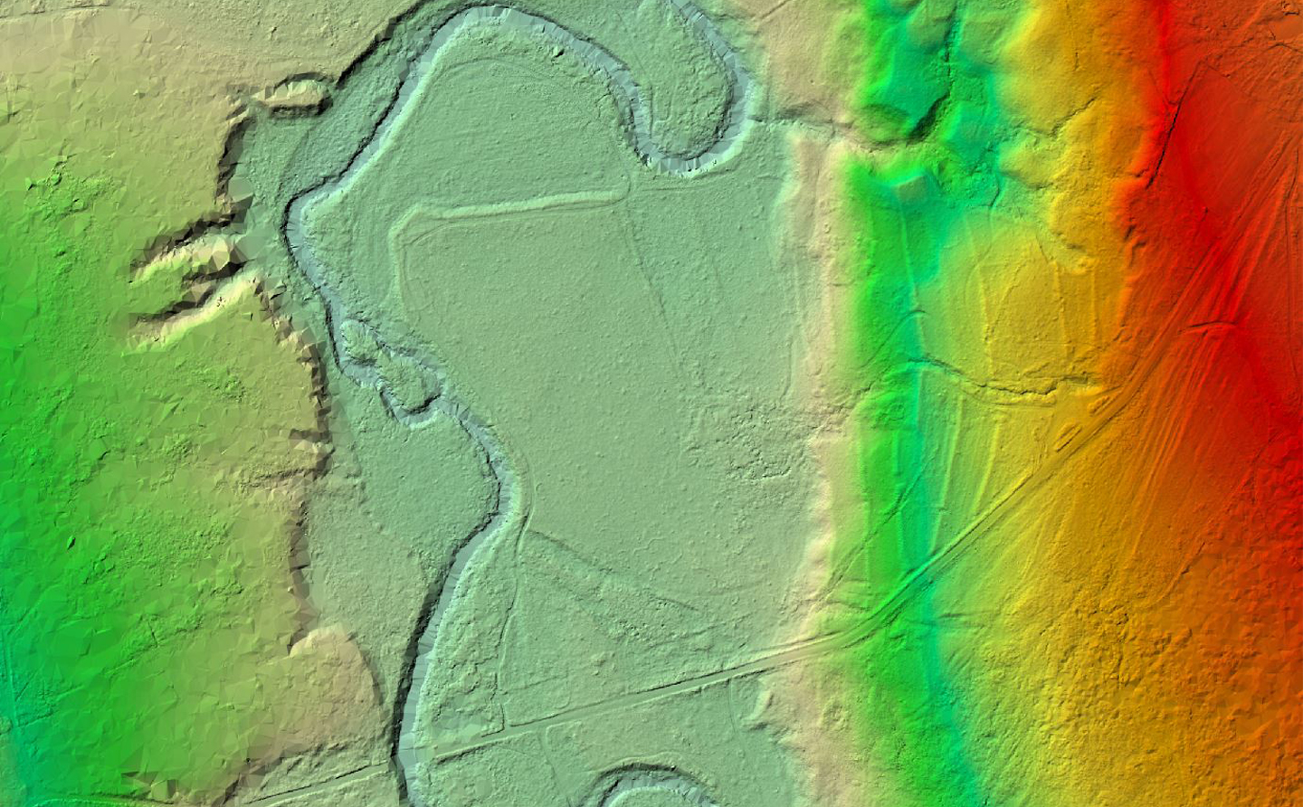
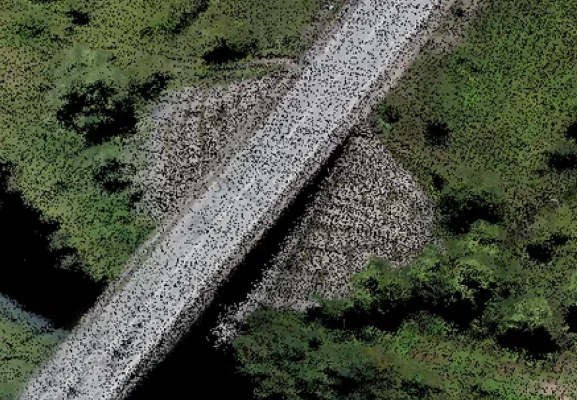
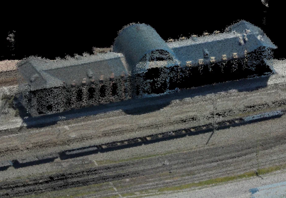
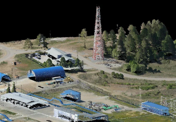
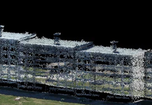
Examples


ALS process
Geoscan 401 Lidar performs ALS at the altitude up to 150 metres in automatic mode.


Application scenarios
For mapping on a scale of 1:500 to 1:10 000, airborne laser scanning materials are actively used to create digital elevation models followed by the construction of contour lines. This is especially relevant for areas with dense tree and shrub vegetation.

Eliding ALS and aerial photography is a fresh look at the survey process. Higher productivity in comparison with classical geodetic works allows reducing the cost of work, including for hard-to-reach and little-studied territories.
The use of ALS is dramatically growing while developing pre-project and design documentation for the construction, reconstruction and diagnostics of railways and roads. The efficiency of obtaining spatial data increases, the time of work and cost are reduced. The data can be used to create digital models of roads or railways, which rises the efficiency of their operation.
ALS data are one of the main sources of geodata. They can be used for automatic analysis, calculations and measurements as well as be combined with other sources. You can use derived data obtained from ALS, and work with polygonal object models, for example, for BIM technologies.
When designing complex objects or industrial areas, it is possible to survey both the entire territory and individual sections or high-rise objects that cannot be photographed from the ground. The obtained data can be combined, for example, with the results of ground-based laser scanning to obtain more complete and precise data.
Creating detailed models of cities and objects of cultural heritage for further designing and planning urban amenities in a three-dimensional environment.
ALS data serve as a tool for determining the height of trees during performing forest inventory and creating standards for the species composition of trees in the classification. When combined with aerial photography, it is used for effective monitoring of forest lands.
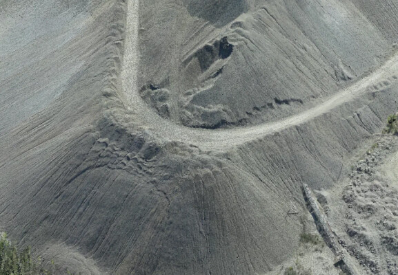
One of the sources of precise and up-to-date data on the surface of a quarry, section, mine. Control over the completeness of excavation, determination of production volumes, accounting of volumes of overburden removed, determination of losses, monitoring of the steady state of sides and dumps.
Regular monitoring energy infrastructure facilities allows obtaining detailed spatial data for reconstructing the position of wires and assessing the state of tree and shrub vegetation in the protected zone.
Have questions but do not know what to start with?
We will help with decision-making, answer your questions and prepare a special offer.
FAQ
What software is used for processing data?
Trajectory and inertial system processing is performed in the Inertial Explorer software. Processing photo centers—in ScanWorks Pro or in software for processing data from GNSS receivers, for example, Magnet Tools, Inertial Explorer. Point cloud processing—in TerraSolid, Lidar360, Credo 3D Scan, Agisoft Metashape.
How did you solve the task of the ALS of linear objects with difficult terrain (large elevation changes)?
When building a flight task, the terrain is loaded automatically into Geoscan Planner. In the properties of linear or areal aerial photography, you can turn on the "Set splitting step" function (enveloping the terrain). For even more accurate contouring of the terrain, for example, a quarry, where space is limited, you can load a digital evaluation model obtained from the results of aerial photography, and use it to build a flight task in order to maintain the required excess over the surface. To do this, when creating a project in Geoscan Planner, you need to select AGM Systems in the additional payload window, then the function of dividing routes into points for rounding the terrain will appear.
How much information can be obtained for 30-minute flight, including Lidar and aerial photography data?
30-minute laser scanning produces about 8GB, aerial photography—about 5GB.
Does the UAV receiver operate in PPK or RTK mode?
The UAV receiver operates in the RRK mode, which allows working either from permanent reference stations, or from a flight base station within a radius of 20-30 km.
Which parameters of the base station are suitable for a combined flight? (Geoscan 201 afternoon and Geoscan 401 at night)
Multisystem geodetic GNSS receivers with a recording frequency of 1-20 Hz can be used for flights of all Geoscan UAVs.
Where can I find the standard ALS parameters (altitude, speed, overlap)?
The standard sidelap for ALS is 10-15%, however if you are conducting aerial photography simultaneously, the overlap needs to be adjusted to suit the image requirements. The shooting altitude depends on the type of laser scanner, the speed is set by the UAV, usually about 10 m/s.
What software do you use to create flight missions?
We use Geoscan Planner for all Geoscan UAVs.