Geoscan Pioneer Indoor navigation system


Geoscan Pioneer Indoor navigation system
Creates a local navigation system allowing for autonomous indoor Geoscan Pioneer flights.
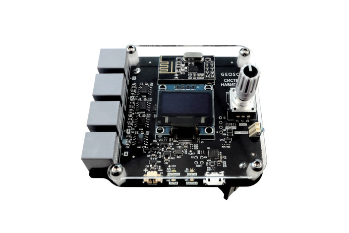
The system consists of four ultrasonic beacons-emitters, installed indoors, and a navigation module mounted on a quadcopter. The navigation module automatically calculates its position, direction and speed in three axes.
System description
To implement an autonomous flight, any unmanned aerial vehicle must know its position.
The ultrasonic local navigation system is able to provide the position of a UAV indoors, where signals from satellite navigation systems are unavailable.
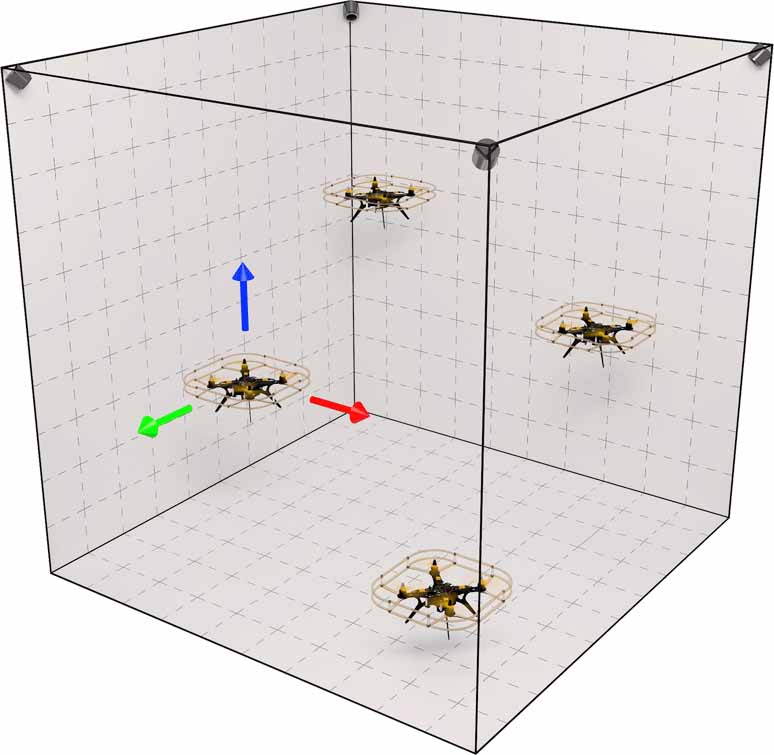
The system creates an "indoor GPS", where ultrasonic emitters controlled by a stationary module act as satellites. By placing 4 beacon emitters at given points, you can create an area where several quadcopters will be able to determine their position and simultaneously perform autonomous flights.
How it works
Measuring the signal travel time from the beacon to the UAV and knowing the speed of the signal, it is possible to calculate the distances from the aircraft to each beacon. If distances to at least three beacons are known, the location of the UAV is defined as the intersection point of the three spheres with the centers at beacons, and the radius equal to the distances from the beacon to the aircraft.
In our system we use ultrasonic emitters as beacons. Two microphones on the navigation module board receive the signals from beacons. Since the microphones are mounted on the top of the board, the emitters must always be higher than the quadcopter, so that the signal reaches the microphone. To determine its location, a quadcopter needs to receive signals from at least three beacons simultaneously. The fourth beacon increases the accuracy of positioning. In addition, the fourth beacon serves as a backup, maintaining the system's operation in case of one of the beacons failure.
Optimal beacons positioning is at a height of 3.5 m at the vertices of a 5x5 m square. The speed of sound depends on air temperature and it is recommended to use the system at a temperature of 20 ± 5 degrees Celsius to obtain the best positioning results.
Freeze light by 6 Geoscan Pioneer quadcopters flying with Indoor Navigation System.
Techical specs of the ultrasonic Local navigation system
Maximum coverage area: 10х10х4 m
Data update frequency up to 100 Hz
Obtained data:
- Coordinates for 3 axes with 2 cm horizontal accuracy and 5 vertical cm accuracy
- Movement speed for 3 axes with 1 cm/s accuracy
- Horizontal direction with 15 degrees accuracy
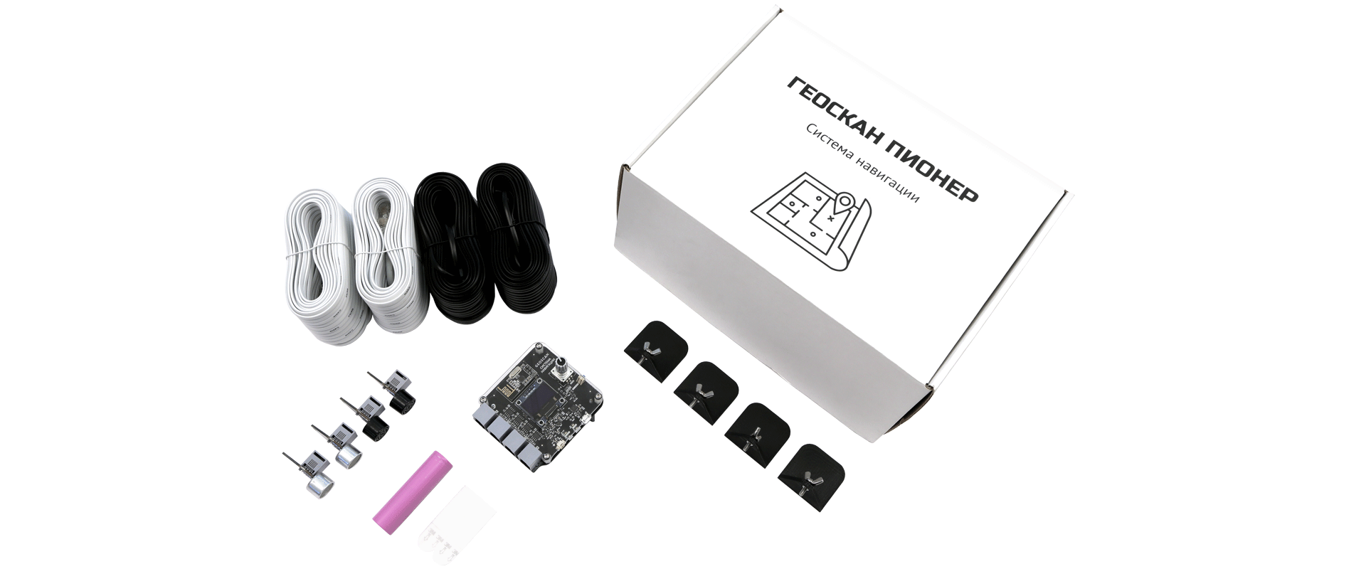
Package content:
- Stationary module
- 4 ultrasonic emmiters
- Cable set
- Emiter wall mounts
Создание и оснащение специализированных классов для беспилотных авиационных систем (БАС)
Геоскан Пионер Локус — система УЗ-навигации, которая соответствует позиции «Система ультразвуковой навигации в помещении, совместимая с БВС» из методических рекомендаций Министерства просвещения РФ по созданию и оснащению классов для обучения программам СПО в сфере разработки, производства и эксплуатации БАС.

1 Year warranty

System operation training course
