Agisoft Metashape Professional
Simple professional photogrammetry

Program description
Agisoft Metashape Professional is software that maximizes the possibilities of photogrammetry. It incorporates machine learning technologies for analysis and post-processing to deliver the highest accuracy results.
- process images obtained with RGB or multispectral cameras, including multi-camera systems,
- convert photographs:
- into dense point clouds,
- into textured polygonal models,
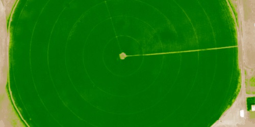
- into georeferenced orthophotomaps,
- in digital elevation / terrain models (DEM / DTM).
Post-processing allows to remove shadows and texture distortions from the surface of models, calculate vegetation indices, compose prescription files for agricultural activities, automatically classify dense point clouds, etc.
The ability to export to all external post-processing packages makes Agisoft Metashape Professional a versatile photogrammetric tool.
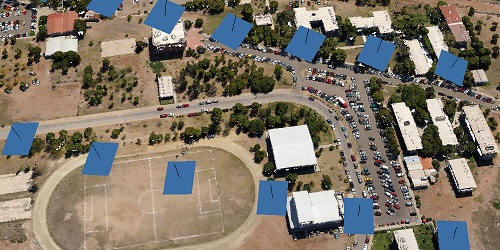
Use Metashape for aerial photos
Point clouds
similar quality as laser scans
Highly detailed
surfaces in TIN or GRID models
Texturised 3D models
based on original images
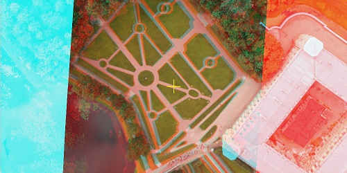
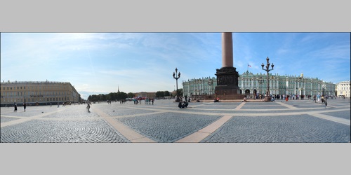
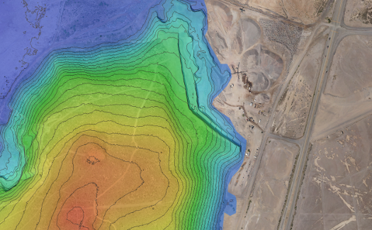
Orthophotos
with 1:500 precision
Professional photogrammetry is easy
The core of Metashape is digital photogrammetry methods supported by modern computer vision algorithms.
Metashape knows what to offer to professionals. You can control the quality of the obtained results by using reports, fine-tune the workspace for specific tasks and use advanced features such as stereo mode or Python scripts.
A professional photogrammetric system can be easily operated by a novice: the intuitive interface is very easy to learn. You can get highly accurate results without even having specialized knowledge and training in photogrammetry.
How it Agisoft Works
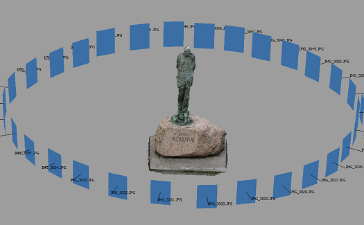
Cameras positioning

Cameras positioning
Cameras positioning
After uploading photos to Metashape, the software will automatically get cameras position and orientation for every shot, and will create base point cloud.
Point cloud

Point cloud
Point cloud
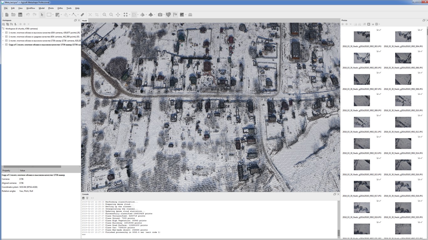
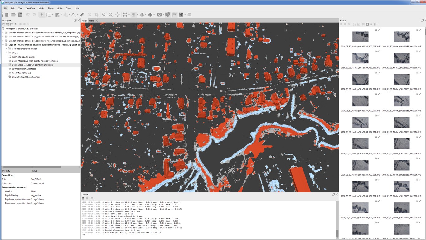
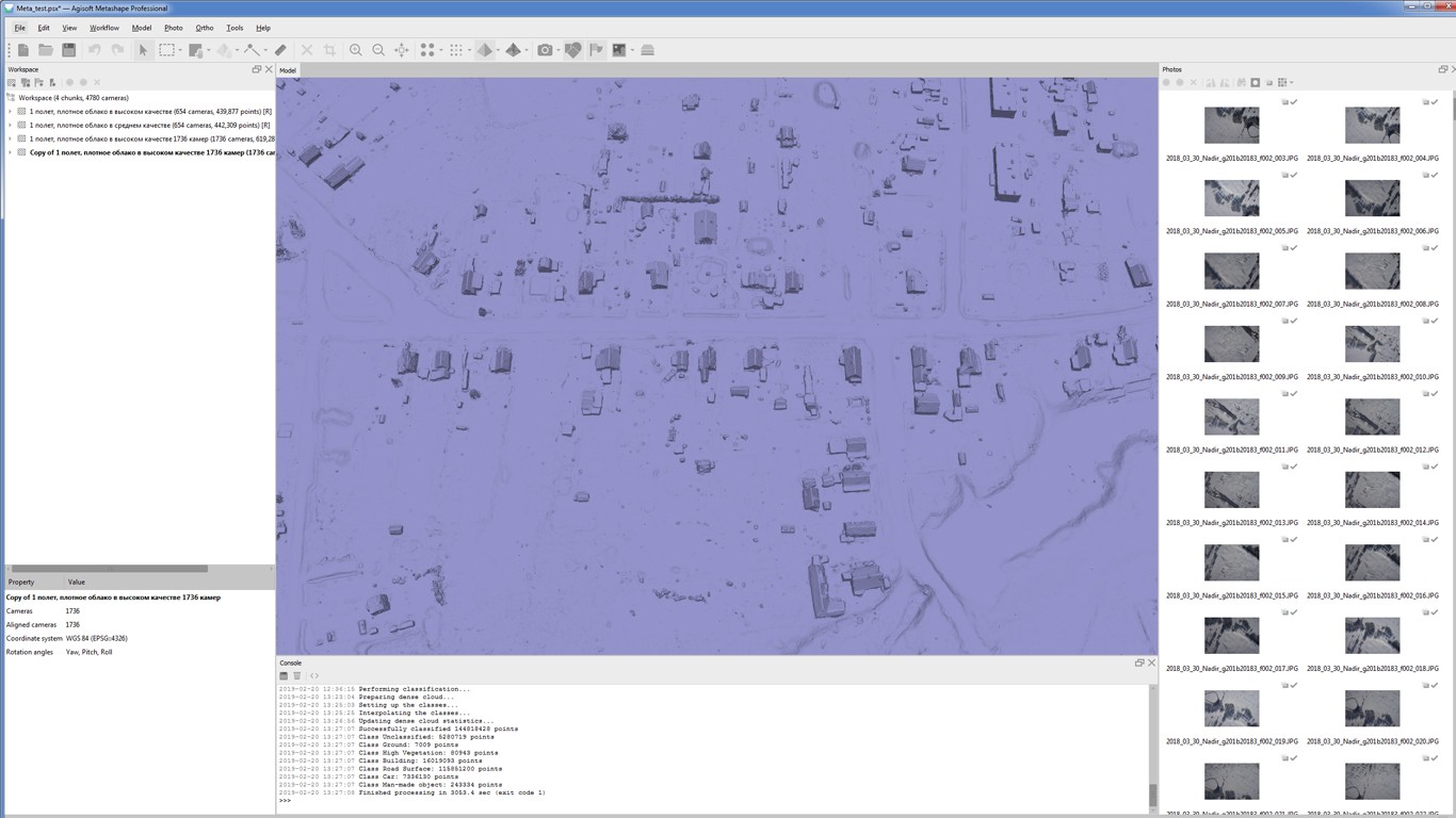
After that, Metashape creates dense point cloud based on calculated cameras positions. Dense point cloud can be cut/excluded and classified.
Polygonal model

Polygonal model
Polygonal model
Based on dense point cloud, a polygonal model is created. Two methods are used altitude map — for such surfaces as relief, and random — for surfaces of any kind. The model can be edited or exported.
Textures

Textures
Textures
To raise textures quality, Metashape uses automated image evaluation. Those rated less then 0.5 are recommended to be excluded from generated texture to make model's visual quality better.
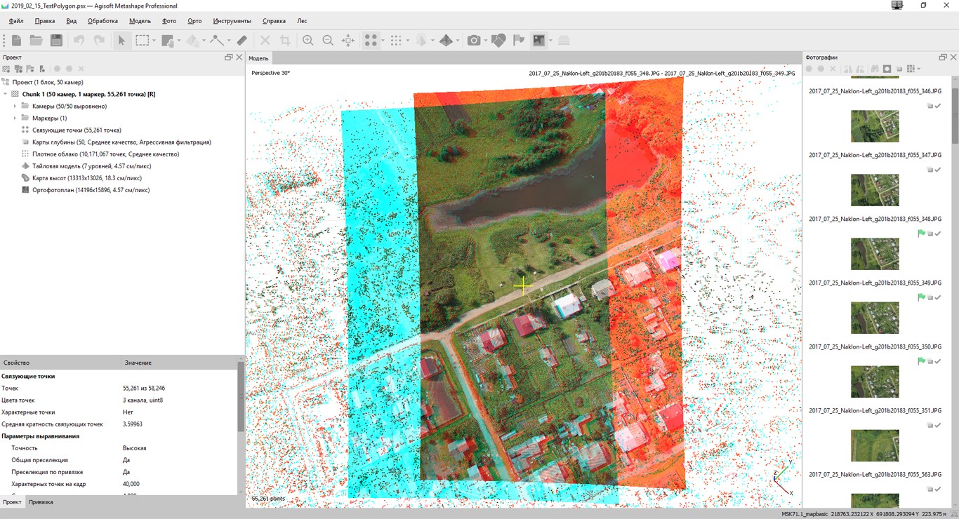
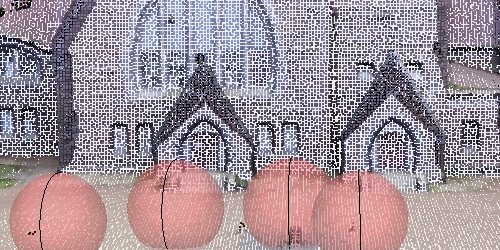
To find common points, Metashape uses an algorithm that first finds 'special' points in individual photographs. Then, on the basis of unique identifiers — descriptors — the points are identified. If a point is recognized in two or more frames, it becomes a match.
This is followed by frame alignment, or phototriangulation. This process is implemented with the use of the Bundle Block Adjustment algorithm, which is based on the least squares method. Bundle Block Adjustment is an interpretation of the Bundle Method, the most rigorous method for solving phototriangulation. The calculation can include the coordinates of the anchor points and the projection of markers on the frame. All parameters can be given weights — the scale of their participation in the calculation.
A dense cloud is built on the basis of depth maps. The Semi-Global Matching algorithm is used to create them. The essence of the algorithm is that for each pixel of the left image of a stereo pair there is a corresponding pixel on the right image. Each pixel in the left image is compared to a subset of pixels in the right image with the corresponding ordinate. Next, a parallelepiped is formed for the entire image, where one 'line' of cells corresponds to each pixel, and one longitudinal section of the cube corresponds to a row of pixels in the image. The elements of the cube are the values of the matching criterion, which are analyzed to find the minimum values for each pixel.
In addition, links between neighboring pixels in eight directions around a given pixel are analyzed. As a result, for each pixel of the left image, the corresponding value of the longitudinal parallax is found and, as a consequence, the spatial coordinates of the points of the dense model.
Capabilities
Processing of various types of imagery: aerial (nadir, oblique), close-range, satellite.
Auto calibration: frame (incl. fisheye), spherical & cylindrical cameras.
Multi-camera projects support.
Scanned images with fiducial marks support.
Additional ability to edit data to obtain the most accurate results in subsequent stages.
Automatic multiclass points for fine-tuning post-processing.
Import / export will help improve the classic point data processing.
Digital Surface and/or Digital Terrain Model — depending on the project.
Georeferncing based on EXIF meta data/flight log: GPS/GCPs data.
EPSG registry coordinate systems support: WGS84, UTM, etc.
Customize vertical datums according to the requirements of a specific project.
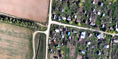
Georeferenced orthomosaic: most-GIS-compatible GeoTIFF format; KML file to be located on Google Earth.
Block export for very large projects. Colour grading to ensure uniform texture.
The built-in noise filter in the image allows to eliminate artifacts resulting from the displacement of the object relative to the camera during shooting.
Set up planar and cylindrical projection options for ground projects.
Simultaneous adjustment of both laser scanner and camera positions.
Capability to combine TLS and photogrammetric depth maps.
Markers support and automatic targets detection for manual alignment of scanner data.
Masking instruments to ignore unwanted objects in scanner data.
GCPs import for georeferencing and control over the accuracy of the results.
Coded/non-coded targets auto-detection for fast GCPs input.
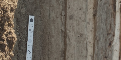
Scale bar tool to set reference distance without implementation of positioning equipment.
Inbuilt tools to measure distances, areas and volumes.
To perform more sophisticated metric analysis Metashape products can be smoothly transferred to external tools thanks to a variety of export formats.
Professional 3D monitors and 3D controllers support for accurate and convenient stereoscopic vectorization of features and measurement purposes.
Various scenes: archaeological sites, artifacts, buildings, interiors, people, etc.
Direct upload to various online resources and export to many popular formats.
Photorealistic textures: HDR and multifile support (incl. UDIM layout).
City scale modeling preserving the original image resolution for texturing.
Cesium publishing.
Multi camera station data processing for creative projects in cinemato- graphic art, game industry, etc.
Basis for numerous visual effects with 3D models reconstructed in time sequence.
It is possible both to build a complete panoramic image using a set of images from one camera station (a camera that is statically located at one point and performs shooting in different directions), and to create a 3D model using data from at least two camera stations.
RGB/NIR/thermal/multispectral imagery processing.
Fast reconstruction based on preferable channel.
Multichannel orthomosaic generation and user-defined vegetation indices (e.g. NDVI) calculation and export.
Straightforward and time-efficient for large-scale projects since requires only aligned images as the input.
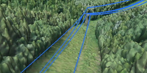
Results export in a form of a 3D polyline model for every wire.
Robust results thanks to catenary curve fitting algorithm.
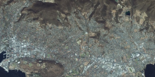
Common processing workflow for panchromatic and multispectral satellite images is supported, provided that sufficiently accurate RPC data is available for each image.
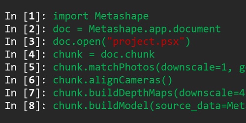
In addition to Batch processing - a way to save on human intervention, Python scripting and Java bindings suggests for sophisticated automation and customization options.
Starting from the adding custom processing operations to the application GUI up to the complete job automation and integration to Python or Java pipeline.
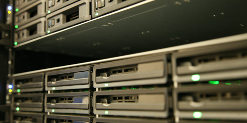
Distributed calculations over a local computer network to use combined power of multiple nodes for huge data sets processing in one project.

Cloud processing interface allows to save on the hardware infrastructure for photogrammetric pipeline, with further option to visualize and share the variety of the processing results online with colleagues or customers, as well as to embed published projects in your own web platforms.
System requirements
| Basic Configuration up to 32 GB RAM |
Advanced Configuration up to 128 GB RAM |
Extreme Configuration more than 128 GB RAM |
|---|---|---|
| Processor: 4 - 8 core Intel or AMD processor, 2.0+ GHz | Processor: 6 - 24 core Intel or AMD processor, 3.0+ GHz | For processing of extremely large data sets a dual socket Intel Xeon Workstation with Quadro/Tesla GPUs can be used. |
| RAM: 16 - 32 GB | RAM: 32 - 128 GB | |
| Graphics card: NVIDIA or AMD GPU with 700+ CUDA cores / shader processor units (For example: GeForce GTX 1080 or Radeon RX 5700) |
Graphics card: 1 - 2 NVIDIA or AMD GPUs with 1920+ CUDA cores / shader processor units (For example: GeForce RTX 2080 Ti or Radeon VII) |
By purchasing Agisoft Metashape license you get full access to software's function capabilities.
License also gets acces to tech support and updates.
Node-Locked license:
Educational License:
Floating License:
Node-Locked License (previously called Stand-Alone license) is a rehostable node-locked license, i.e. one license allows to activate the program at one machine only, however, the license can be transferred to a different computer if needed. The license is available both to individuals and legal entities.
Floating license allows to install the program on as many computers as desired and run it, at any one time, on as many systems as the number of licenses purchased indicates. One computing machine shall be designated as the "license server"; the license server utility installed on it will manage license distribution across the network of computers where the program has been installed. Floating license is available for Agisoft Metashape Professional Edition only.
Educational licenses (rehostable node-locked) and Educational Floating licenses are available exclusively to accredited educational institutions, their employees and students of such institutions. Only officially accredited educational institutions are eligible to obtain Agisoft Metashape educational licenses. This includes: universities, colleges, junior colleges, scientific and technical schools, vocational schools, and correspondence schools. Educational or Educational Floating licenses can also be purchased by students and officially employed teaching and research staff of officially accredited educational institutions. Any educational license prohibits all commercial uses of the software. Educational / Educational Floating and Node-Locked / Floating licenses differ legally but are technically identical.

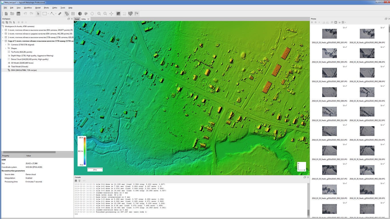
Orthophoto & DEM Generation (with and without GCPs)
This tutorial demonstrates how to generate your first orthophoto and/or DEM with Agisoft PhotoScan Pro, no matter whether you have ground control points (GCPs) data or not.
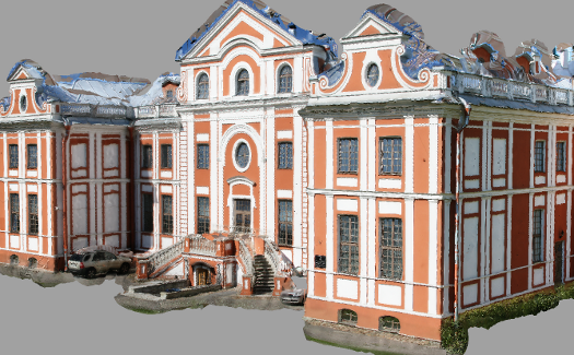
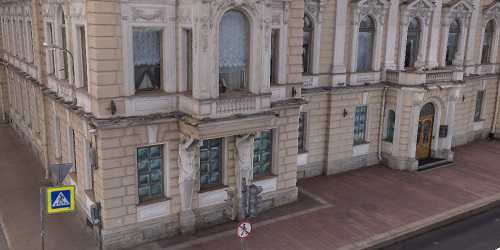
Building reconstruction
This tutorial describes how to create a model of a building with Agisoft PhotoScan, workflow being illustrated with an XVIIIth century mansion reconstruction.
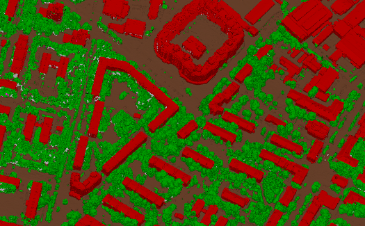
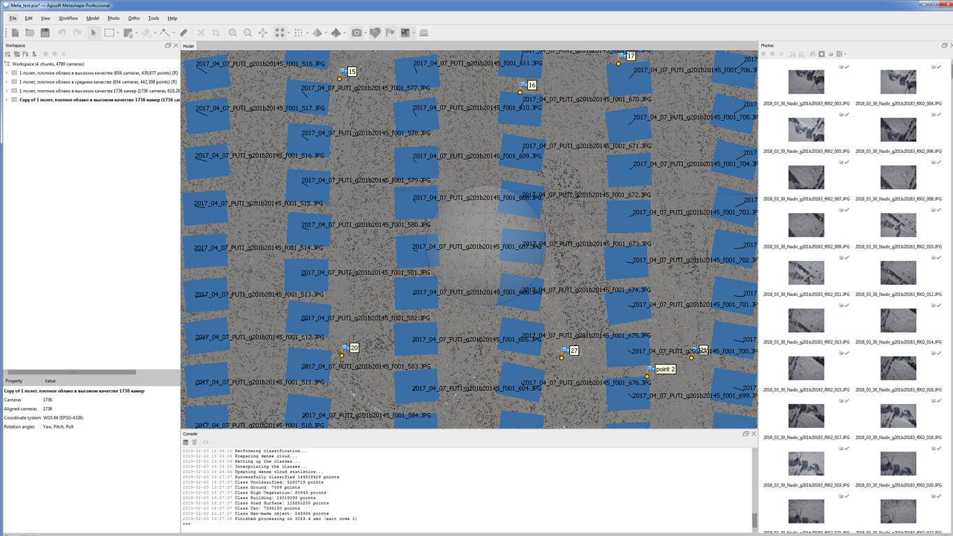
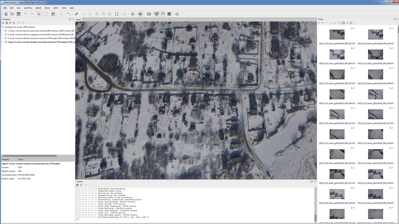
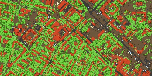
Dense Cloud Classification & DTM Generation
This tutorial illustrates how to use automatic and manual dense cloud classification instruments in Agisoft Metashape Pro.
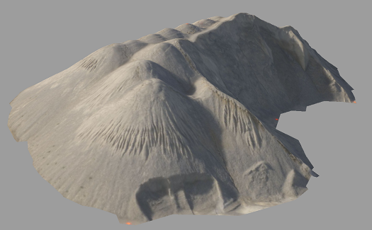
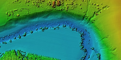
DEM based measurements
This tutorial illustrates how to perform different types of the measurements based on the Digital Elevation Model.
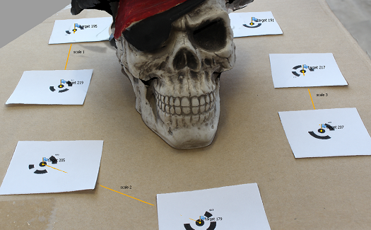
Coded Targets & Scale Bars
This tutorial illustrates the use of coded targets and scale bars in Agisoft PhotoScan Pro.
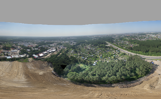
Spherical Panoramas Generation
This tutorial shows how spherical panoramas can be generated using Agisoft Metashape for images taken from the same point.
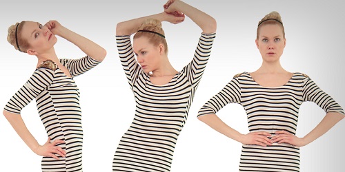
3D Model Reconstruction
This tutorial teaches you how to generate a 3D model of an object with Agisoft PhotoScan using amateur level photographs set only.
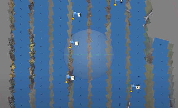
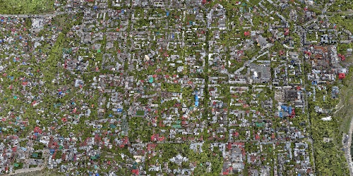
Aerial photography data processing in Agisoft Metashape Professional
This tutorial shows how to process aerial data in Agisoft Metashape Professional software.
Data structure and project creation in Magnet Tools
This tutorial shows how to process geodetic measurements from an unmanned vessel and a ground base station to obtain the coordinates of focal points by using the MAGNET Tools program as an example.