
Unmanned aerial magnetic survey


Geophysical research methods are also used for geological applications as:
Deposites survey
Recently aeromagnetic survey required helicopters or planes use to perform it in distant areas with rough terrain conditions. This was the main reason of extremely high price of such research.
Now, an affordable alternative became availible - aeromagnetic survey with unmanned quadcopter as a carrier. This method is perfect for severe terrains and especially useful in case there is a large altitude difference or swampy area. More importantly, it eliminates any risk for operator during the mission.
Magnetic survey methods comparison
 Land survey Land survey |
 UAV survey UAV survey |
 Aviation survey Aviation survey |
|
|---|---|---|---|
| Price ($/km) |
from 105 | from 32 | from 24 |
| Precision | high / interference exposure |
high / precise |
average / complex interference compensation |
| Performance (km/day) |
15 on average | up to 330 | up to 1000 |
| Preparation | complex | simple | complex / expensive |
| Human error possibility |
high | none | average/ crew life risk |
Unmanned magnetic survey efficiency
This method proved itself as a flexible tool for geophysics engineer. Key advantages:


Comparison of magnetic survey data


Detailed proximity flight results

Comparison of magnetic survey data
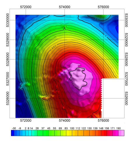
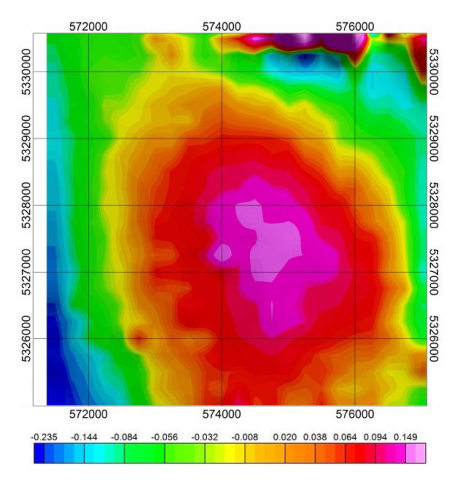
ММС-214 aviational magnetometer was used in 1988 to perform survey on the same site, where Geoscan 401 Geophysics system was applied in 2017. The results comparison is presented:
ABnormal magnetic field
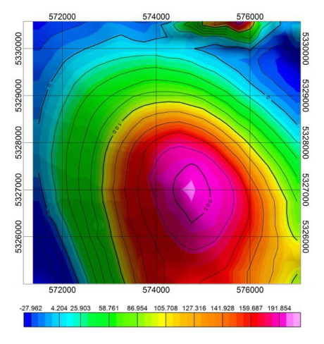
AN-2, ММС-214
Survey scale 1:25 000
Geoscan 401 Geophysics
Survey scale 1:10 000
Magnetic field vertical gradient
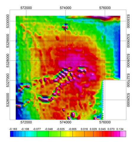
AN-2, ММС-214
Survey scale 1:25 000
Geoscan 401 Geophysics
Survey scale 1:10 000

Geoscan 401 Geophysics for aeromagnetic survey
To use the advantages of unmanned magnetometric survey, Geoscan engineers developed compact and highly-accurate quantum magnetometer (Geoscan Shark QM-Rb1). Geoscan 401 industrial quadcopter acts as a carrier.
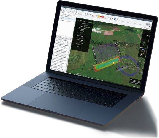
The system includes a ground control station with pre-installed “Geoscan Planner” flight planning software. With Geoscan Planner you can easily set up survey parameters, specify landing point, perform a preflight system check and launch the UAV. During the flight mission, GCS displays UAV status and position, that allows see aerial mission progress.
Application
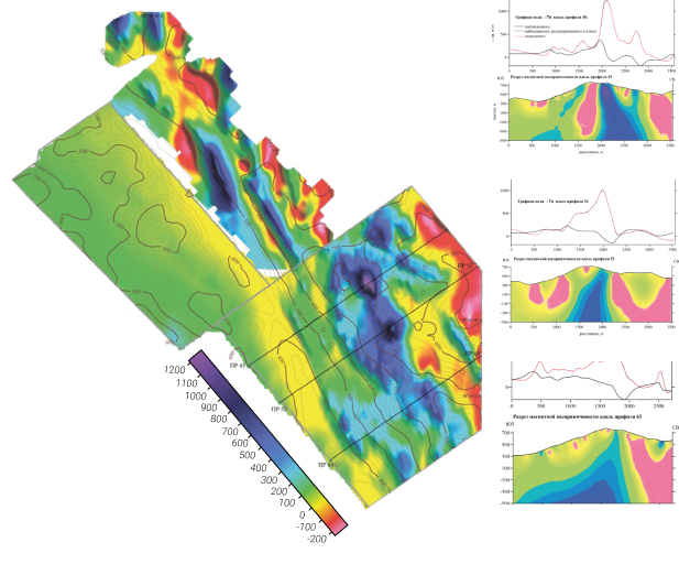
In January, 2019, Geoscan specialists performed aeromagnetic survey in north-western part of Laos Republic on Aurora site. The results are presented as a abnormal magnetic field map and a set of profiles.
This model shows the site's geological structure and allows to observe highly magnetic linear zones, which, possibly, correspond with Mt+Cu+Au mineralization with large amounts of copper, iron ore and gold.
To acquire enough data on specified territory, it is necessary to explore it multiple times, placing magnetometric sensor on different altitudes. Most affordable and convenient way to do this is using UAV multi-level measurements method.
The results are most efficient to locate sub-surface geological structures, their form and three-dimensional positioning.
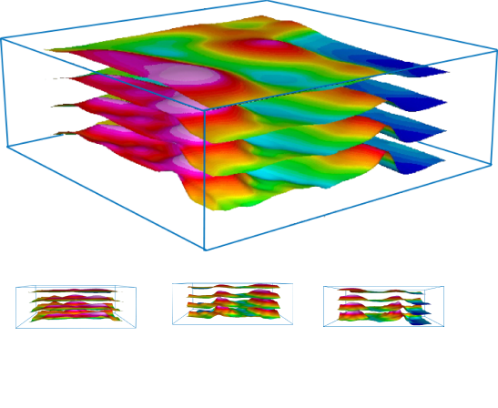
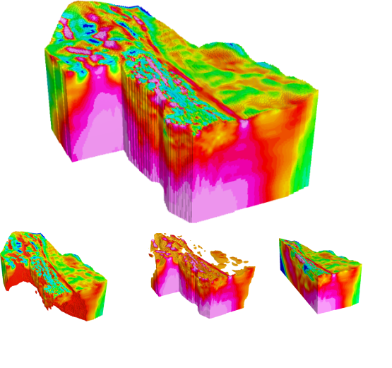
Aeromagnetic UAV survey results can be presented as volumetric model.
This model represents internal geological structure of the site and helps to visualize it properly.
It is also possible to set values range to distinguish different magnetic structures from one another.
In-depth modelling allows to evaluate reserves and calculate them with extreme accuracy.