Geoscan 401 Lidar


Geoscan 401 Lidar
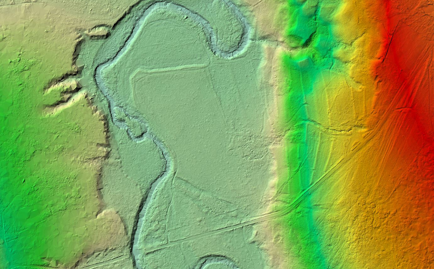
The unmanned aerial system provides prompt digital terrain models development — even for forested areas


up to 450 ha (ALS)
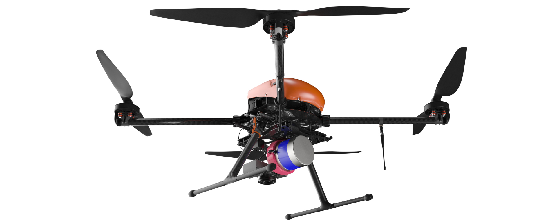
Geoscan 401 Lidar system with the AGM-MS laser scanner and the Sony ZV-E10 camera
System description
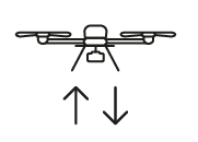
The Geoscan 401 Lidar system is designed for laser scanning and the following creation of digital terrain models or models of particular objects. Unmanned aerial vehicle (UAV) can take off from a 5 m launch site, operate within confined space and accurately follow the terrain.
It carries an AGM-MS laser scanner with inbuilt GNSS receiver as well as Sony ZV-E10 or the Geoscan Pollux multispectral camera as an option.
You can quickly replace one camera with another or disconnect the camera from the LiDAR when you need to perform only airborne laser scanning without additional tools.
Aerial photography (AP) with Geoscan Pollux will supplement airborne laser scanning with multispectral orthophotomaps which can be used to calculate various vegetation indices: SAVI, NDVI, NDRE, LAI, etc.
Survey materials can also be used to build digital terrain models, composite raster images and pseudo-color composites, allowing to achieve color separation of cultivated plants and trees, which, for example, is important in forest inventory.
Instruction:
Advantages
 High productivity
System is able to be airborne for 40 minutes and develop a speed of 50 km/h. In one flight, it may cover:
- up to 200 ha within aerial photography and airborne laser scanning,
- up to 450 ha within airborne laser scanning without aerial photography.
 Efficiency
Laser scanner builds a dense point cloud, and several reflections make it possible to create digital terrain models even in densely forested conditions. Based on high-precision data collected from the laser scanner and the camera, it is possible to build the most detailed 3D models.
 Convenient operating
Specialized Geoscan autopilot software allows its clients to perform all the tasks without debugging and complex settings even on hard-to-reach and complex objects. Geoscan Planner provides maximum simplicity and safety of UAV operation.
 Reliability
Manoeuvring system precisely follows even difficult terrain and steers the course at wind speed 12 m/s in fully-automatic mode.
 Utility
Vertical launch and landing make drone suitable for using in a tight city space or in a thick forest. Smart battery covered with special shell, guarantees fail-safe operating at temperature range from −40 to +40 °С (Arctic option).
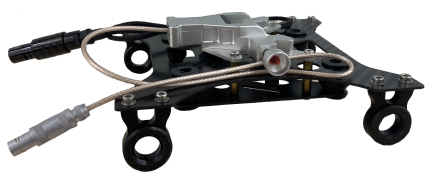
A special quick-release bracing allows using two payloads simultaneously, which eliminates the need for ALS and AP to be carried out by different UAVs.
Application scenarios

TOPOGRAPHIC AND GEODETIC WORKS

Road and railway certification

Data creation for GIS and CAD

Design complex engineer building

Urban development

Forest inventory

Mining

Power lines inspection
Geoscan 401 Lidar effectively carries out the aerial survey of vertical surfaces (building faces), forests, areas with large-statured trees or high level difference (cast mines, mountainous areas). Laser scanning in accordance with a flight mission is performed automatically. Survey data can be used for developing geotagged orthophotos, 3D and digital terrain models.
Depending on client’s goals UAV can be equipped with the AGM-MS1 or AGM-MS3 laser scanner.
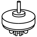
AGM-MS1 laser scanner
Cost-effective highly precise laser scanner used on UAV can be operated together with external photo camera or thermal imaging camera.
- Data acquisition rate: up to 300 kHz
- Range: up to 100 m
- Altitude: 60 m
- Spatial accuracy: 3–5 cm
- Operating temperature: -20 to +50 °C

AGM-MS3 laser scanner
Highly precise laser scanner used on UAV can be operated together with external photo camera or thermal imaging camera.
- Data acquisition rate: not less than 600 kHz
- Range: up to 200 m
- Range accuracy: 3 cm
- Spatial accuracy: 3–5 cm
- Operating temperature: -20 to +50 °C

Suspension for laser scanner PRIN AIR450
Geoscan 401can be equipped with the PRIN AIR450 laser scanner. The Geoscan Planner software allows building flight missions for this payload and is adapted to its calibration specifics.
Geoscan 401 Lidar equipped with AGM-MS3 laser scanner
Data processing technology

- Survey with pre-set overlap
- Fully automatic flight
 Geoscan Planner
![]()
![]()

- Processing the trajectory and inertial system of the laser scanner
- Point cloud output of laser reflections
- Obtaining image centers
Agisoft Metashape
AGM PosWorks Web
AGM ScanWorks Base
AGM ScanWorks Pro
![]()
![]()

- Classification
- DTM/DEM building
- TIN building
- Orthophoto building
- Contour lines building
- Visualization
Agisoft Metashape
Lidar 360
TerraSolid
Credo 3D SCAN
![]()
![]()

Creating products for clients
Software for trajectory processing
| Function | AGM-MS1 | AGM-MS3 |
| Trajectory processing through the AGM PosWorks Web service (requires an Internet connection of at least 1 Mbps) | + | + |
| Point cloud output through the AGM ScanWorks software | + (only Base) | + (Base/Pro) |
| Collecting image centers through Agisoft Metashape or AGM ScanWorks | + | + |
| Offline trajectory processing and point cloud output through AGM ScanWorks Pro software | - | + |
| Processing software: Agisoft Metashape, AGM PosWorks, AGM ScanWorks (Base, Pro) | + (only Base) | + |
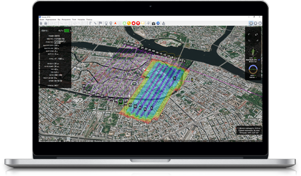
Geoscan Planner. Software for flight planning
Plan flights in a couple of clicks and use various flight modes. Just select flight area or upload it from the file. The program plans the flight assignment automatically, sends it to UAV during pre-launch preparation and monitors flight accuracy after the start.


UAV specifications
Flight endurance:
up to 40 min
Coverage:
up to 200 ha (AP and ALS)
up to 450 ha (ALS)
Maximum survival wind speed:
12 m/s

Flight speed:
up to 50 km/h
Dimensions:
Folded: 70 × 25 × 19 cm
Unfolded: 150 × 150 × 56 cm
Minimum flying safety altitude:
from 25 m
Most efficient flight altitude:
60 m (with AGM-MS1)
200 m (with AGM-MS3)
Operating temperature:
from -20 to +40 °С
(extra option extends operating temperature range to -40 °С)
Motor:
electric / 4 pcs
Take-off / landing:
vertical, automatic, 5 m radius site
Laser scanner technical specifications
| Model | AGM-MS3.200 Ublox | AGM-MS3.200 Novatel | AGM-MS1.100 |
| Scanning frequency | Not less than 600 kHz | Not less than 600 kHz | Up to 300 kHz |
| Maximum range | Up to 300 m | Up to 300 m | Up to 100 m |
| Working long range | Up to 200 m | Up to 200 m | Up to 60 m |
| Angle of view | Up to 360 degrees | Up to 360 degrees | Up to 360 degrees |
| Scanning mirror rotation speed | Up to 20 rps | Up to 20 rps | Up to 20 rps |
| GNSS board | Ublox | Novatel | Ublox |
| Range accuracy | 3 cm | 3 cm | 3 cm |
| Coordinate determination accuracy | 3–5 cm | 3–5 cm | 3–5 cm |
| Sensor unit weight | 1 Kg | 1 Kg | 1.1 Kg |
| Use temperature | -20...+50 °c | -10...+50 °c | -20...+50 °c |
| Discreteness of GNSS receiver | 20 Hz | 20 Hz | 20 Hz |
| Camera control from the system | Geoscan | Geoscan | Geoscan |
| Measuring Instrument Certificate | Yes | Yes | Yes |
Default kit
- Geoscan 401 Lidar UAV
- AGM laser scanner (selected modification)
- Software for working with trajectories and outputting data from a laser scanner AGM ScanWorks (Base/Pro) and AGM PosWorks Web (depending on the laser scanner
- 2 rechargeable batteries for Geoscan 401
- Charger suitable for charging two batteries at once
- The Geoscan Planner software for missions planning
Consultation on operating the UAV is provided by Geoscan Support Service ([email protected]). Laser scanner service support is carried out by AGM Systems ([email protected]).
Extras
- Sony ZV-E10 20 mm camera with a quick-release bracing to the AGM laser scanne
- Multispectral camera Geoscan Pollux with a quick-release bracing to the AGM laser scanner
- Double-axis suspension with upgraded photogrammetric camera 45 MPix
- Detailed consultation on applying software in office data processing (Agisoft Metashape Pro, Magnet Office tools).
Geoscan 401 is a multifunctional platform for various payloads that provide wide range of application scenarios.
UAV can be equipped with:
-
AGM-MS1 or AGM-MS3 laser scanner
— Laser scanning of areas or particular objects.
-
Upgraded Sony ZV-E10 and upgraded photogrammetric camera 45 MPix
— Detailed aerial photography with GNSS georeferencing and capability of image overlap adjustment with a view to later processing.
-
Multispectral camera Geoscan Pollux
— An integrated tool for agricultural land assessment.
-
Magnetometer Geoshark
— Magnetic survey tagged to terrain features. Highly productive inspection of areas inaccessible for ground exploration.

1 Year / 80 flights warranty

System operation training course
