Geoscan is actively exploring opportunities for cooperation with foreign countries. For example, in late June, our team conducted demonstration flights for one gold mining company in Saudi Arabia. The company was asked to perform an aeromagnetic survey using an UAS in an area previously surveyed using ground-based methods. The aim was to compare the effectiveness of the two approaches.
After extensive negotiations with the client in the city of Bisha, Geoscan specialists, along with a team of experts from the local partner, Najabah Co., who arranged flight permits, drove to the work site, located two hours away. The field works spanned two days. During this time, 180 linear kilometers of aeromagnetic survey were performed by Geoscan 401 Geophysics.
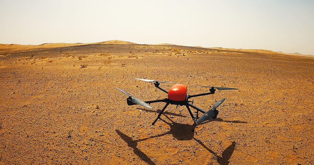
Before the flights, the team had to identify the optimal location for the magnetometer sensor, ensuring that the magnetic field lines passed through it vertically. Being an equatorial country, Saudi Arabia presented unique challenges with both the angle of the magnetic field and the flight azimuth, unlike the northern latitudes, where the magnetic field lines are nearly vertical and the sensor placement requires minimal thought. Due to the magnetometer setup and an issue with the power generator that prevented equipment charging on site, only four flights were conducted on the first day. The remaining 12 flights were successfully carried out the following day, once all the problems had been resolved.
The initial processing of the survey data was done at the client’s office on-site. Geoscan specialists generated a comprehensive report outlining the methodology employed and produced magnetic field maps. The team is currently working on geological interpretation of the data, which will be sent to the client for a detailed analysis and decision regarding further collaboration.
“The client will be able to compare our aeromagnetic surveying method with the classical ground-based approach. Based on the preliminary data, it is evident that UAS surveys are much cheaper and faster. A local geophysical company conducted a ground magnetic survey at the site in 2022, covering 67 kilometers in 7-8 days. In contrast, we were able to complete 180 linear kilometers in just 2 days, despite the delays caused by the faulty generator that limited our productivity to just 30%,” says Dmitry Goglev, deputy head of the Geophysics Department at Geoscan.
With the air heating up to 48 °C and occasional sandstorms, the weather posed the greatest challenge to our specialists and hardware. Nevertheless, the equipment worked like a charm, demonstrating its resilience. This successful experience of utilizing our larger UAS in the desert conditions, under such extreme temperatures, is noteworthy. Previously, we had primarily launched small Salut copters in Saudi Arabia for light shows, in particular, the most elaborate drone show in history.