


Sputnik Agro
Geographic information system for precision agriculture.
Analyze state of crops, plan differential fertilization and land improvement activities based on the data of multispectral imagery and accurate information about the relief.
Sputnik Agro provides specialists with the necessary set of tools for solving problems of land inventory, crop control and agrotechnical measures, land reclamation planning and risk management.
The software provides full-fledged workflow with raster maps in the multi-spectral range, digital elevation models and vector maps.
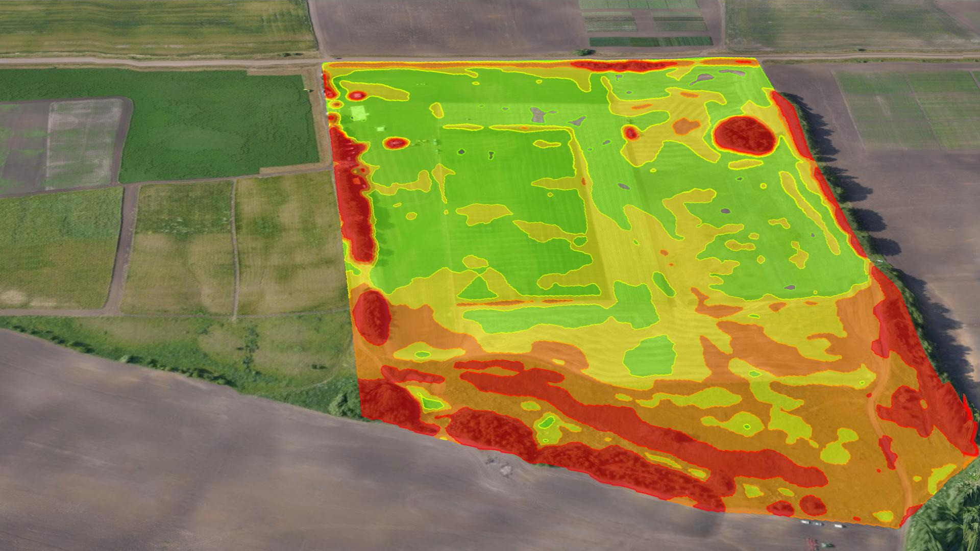
NDVI analisis & Prescription generation
Analyze crop stress level for given field with interactive histogram.
Generate zoning NDVI maps by class with the specified bounds and export prescription maps.
Indices generation
Generate custom indices maps with raster calculator.
Use predefined list of indices and visualization modes for Altum, RedEdge and Sequoia cameras.
Inspect multispectral data in RGB and CIR modes.
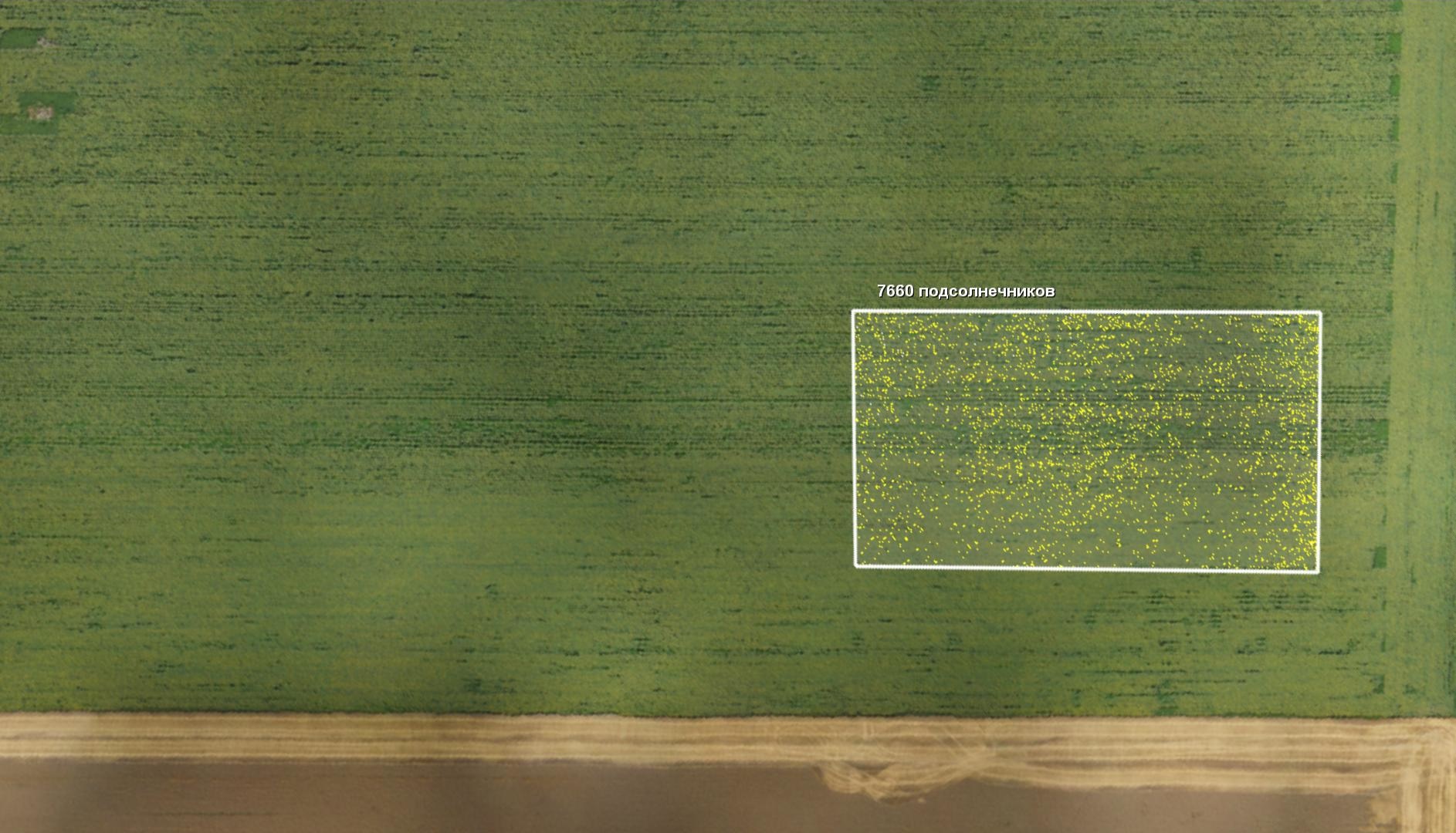
Counting crops
Automatically detect and count sunflowers.
Export results into *.xls and *.tiff to use in third-party products.
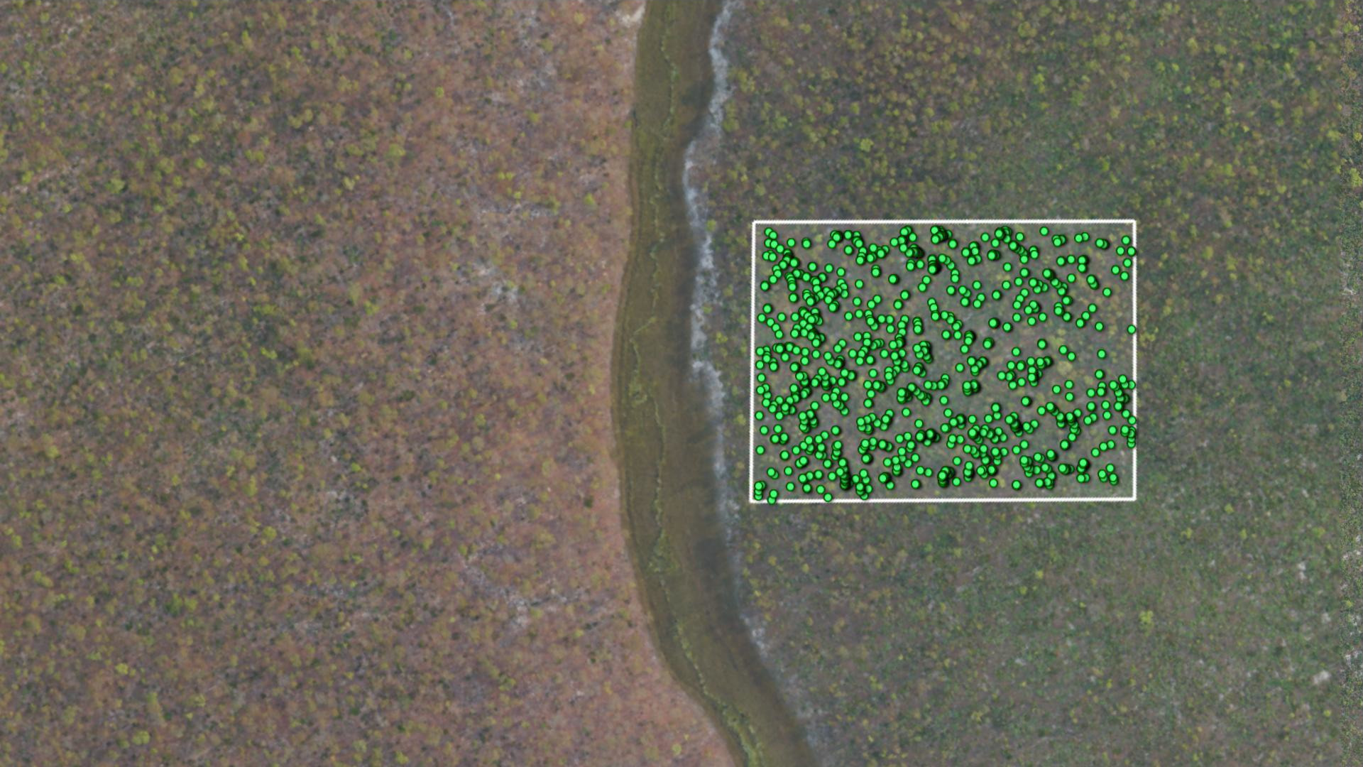
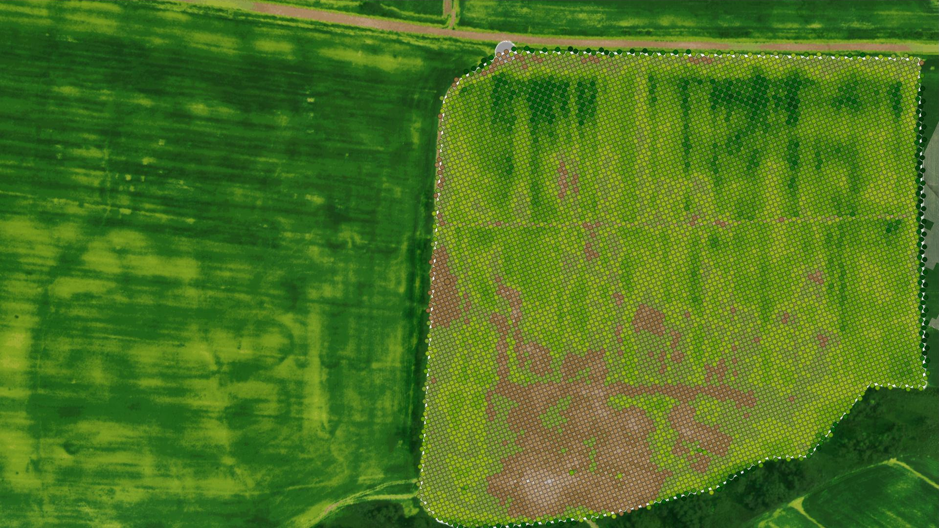
Counting trees
Automatically detect and count trees.
Export results into *.kml and *.shp to use in third-party products.
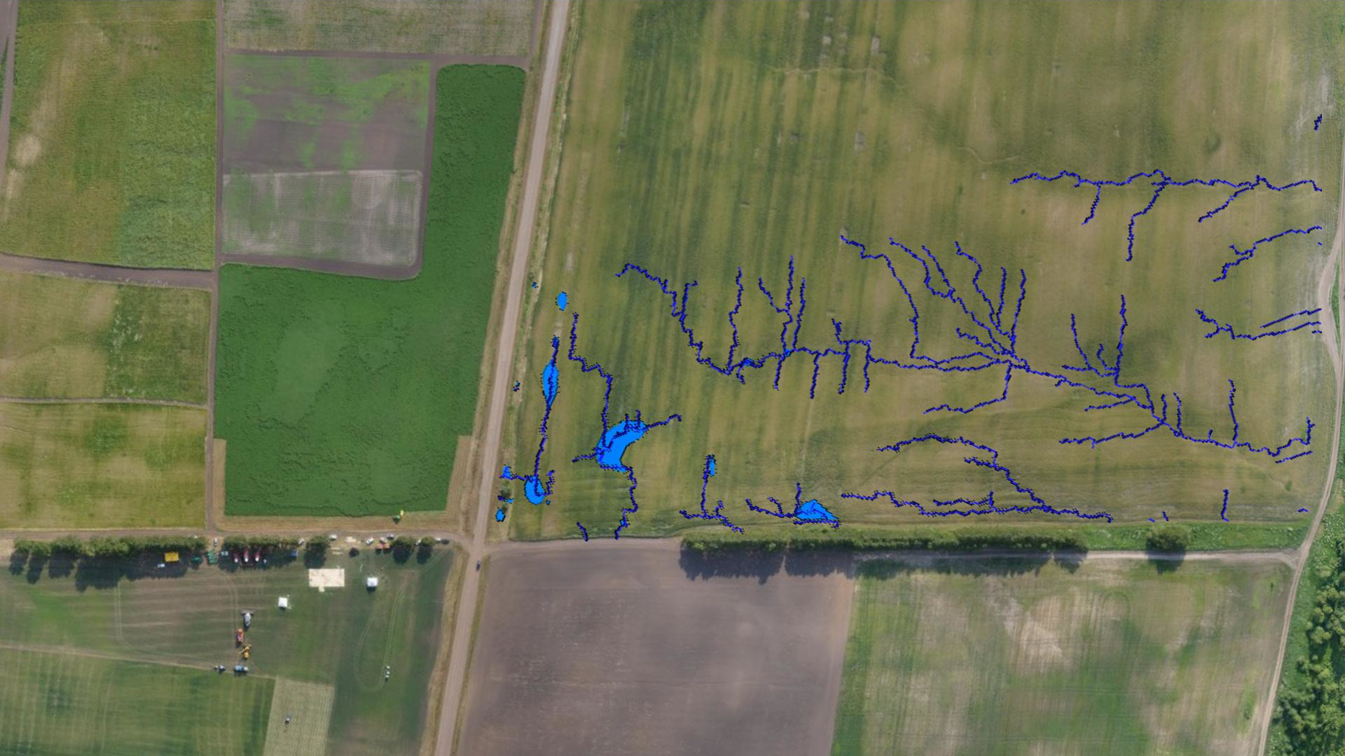
Waterflow modeling
Plan land improvement activities with respect to dry and waterlogged areas according to water flow and catchment areas maps.

Slope map generation
Generate slope maps and plan land improvement activities with respect to relief features.
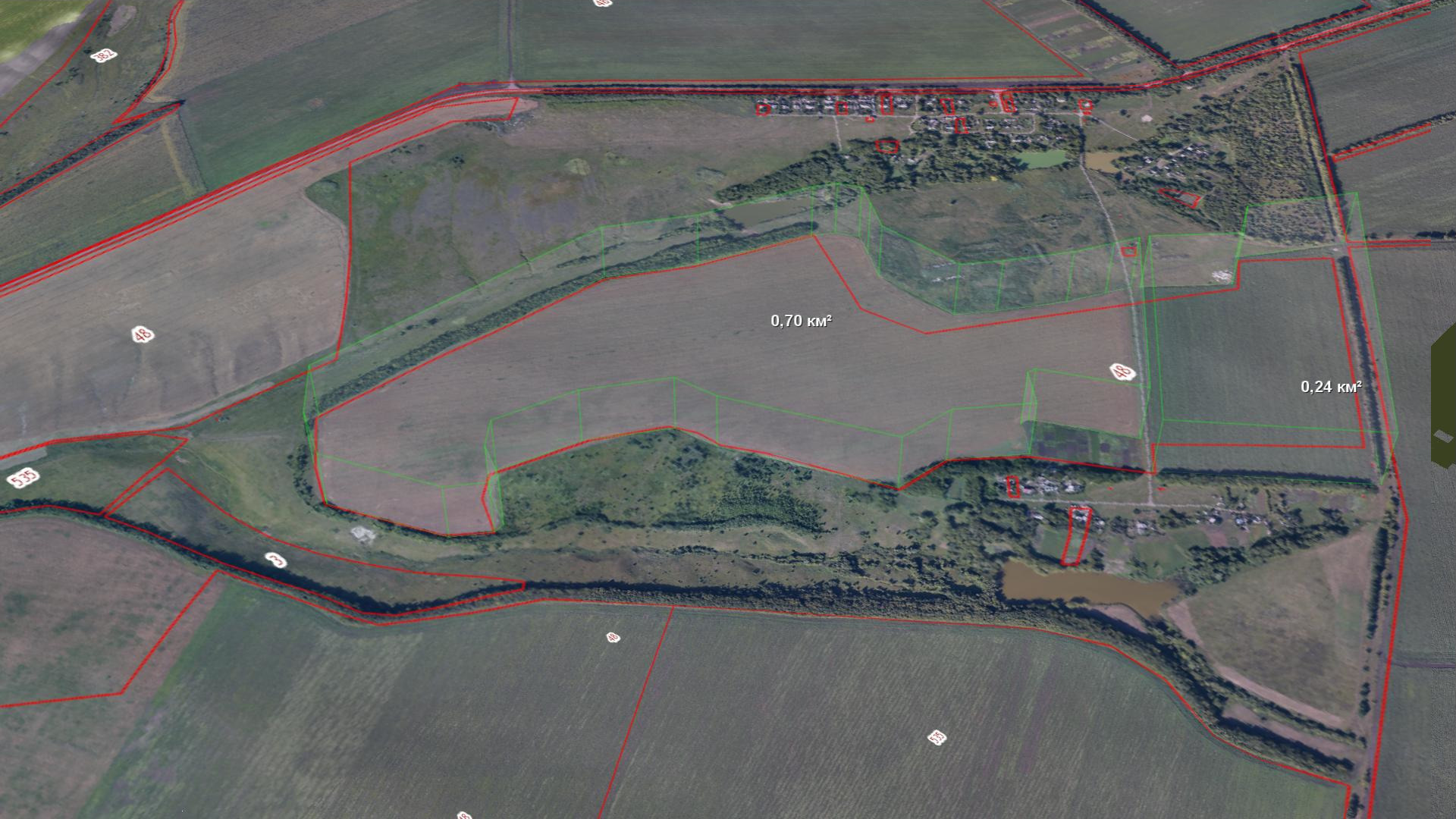
Field boundary
Import or draw precise field boundary and calculate area. Annotate fields or areas of interest.
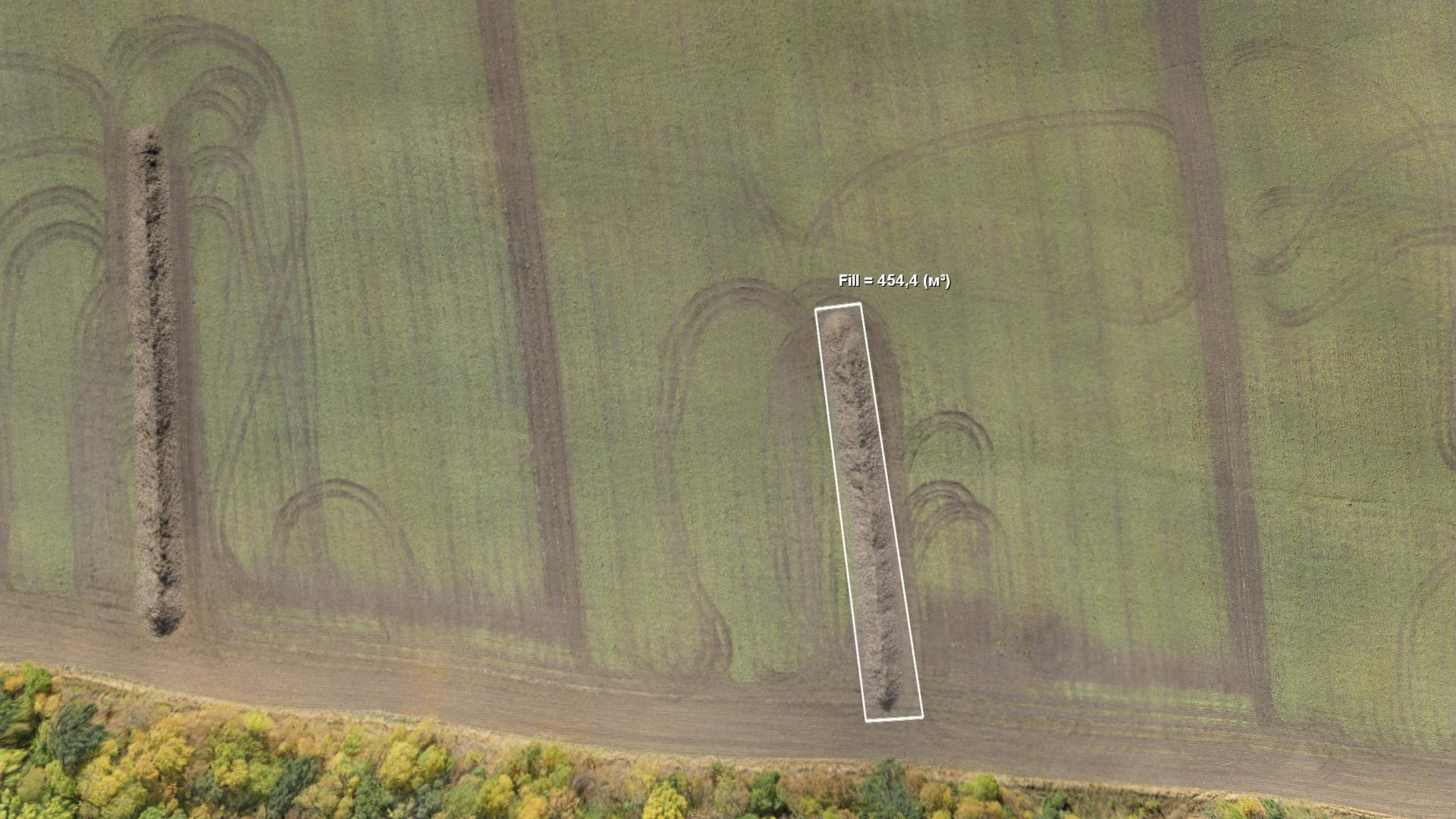
Volume calculation
Measure the volume of the root vegetables in opened storages.
Detect changes using DEM for different time periods.
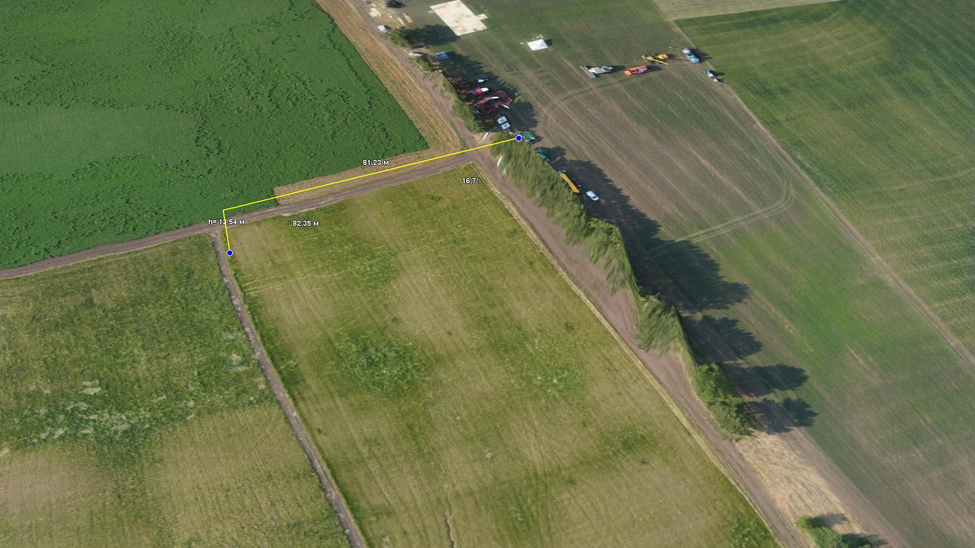
Basic measurements
Measure distances with taking relief into account, calculate and compare section, generate section lines.
The program is distributed free of charge and without restrictions on use.


Video tutorials
Sputnik Agro - RedEdge camera. Calculate NDVI parameters
Spuntik GIS video tutorial - RedEdge camera. Calculate NDVI parameters
Sputnik Agro - Counting trees and sunflowers
Spuntik GIS video tutorial - Sputnik Agro. Counting trees and sunflowers
Sputnik Agro - Raster calculator
Spuntik GIS video tutorial - Sputnik Agro. Raster calculator
Spuntik GIS - Calculating contours and triangulation
Spuntik GIS video tutorial - Calculating contours and triangulation
Spuntik GIS - Detecting changes
Spuntik GIS video tutorial - Detecting changes
Spuntik GIS - Area and volume calculation
Spuntik GIS video tutorial - Area and volume calculation
Spuntik GIS - Linear measurements
Spuntik GIS video tutorial - Linear measurements
Sputnik GIS - Creating reference surface
Spuntik GIS video tutorial - Creating reference surface
Spuntik GIS - Calculating sections
Spuntik GIS video tutorial - Calculating sections
Spuntik GIS - Creating slope map
Spuntik GIS video tutorial - Creating slope map