StratoSat TK-1, the first satellite built by Geoscan for a client, blasted off into orbit from Vostochny Cosmodrome on June 27. The satellite went online as expected, and accomplished one of its key tasks, deploying six Stratonautica PicoSats – five of them are currently operational and transmitting data back to Earth. The StratoSat small spacecraft also successfully continues its flight in a polar orbit with an inclination of 97.7º at the altitude of 548x575 km, making a full revolution every 96 minutes. All onboard systems are operating properly.
The Picosat separation process was captured with the HRCAM-S video camera developed by Geoscan. Recently we also completed the testing of Geoscan HRCAM-M camera, designed in-house and equipped with a telephoto lens.
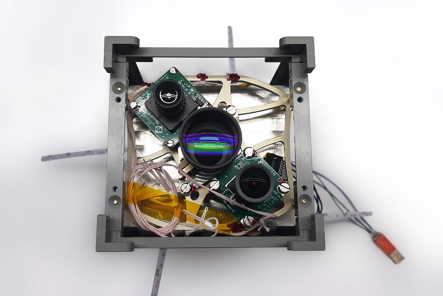
Center: Geoscan HRCAM-M camera
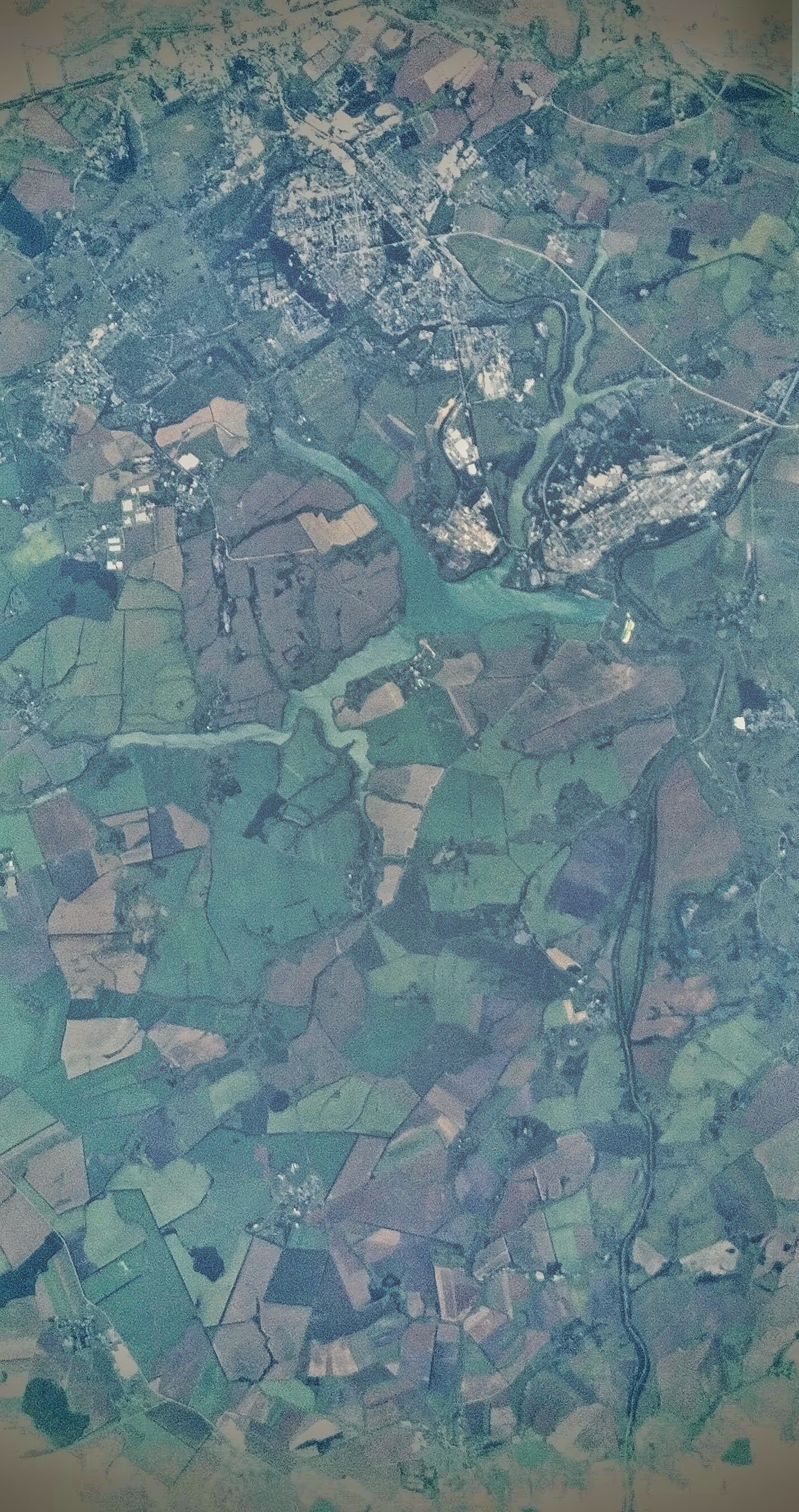
Designed specifically for orbital photography, HRCAM-M has advanced specifications compared to its predecessor mounted on the company’s first satellite: a 12 Mpix sensor, a 70 mm focal length lens and a linear ground resolution of 20 meters per pixel. These properties make it possible to acquire relatively high quality images from the satellite. To validate the camera performance, a series of Earth images were taken, which you can see in the gallery below.