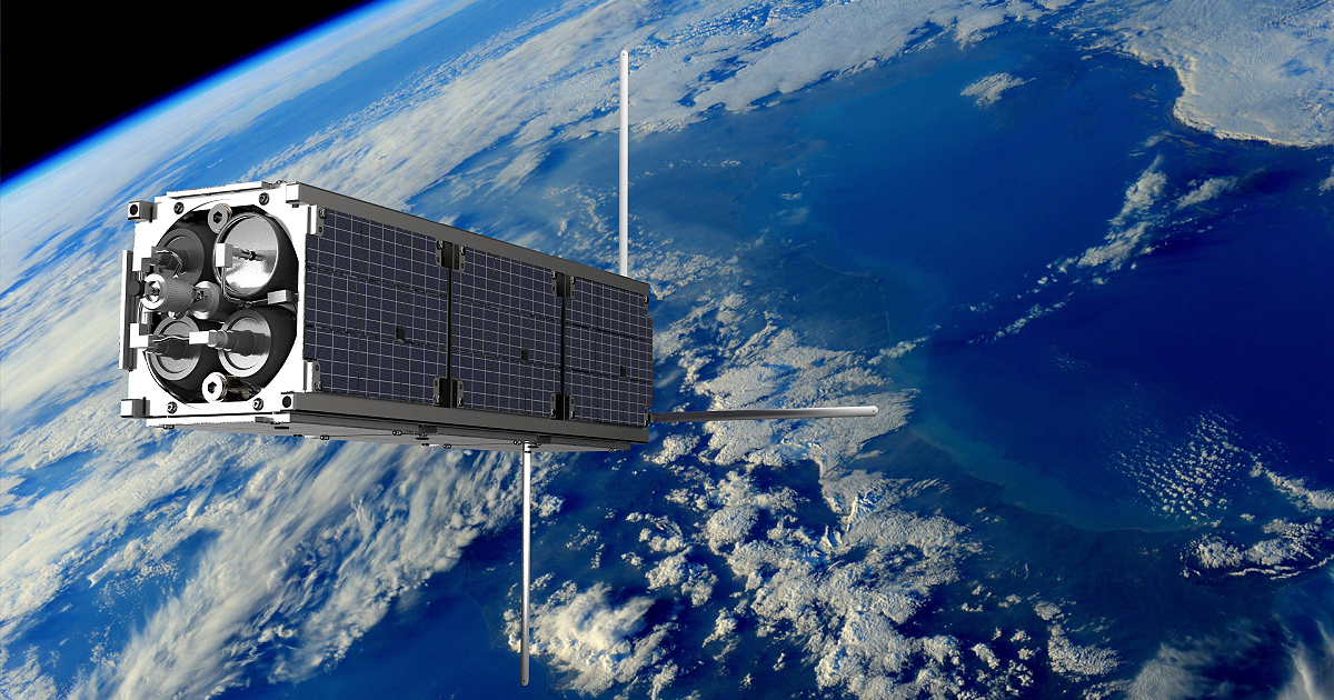
August 9 marks exactly one year since our first satellite, Geoscan-Edelveis, blasted off from the Baikonur Cosmodrome on its journey to the orbit. To celebrate the anniversary, we have completed the flight test program and successfully trialed the cold gas thruster for CubeSats in outer space – the first achievement of this kind in the Russian history.
The cold gas thruster (CGT) used in Geoscan-Edelveis was developed at Fakel Experimental Design Bureau with the support of the Foundation for Assistance to Small Innovative Enterprises in Science and Technology (FASIE) specifically for CubeSat 3U satellites, and the control board was designed by our team of specialists. The tests were planned to check the performance of the engine in space flight conditions. It was also necessary to find out how its inclusions would affect the orbit of the spacecraft. Similar thrusters will be used in the future to correct the CubeSat orbit and to deorbit them once their service life is over, thus reducing space debris.
The trials started back in April and May with preliminary tests of the receiver operation: we opened the valve on high-pressure storage tanks, fed some gas to the receiver and executed a few test runs of the thruster. The first results looked promising, so we continued our experiments in July. This time the goal was to record the acceleration produced by the thruster, using the on-board accelerometer – the device that measures changes in speed resulting from the thruster use.
A communication session was the most convenient moment for the final trials, as the satellite was flying over St. Petersburg towards the North Pole. The thruster was directed away from the Earth, and as due to its design and construction features, the thrust axis is not aligned with the satellite’s main axis, so activating the thruster, regardless of its position, produces some spin.
During the test, eight pulses of four seconds each were produced at one-minute intervals. During the first thrust, the accelerometer recorded a 0.2 m/s2 change in acceleration along the roll axis, which can be seen in Chart 1.
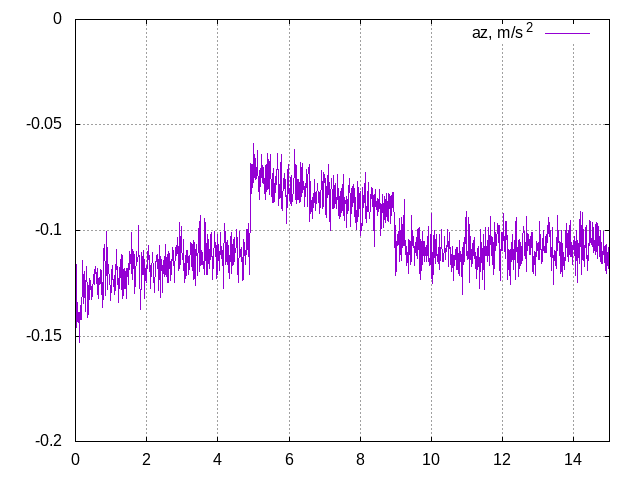
Chart 1. Seconds 5 through 9 show change in acceleration along the roll axis from the first thruster pulse
Since the roll axis was nearly perpendicular to the orbital velocity, the acceleration recorded was miniscule. The angular velocity sensors recorded a change in the satellite’s rotation after the thruster was activated: Graph 2 shows that the satellite’s roll speed increased (purple line).
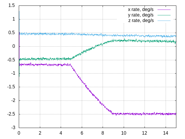
Chart 2. Angular velocities relative to the main axes of the spacecraft
Radio amateurs could also witness the evolutions of Geoscan-Edelveis. During one of the pulses, the satellite signals were received by a SatNOGS network station in Germany. In the “waterfall” (a frequency plot of the signal over time), it is clear that the Doppler shift that occurs as the satellite moves toward or away from the observer does not match that calculated from the TLE. The reason is a slight change of the satellite speed during the experiment.
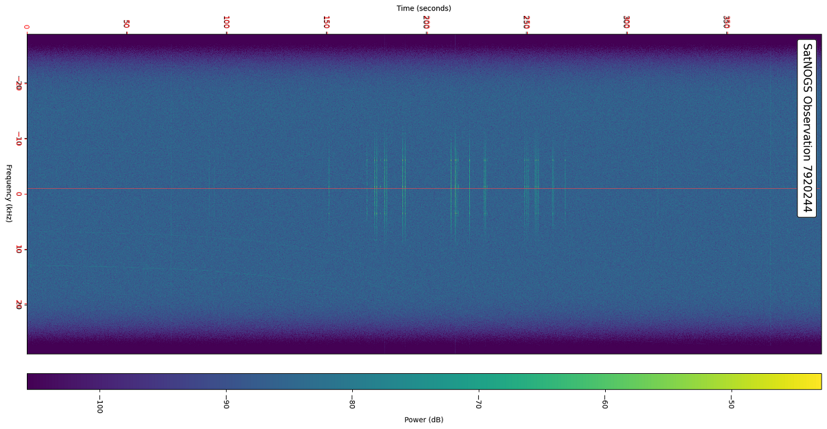
The “waterfall” chart is plotted by SatNOGS ground station from the sat signal received, so that the carrier frequency is always at the center of the spectrum (red line). In this observation, there is a slight but visible shift of the signal to the right.
After the test pulses, the satellite started spinning, which resulted in reduced current produced by the solar panels. Our developers decided to end the experiment in order to keep the satellite operational. The tests proved successful: the thruster operates as intended, and the Geoscan team estimates that given the most effective maneuvering model and complete utilization of the gas in the tanks (nitrogen), the altitude of the circular orbit can be changed by up to 12 kilometers. This requires the thruster to be activated more than 30 times in total.
So far, Geoscan-Edelveis can only use the Earth’s magnetic field for orientation. This is a low-precision approach, so even with the best timing of the pulses the resulting maneuvers will only be approximate. Our future spacecraft will feature an inertial navigation system with flywheels made in-house by Geoscan. The two small satellites we are currently producing for MGU-Standard company and the Presidential Physics and Mathematics Lyceum No.239 in St. Petersburg will also receive VERA pulsed plasma thrusters developed by LaPlas Institute of MEPhI University. Meanwhile, our first satellite, having successfully completed all flight trials, will continue to transmit telemetry data and new photos of the Earth surface to radio amateurs around the world.