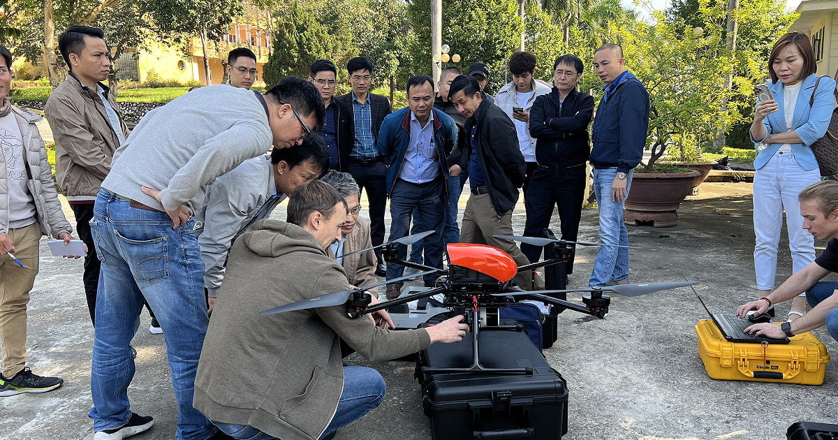
Our company's team conducted an on-site training session on the operation of the Geoscan 401 Lidar UAV for specialists from Vietnam's Department of Topography, Cartography, and Geographic Information. This marks the first acquisition of this drone model by an organization in this country. The UAV, equipped with the highly accurate AGM-MS laser scanner and a Sony ZV-E10 aerial camera, will be deployed for aerial photography and laser scanning services, aimed at generating topographical maps using geospatial data.
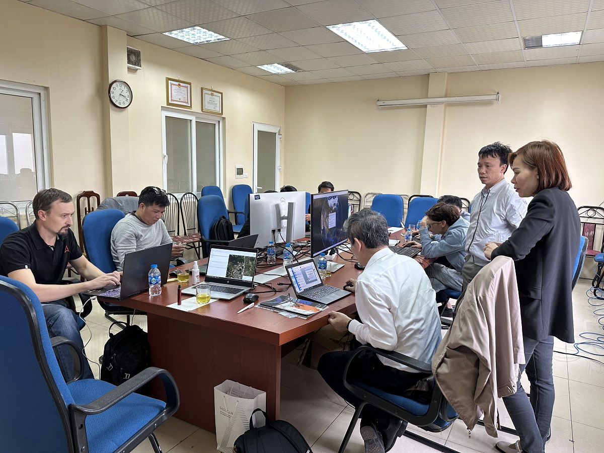
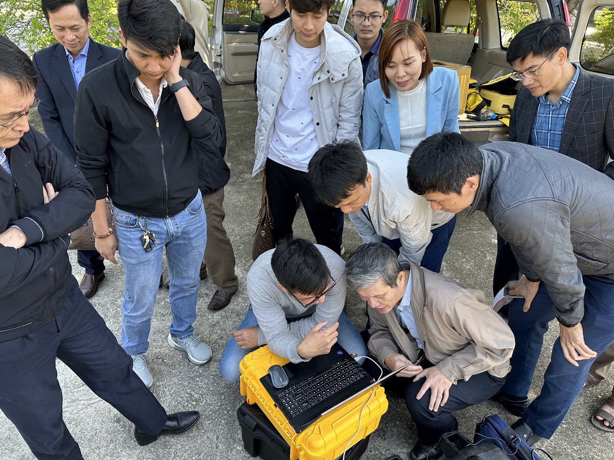
Over a four-day period, the attendees were introduced to the technical capabilities of the Geoscan 401 Lidar, gaining insight into its features and the primary tools of the Geoscan Planner software for creating flight tasks. They also mastered the assembly and piloting of the quadcopter. A crucial component of the training involved processing the data gathered during practical flight sessions. The foreign specialists learned to operate the AGM ScanWorks Base software and the AGM PosWork Web cloud service, both integral parts of the system. Thanks to these programs, they successfully generated an unclassified point cloud in LAS format. In the future, with the Agisoft Metashape software, our Vietnamese partners will be able to independently classify laser reflection data and create digital elevation models based on it.
“We conducted the course for our foreign partners in English. Despite some challenges related to the varied levels of English proficiency among the trainees, we managed to overcome the language barrier, providing a comprehensive explanation and demonstration of how to operate the UAV system. As a result, all participants acquired the necessary knowledge and skills, along with the corresponding certificates,” explained Aleksey Vorotilov, a UAV operator from Geoscan.
Geoscan has been collaborating with Vietnamese organizations since 2019, regularly supplying Geoscan Lite UAVs to our official dealer, HDS Survey, which then distributes the equipment to local companies.
The Department of Topography, Cartography, and Geographic Information of Vietnam is the nation's official cartographic organization, functioning under the country’s Ministry of Natural Resources and Environment (MONRE). It assists the ministry in maintaining unified state management of geodetic and cartographic activities, manages basic geodetic surveying, and organizes the mapping of inland and territorial waters.