


Sputnik GIS
Professional drone surveying software for engineers, surveyors and urban planner.
Visualize and analyze multidimensional spatial data with no limits on data size, create surveys and get insights from your drone data in height performance GIS solution.
Sputnik GIS is efficient software, designed for professional surveyors, engineers and urban planers to get the best from aerial surveys.
Software used in such industries as: construction management, monitoring and inspection, mining, urban planning, oil and gas, emergency management.
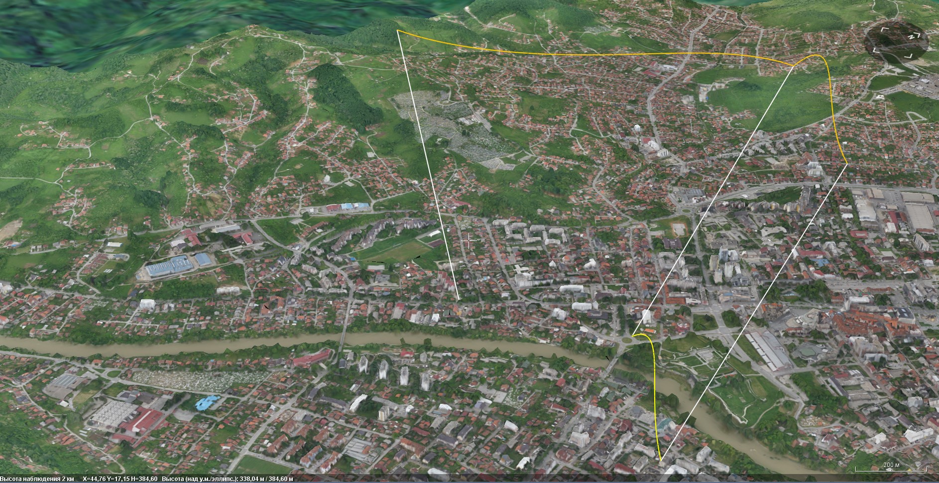
Measurements
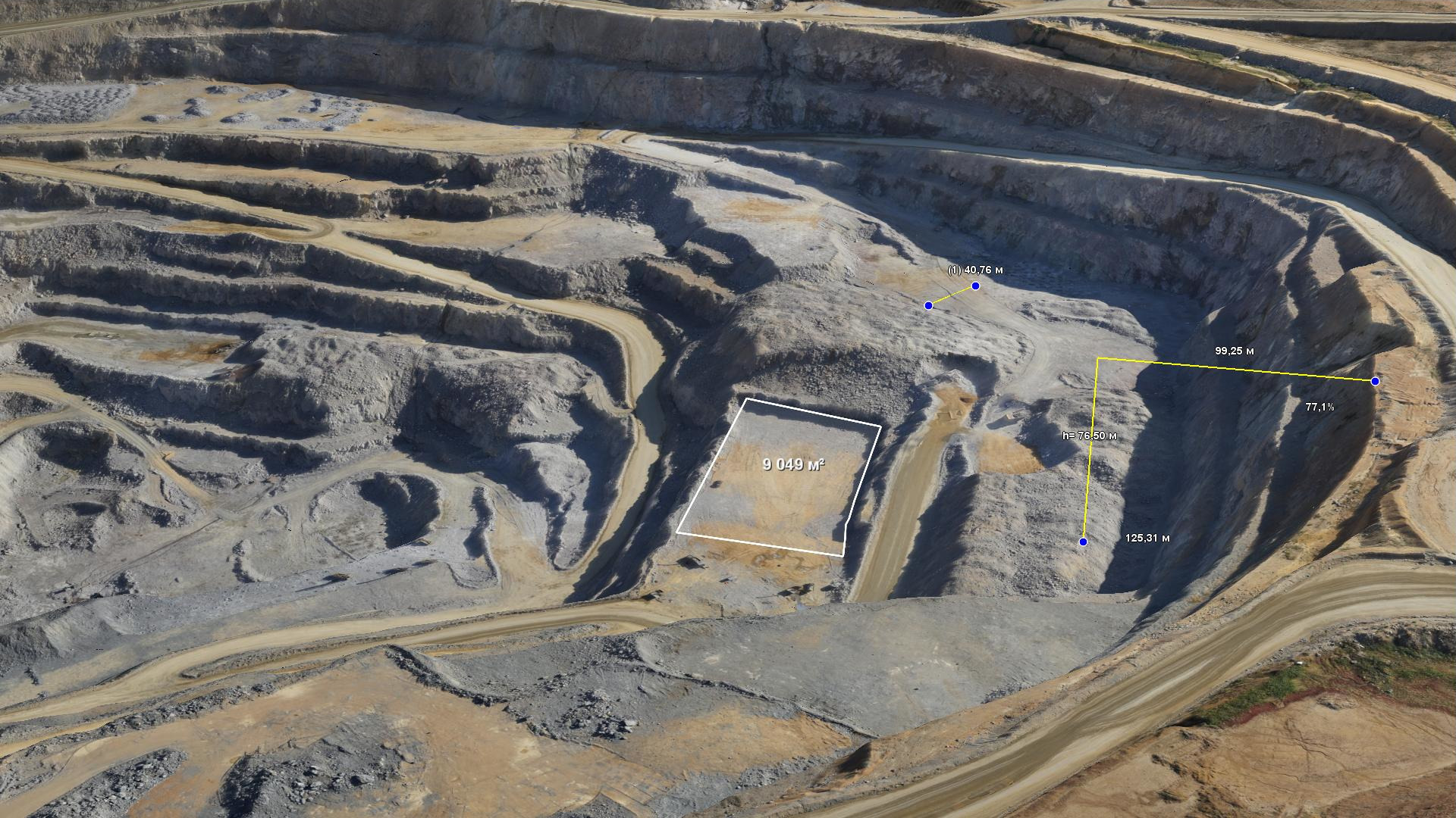
Measurements tools
Measure shortest distances and distances by surface. Calculate areas on plane or on surface.
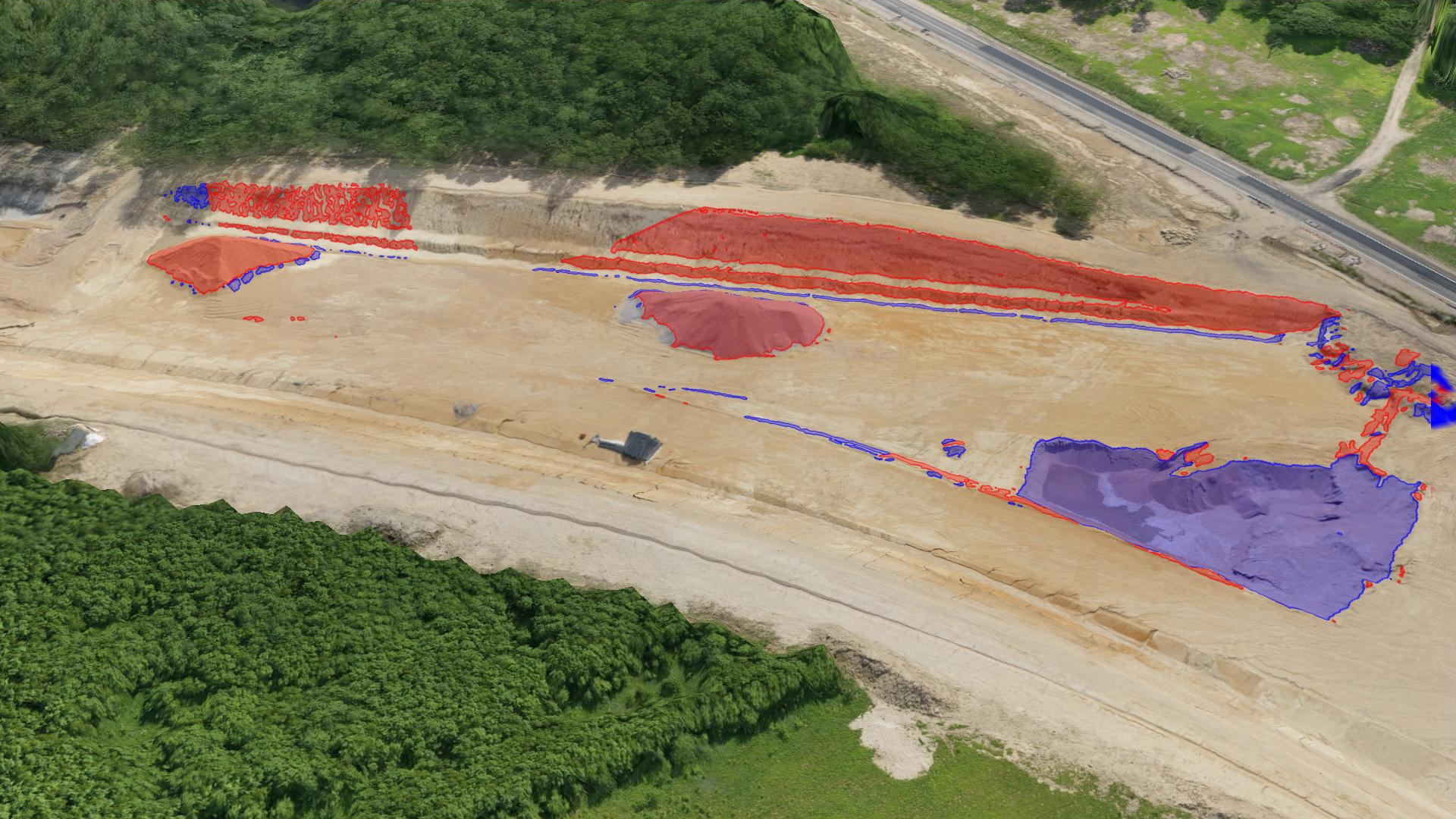
Volumes
Calculate stock an pile volumes from automatically generated reference surface or from given level.
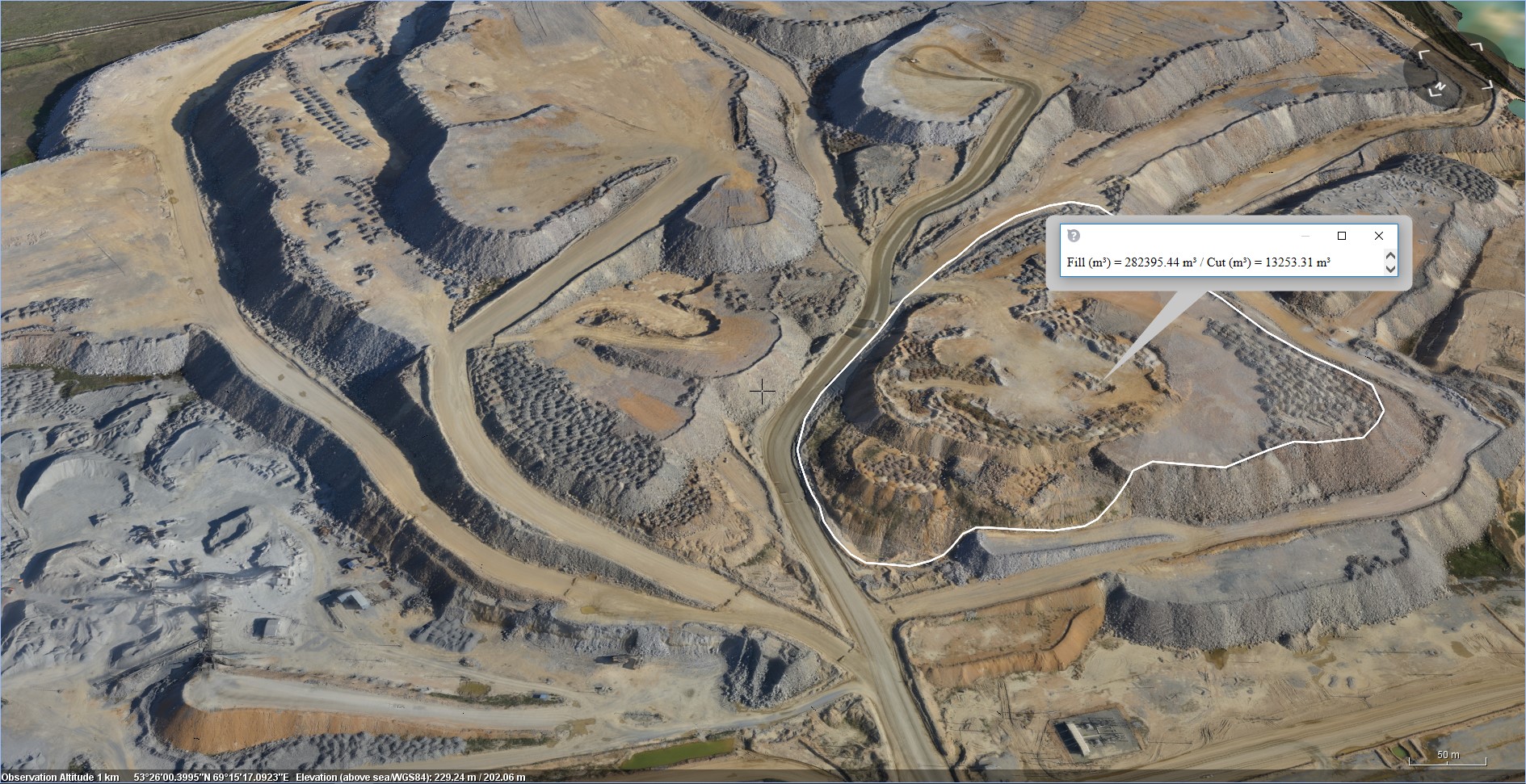
Volume difference
Calculate volume difference between two elevation models. Detect zone of changes between two elevation models.
Surveys
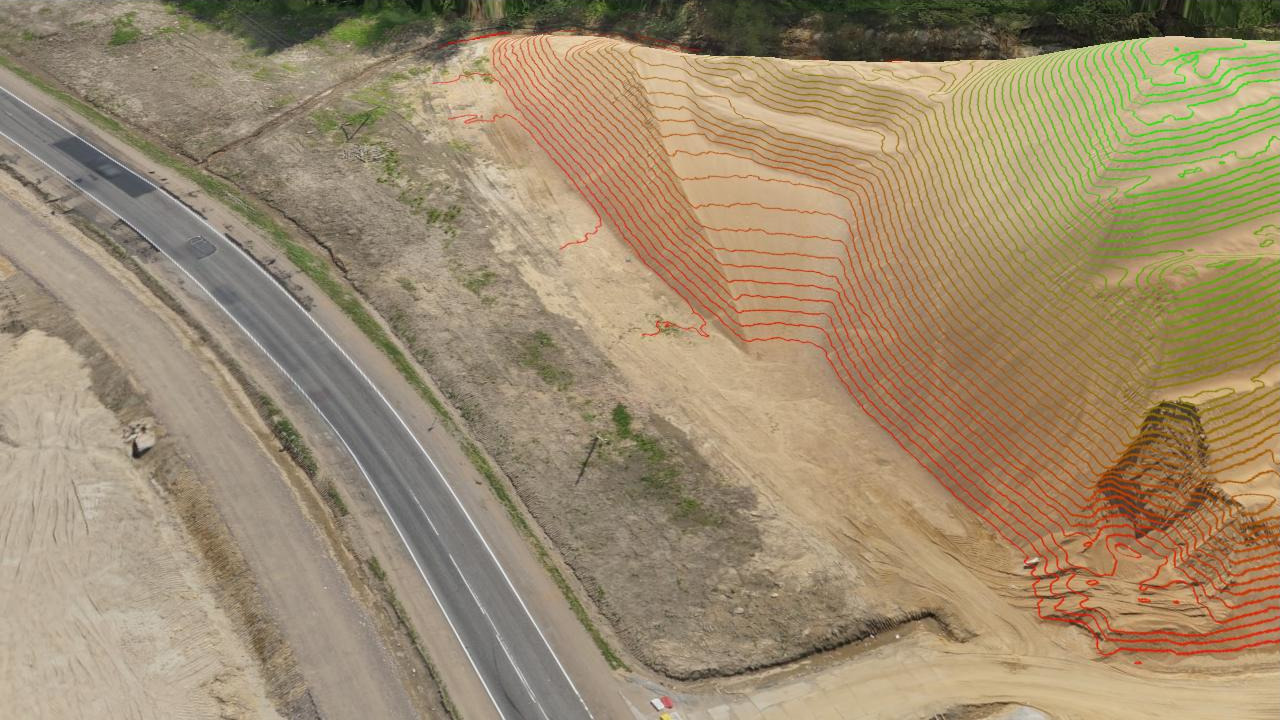
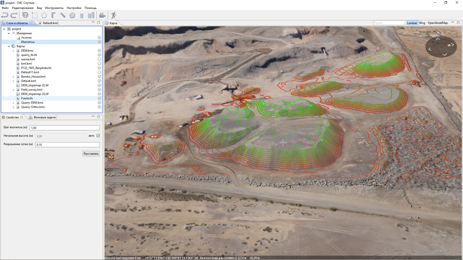
Contour lines
Calculate contour lines, export results as *.dxf or *.shp.
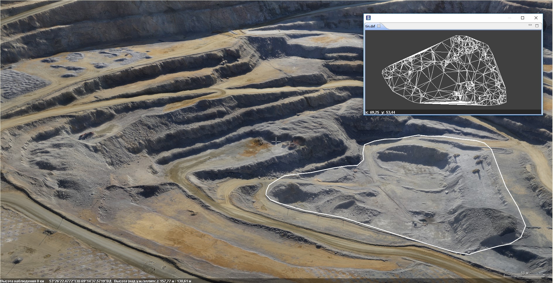
TIN calculation
Convert raster elevation map to TIN, export result to *.dxf.
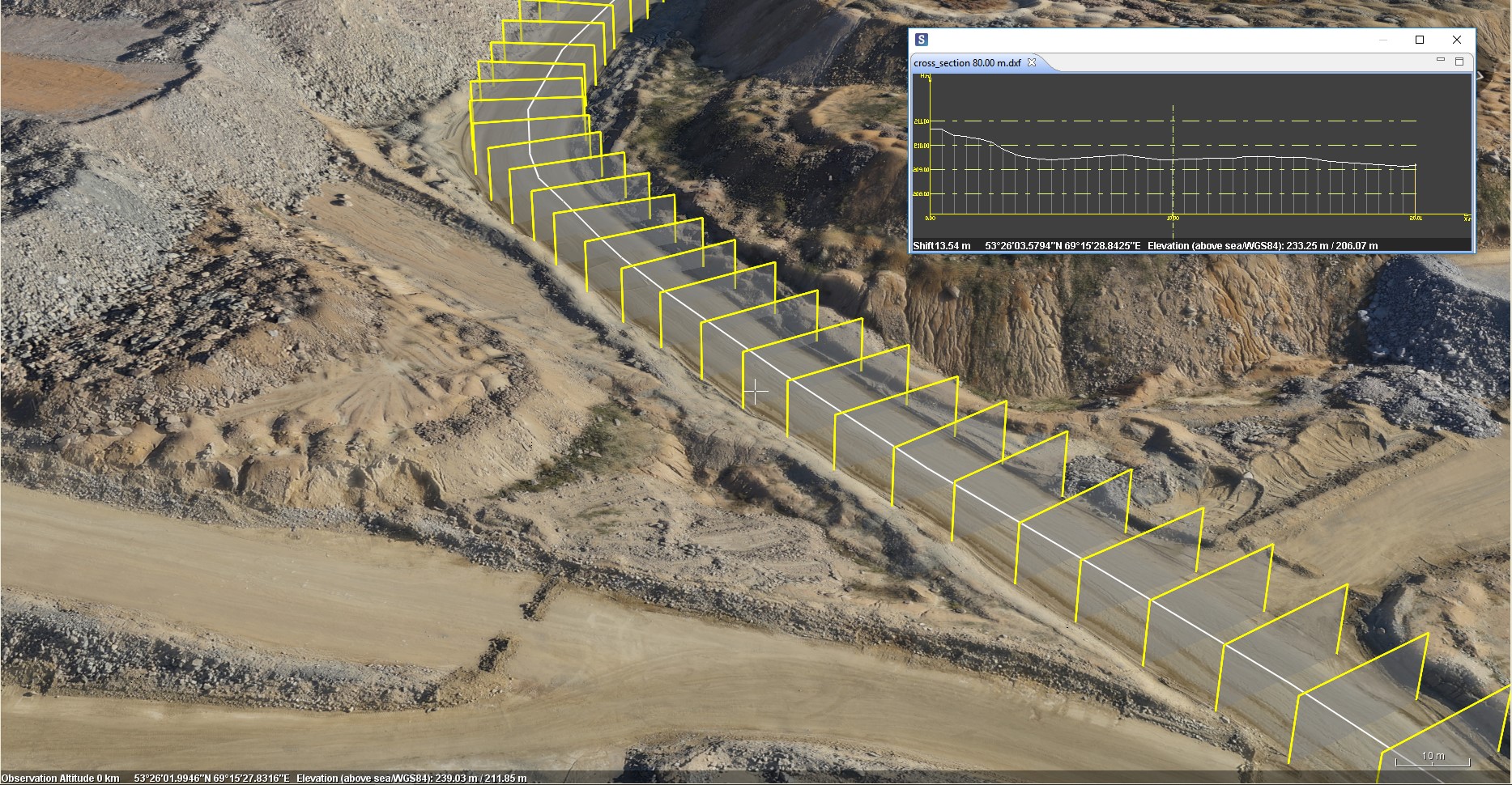
Generating Sections
Generate sections, cross sections and section comparing. Analyze elevation dynamics. Export results to *.csv or *.dxf
Modeling
Daylight Modeling
Model daylight conditions for given location at given time.
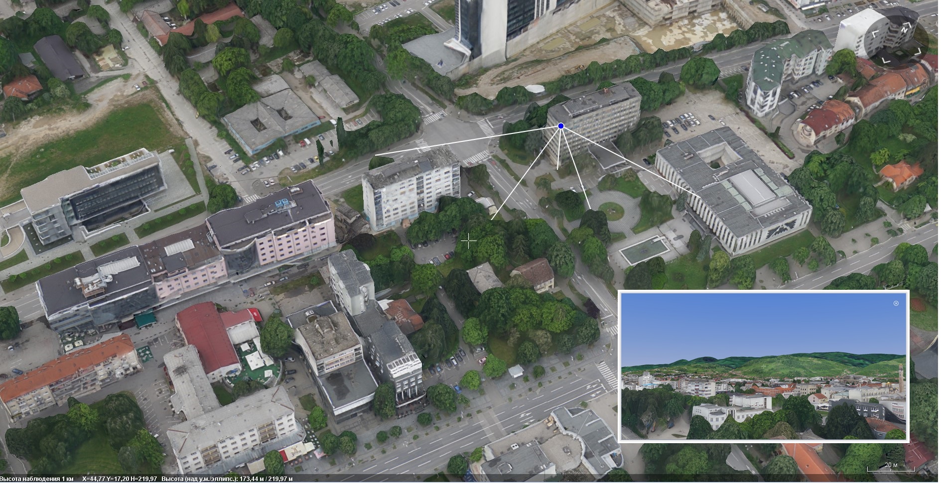
Observation point
Model observation points from given locations.
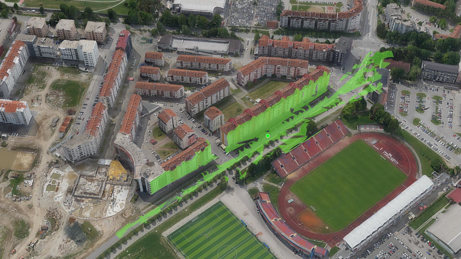
Visibility area
Model visibility area from given point. Analyze observations areas and blind areas. Export results as *.geotiff.

TLS Mask And Export
Mask parts of *.tls model to analyze the situation. Export part of *tls model in *.obj, *.3ds or *.dae to share it.
Presentation
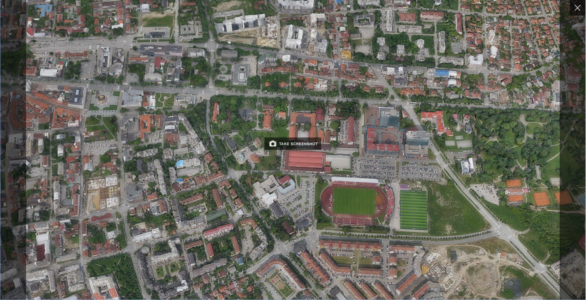
Sreenshots
Make high resolution screenshots
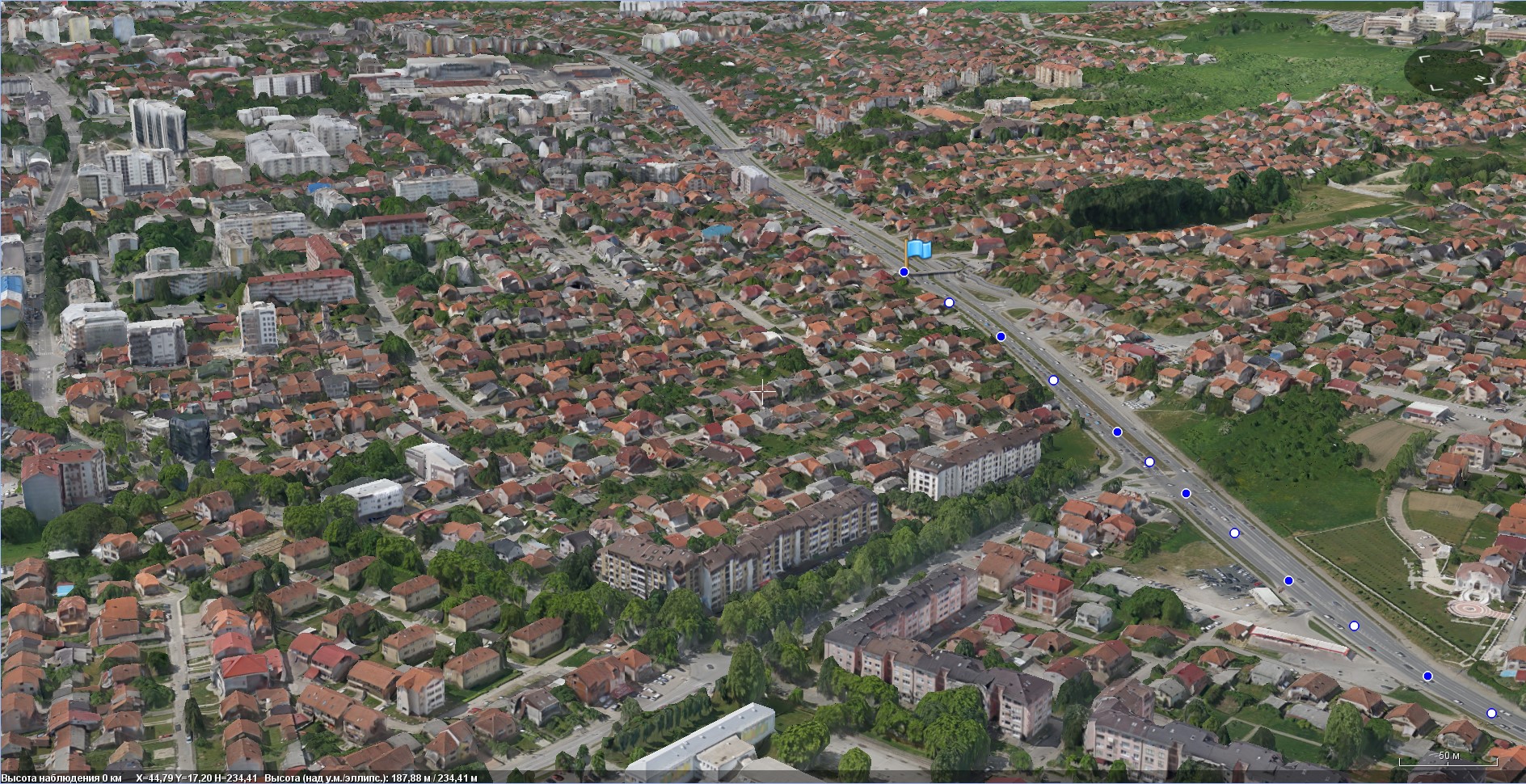
Animated Track
Animate moving of 3D models with tracks
Animated tour
Create animated tours for your presentations. Combine it with animated tracks and render high resolution animated videos.
Download program
The program is distributed free of charge and without restrictions on use.

Sputnik GIS
Features and innovations

Video tutorials
Sputnik Agro - RedEdge camera. Calculate NDVI parameters
Spuntik GIS video tutorial - RedEdge camera. Calculate NDVI parameters
Sputnik Agro - Counting trees and sunflowers
Spuntik GIS video tutorial - Sputnik Agro. Counting trees and sunflowers
Sputnik Agro - Raster calculator
Spuntik GIS video tutorial - Sputnik Agro. Raster calculator
Spuntik GIS - Calculating contours and triangulation
Spuntik GIS video tutorial - Calculating contours and triangulation
Spuntik GIS - Detecting changes
Spuntik GIS video tutorial - Detecting changes
Spuntik GIS - Area and volume calculation
Spuntik GIS video tutorial - Area and volume calculation
Spuntik GIS - Linear measurements
Spuntik GIS video tutorial - Linear measurements
Sputnik GIS - Creating reference surface
Spuntik GIS video tutorial - Creating reference surface
Spuntik GIS - Calculating sections
Spuntik GIS video tutorial - Calculating sections
Spuntik GIS - Creating slope map
Spuntik GIS video tutorial - Creating slope map