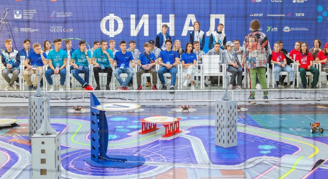
Competition ground
«Geoscan Arena»


Competition ground
«Geoscan Arena»
Designed for educational events in unmanned robotics
A safe airspace, bounded by mesh and equipped with everything you need to conduct drone robotics training and to create various game scenarios when organising competitions.
Description
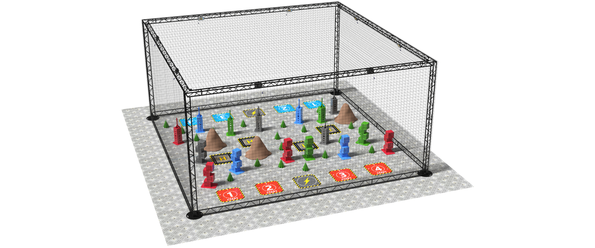
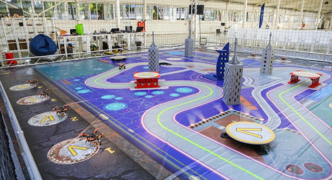
The Geoscan Arena competition ground is a state-of-the-art solution for unmanned ground and aerial robotics training events. It allows you to hold competitions or perform training exercises in any suitable location, such as a school gym.
The ground is a transportable structure with a protective mesh which is equipped with the Locus ultrasonic navigation system (to realise autonomous drone flight), game mechanics control systems, lighting and video broadcasting, as well as take-off and landing platforms, launch positions and models, which can be used in different ways, coming up with unique scenarios.

Application scenarios

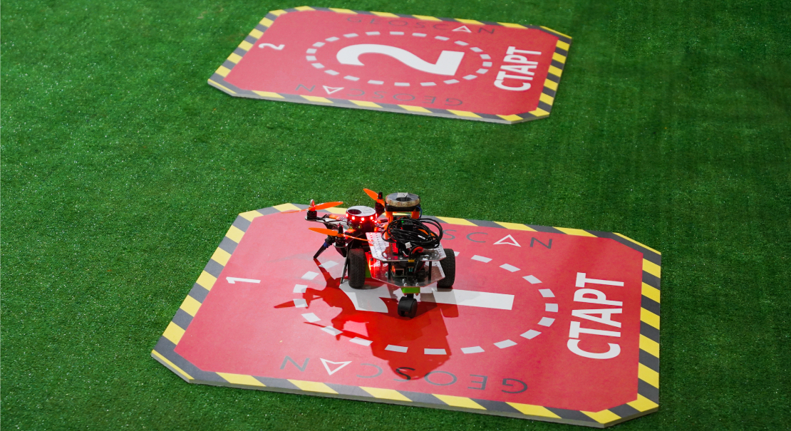
- A ground for in-person competitions and learning games in unmanned robotics with manual or autonomous control: cargo delivery, firefighting, object search, fight for resources, aerial photography, robot battles and much more.
- An FPV site to organise remote-controlled robotics competitions with video broadcasting from different angles.
- Space for organising the educational process: practice UAV skills in an environment that simulates real-world tasks.

- A training ground for UAV operators.

Create your own unmanned robotics competition scenarios and bring them to life using the Geoscan Arena ground!
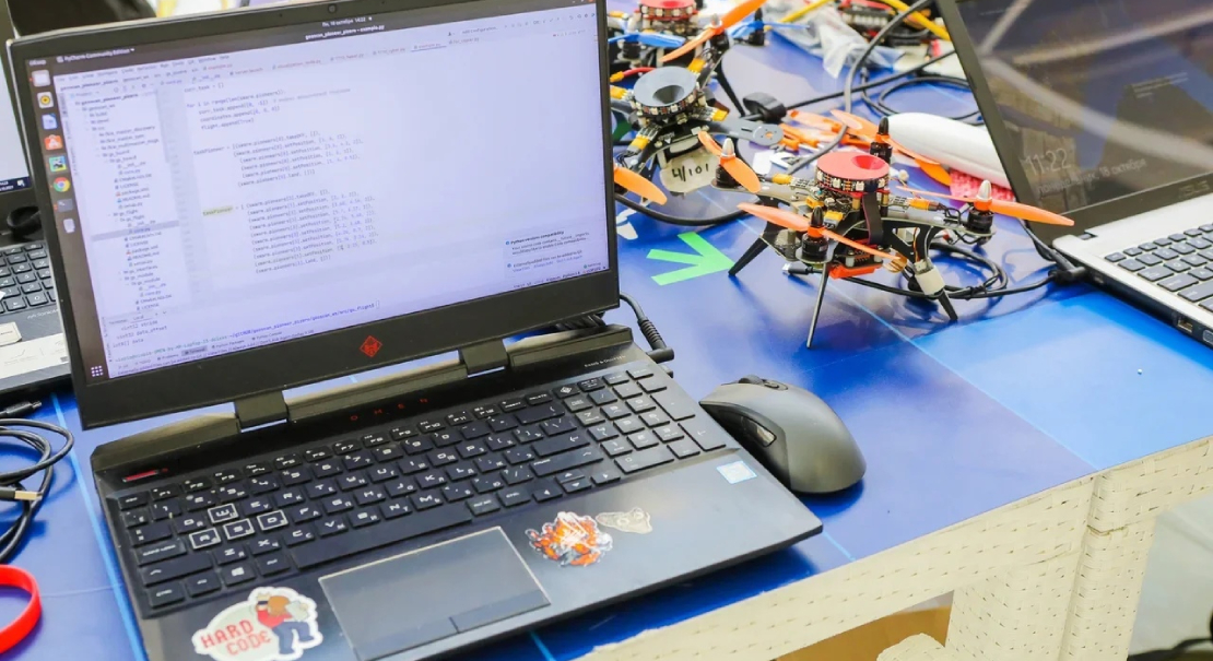
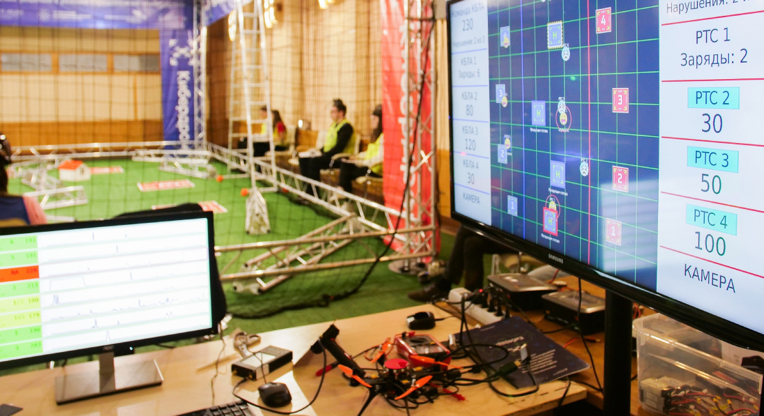
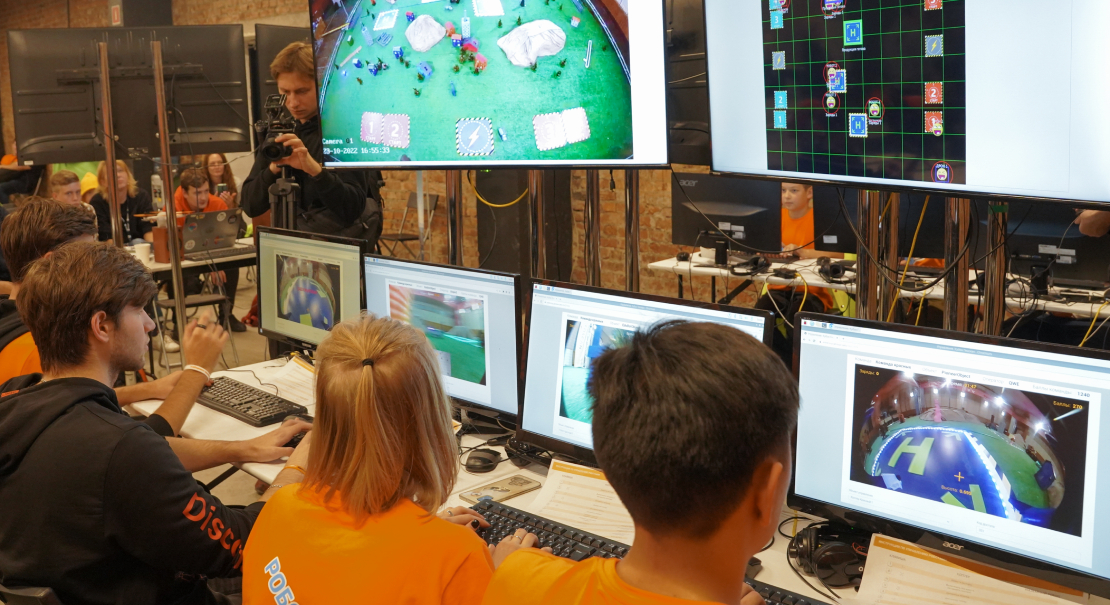
Unique gaming server
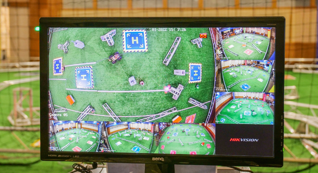
The competition ground is equipped with a Geoscan intelligent gameplay control system, through which various game mechanics can be implemented. It enables interaction between objects on the ground and remote control of robots, automatic scoring, as well as recording and processing of all participants’ actions and data. This creates a unified game system that can be used in many different ways, due to the goals of an event.
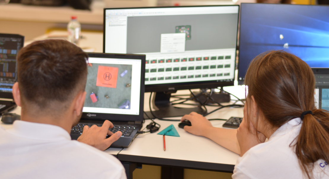
Remote learning opportunities
Anyone wishing to hold remote lessons or competitions in unmanned robotics is able to rent a ground at the Geoscan premise. It is fully equipped with everything you need, including Pioneer Basic copters and wheeled robots, with our staff providing ongoing technical support.
All that is required to connect to the control system is a room equipped with computers and a stable internet connection. The event on the ground transmits with audio to monitors from various angles, including from the cameras on the robots, which provides for a fully immersive experience.


The Geoscan Arena model

Package bundle
| Item description | Competition format extended | Competition format basic | Training format | Qty, pcs | |
|---|---|---|---|---|---|
| Safe airspace | 5 x 5 x 3,5 m | 1 | |||
| 8 x 8 x 4 m | |||||
| 11 x 11 x 4 m | |||||
| Lighting equipment | 1 | ||||
| Geoscan Pioneer - Locus indoor ultrasonic navigation system for large spaces | 1 | ||||
| Video broadcasting system | 1 | ||||
| Testing ground management system (hardware + software) | 1 | ||||
| Stand-alone heliport with controlled testing ground functions | 4 | ||||
Visual equipment for the testing ground, including:
|
1 | ||||
| Equipment installation and setup works (4 persons) Travel and accommodation costs are paid separately | 1 | ||||
| Briefing (2 people) Travel and accommodation costs are charged separately (measured in hours) | 32 | ||||
| 24 | |||||
| 16 | |||||
| A “Geobot” robotic complex | 8 | ||||
| Geoscan Pioneer | Basic | 8 | |||
| Arena | |||||
| Geoscan Pioneer - On-board module for indoor ultrasonic navigation | No LED | 16 | |||
| With LED | |||||
| Computing module with camera for Geoscan Pioneer Basic (Pi Zero) | 8 | ||||
| Geoscan Pioneer - Onboard load pickup module | 8 | ||||
| Geoscan Pioneer - OpenMV programmable on-board camera | 8 | ||||
| Geoscan Pioneer - FPV camera | 8 | ||||
| Geoscan Pioneer - FPV helmet | 8 | ||||
| Laptop for the management of the testing ground and remote connectivity | 3 | ||||
| Battery charger - 4 channels | 3 | ||||
| Repair kit | Basic | 16 | |||
| Arena | 8 | ||||
| Geoscan Pioneer - Rechargeable Battery | 48 | ||||
The standard configuration can be changed or supplemented upon request.