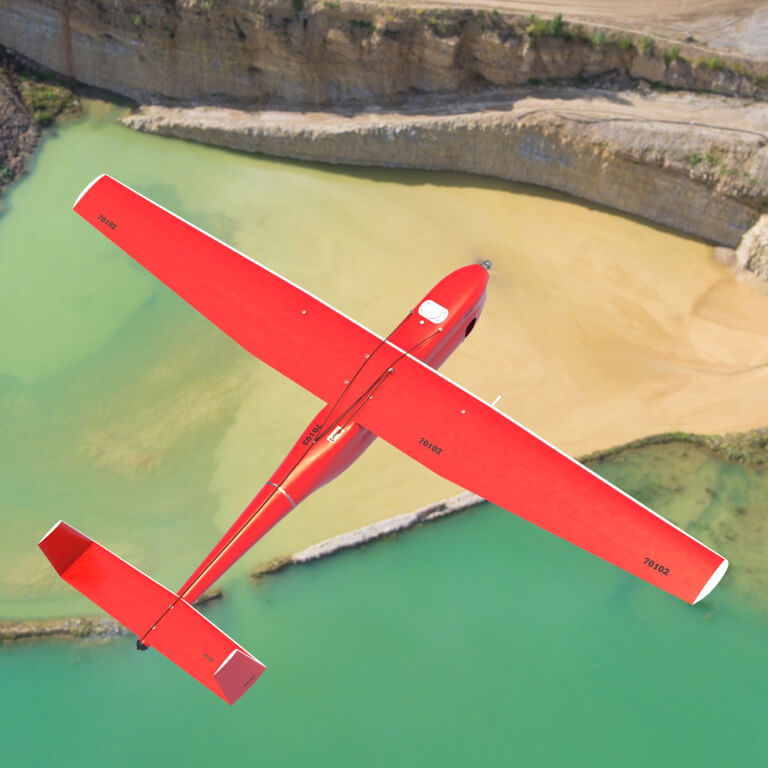
About UAV


Geoscan 701 provides a set of images with precise camera position at the time of image capture and data from a geodetic-class GNSS receiver. After processing data in Agisoft Metashape software you get orthomosaics, digital surface models and digital elevation models in any coordinate system, including those without using horizontal and vertical control points.
The key advantage is the possibility to survey hard-to-reach territories including those in Siberia, the Arctic and the Far East where a launch point is far from the object of interest.
Advantages

Maximum efficiency
- ICE allows covering up to 1,000 km.
- It is possible to integrate several cameras simultaneously.

Sharp results
- Together with PPK
 /PPP, an onboard geodetic-class GNSS receiver and precise camera position at the time of image capture ensure high accuracy of projection center coordinates (PCC) down to 1.5 cm.

Convenience
- Automatic flight planning, taking into account the area to be surveyed and parameters in Geoscan Planner software.
- Fully automatic flight after catapult launch. The UAV will land on a parachute in a preset area.
- GNSS data can be converted into a RINEX file with the camera position at the time of image capture for the calculation of kinematic data in any specialized software.
- The ability to customize the payload.

Reliability
- Communication between the devices is via the interference-resistant CAN interface.
- Automatic check of all systems before take-off.
- Autonomous flight out of ground control station radio communication range using the Iridium system for aircraft position tracking.
- Extended ICE lifespan through modernization.
- Hybrid landing system: parachute and ballonet.
Examples
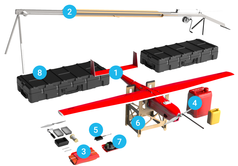
Additional equipment
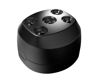
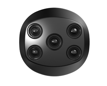
Geoscan 701 can be equipped with multispectral camera Geoscan Pollux
Multispectral digital camera. The Geoscan Pollux Multispectral Camera provides simultaneous captures in five narrow bands (12-40 nm). In addition to the main bands of the visible spectrum (Blue, Red and Green), the camera registers Red Edge and IR, which makes it possible to calculate various vegetation indices: SAVI, NDVI, NDRE, LAI, etc. Geoscan Pollux uses IMX273 Sony Pregius sensors with 12-bit ADC which deliver low noise and wide dynamic rage.
| Technical specification | Geoscan Pollux |
| Shutter type | With frame-by-frame transfer (global shutter) |
| Number of pixels, MP | 1,55 |
| Resolution, px | 1440x1080 |
| Pixel size, microns | 3,45 |
| Technical specification | Geoscan Pollux |
| Shutter type | With frame-by-frame transfer (global shutter) |
| Number of pixels, MP | 1,55 |
| Resolution, px | 1440x1080 |
| Pixel size, microns | 3,45 |
Shutter type
With frame-by-frame transfer (global shutter)
Number of pixels, MP
1,55
Resolution, px
1440x1080
Pixel size, microns
3,45
Сharacteristics
Max flight time
10 h
Max coverage in one flight
Wingspan
3.33 m
Flight speed
80-120 km/h
Max take-off weight
22 kg
Max payload weight
3.5 kg
Max route length
1000 km
Max flight altitude
(above sea level)
4 500 m
Four-stroke petrol ICE
40 сm3, 3.75 hp
Take-off preparation time
30 min
Take-off/landing
Temperature
-20 to +40°С
Case dimensions
170×68×30 cm
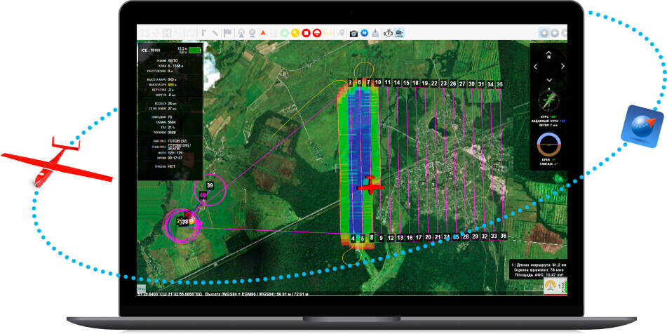
Gеoscan Planner
The Geoscan Planner software makes it possible to manage a flight mission for surveying areal and linear objects, using various flight modes (by points, based on terrain, etc.). Import KML and KMZ files, use different cartographic bases, control the flight, and adjust the mission while working with the drone. After the flight is completed,the software creates a RINEX file with the times of image capture.
Features of Geoscan Planner:
- 3D framework for creating terrain-oriented flight tasks
- User’s maps and bases import (wms, wmts, tiff, kmz, tls)
- Automatiс flight task construction according to KML files
- Multiple coordinate systems
- Distant manual operating
- Playback mode
Geoscan Planner is included in the bundle.

Agisoft Metashape Professional is software that maximizes the possibilities of photogrammetry. It incorporates machine learning technologies for analysis and post-processing to deliver the highest accuracy results.

Photogrammetric software Agisoft Metashape Professional
Consultation on office data processing in Agisoft Metashape Professional (in person or remote)
Profound individual consultation on operating the system (in person or remote)