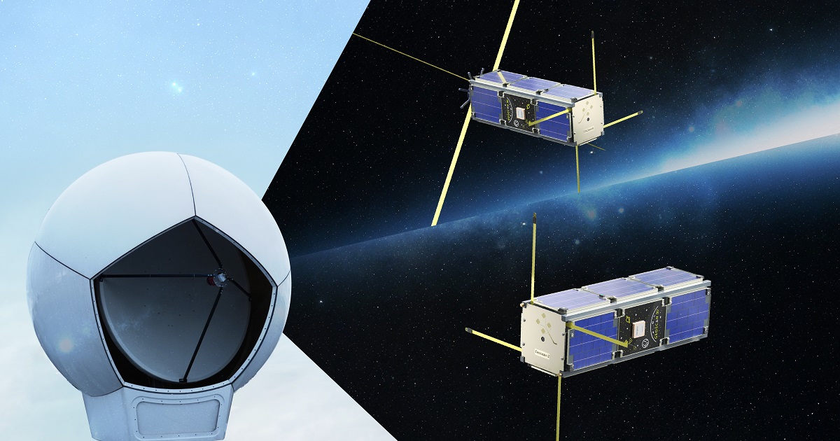
InnoSat3 and Geoscan-2 continue to carry out their mission in orbit. Both satellites were launched in July 2025 and are operating normally, showcasing Geoscan’s satellite-based transport monitoring technologies.
InnoSat3
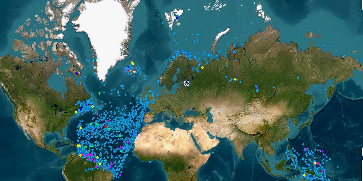
InnoSat3 is performing trials of a technology for receiving Automatic Identification System (AIS) signals, providing real-time data on global maritime traffic.
The satellite carries two independent receivers developed by Geoscan. They capture vessels’ identification details as well as information about their coordinates, size, status, course, and velocity. Reception takes place simultaneously on two international AIS channels: AIS1 at 161.975 MHz and AIS2 at 162.025 MHz.
“The Space Development Department continues developing AIS capabilities on InnoSat3. At this stage, we have achieved stable performance of the onboard equipment, ensuring continuous reception and processing of AIS messages for eight orbit passes a day (12 hours), as well as high data rate X-band downlink of the collected data to the ground station,” said Dmitry Borovitsky, Head of Space Development Department at Geoscan.
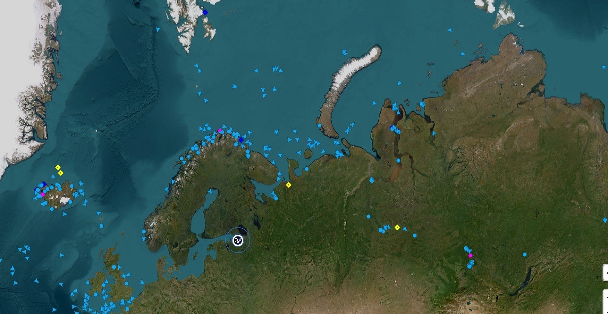
On November 2, InnoSat3 transmitted 10,316 messages from 3,789 ocean- and river-going vessels, including ships sailing along the Northern Sea Route
Geoscan-2
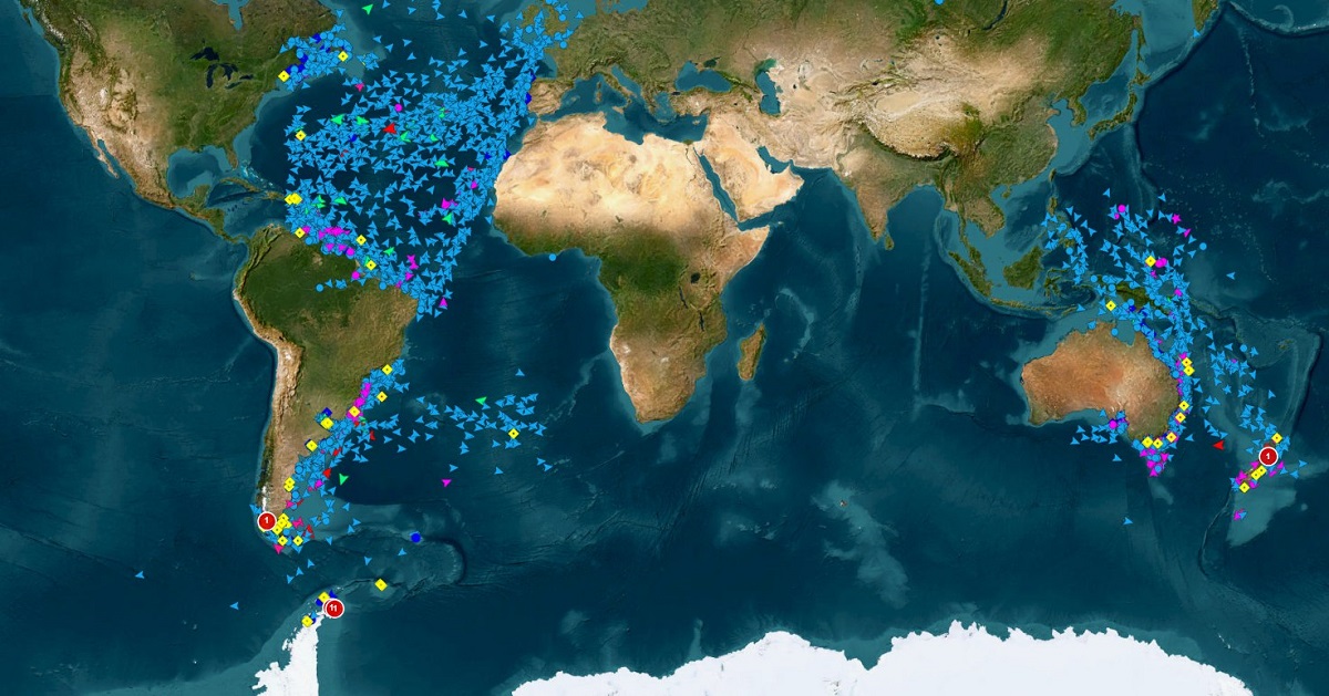
Geoscan-2 is testing its Automatic Dependent Surveillance-Broadcast (ADS-B) receiver. This technology provides pilots and air-traffic controllers with accurate, up-to-date information about aircraft’s position, altitude, velocity, and heading. ADS-B improves air-traffic safety and supports coordination between pilots and ground systems, as well as between aircraft.
Tests show that the satellite can receive ADS-B signals from long-haul aircraft, low-flying helicopters and even aircraft on the ground — at altitudes up to 13,100 m, including signals from the runway. During a test run on October 10, 2025, Geoscan-2 completed four orbit passes and received 2,203 messages from 114 aircraft across 32 countries. The collected data fully matched publicly available results from ADS-B Exchange* and other open services, confirming the system’s accuracy.
According to Geoscan engineers, satellites of this type may eventually monitor unmanned aircraft as well, forming the basis of an integrated air traffic management system.
“At the next stage of work with Geoscan-2, we plan to embed the satellite’s coordinates into the received messages. This will help us assess how the distance between the satellite and an aircraft affects signal quantity and quality, and how external factors influence data reliability. We also intend to apply mathematical tools — such as interpolation and filtering — to clean and reconstruct data when messages are partially lost. These studies will bring us closer to more robust and accurate data collection systems for small satellites,” said Alexander Khokhlov, Head of Space Projects at Geoscan.
InnoSat3 and Geoscan-2 missions show that even compact low-Earth-orbit satellites can gather and transmit large volumes of navigation data. To handle this data flow, Geoscan uses X-band transmission technology.
New X-band Data Reception Station
In 2024, Geoscan engineers developed the COMMX high data rate transmitter with a 250 Mbps capacity, enabling satellites to downlink large data sets to Earth. This year, Geoscan launched a new X-band ground station. It includes a parabolic antenna with a feed and down-converter, a precision antenna positioning system for accurate satellite tracking, and a radome that protects the hardware from weather conditions.
The upgraded antenna drive ensures precise satellite tracking throughout each communication session. This advancement allows the station to receive and process even larger volumes of data from the satellites equipped with the COMMX transmitter.
* ADS-B Exchange is an online platform that aggregates and publishes aircraft flight data collected from ADS-B signals worldwide, using information from ground and satellite receivers.